- Zbehy
-
Zbehy
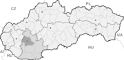
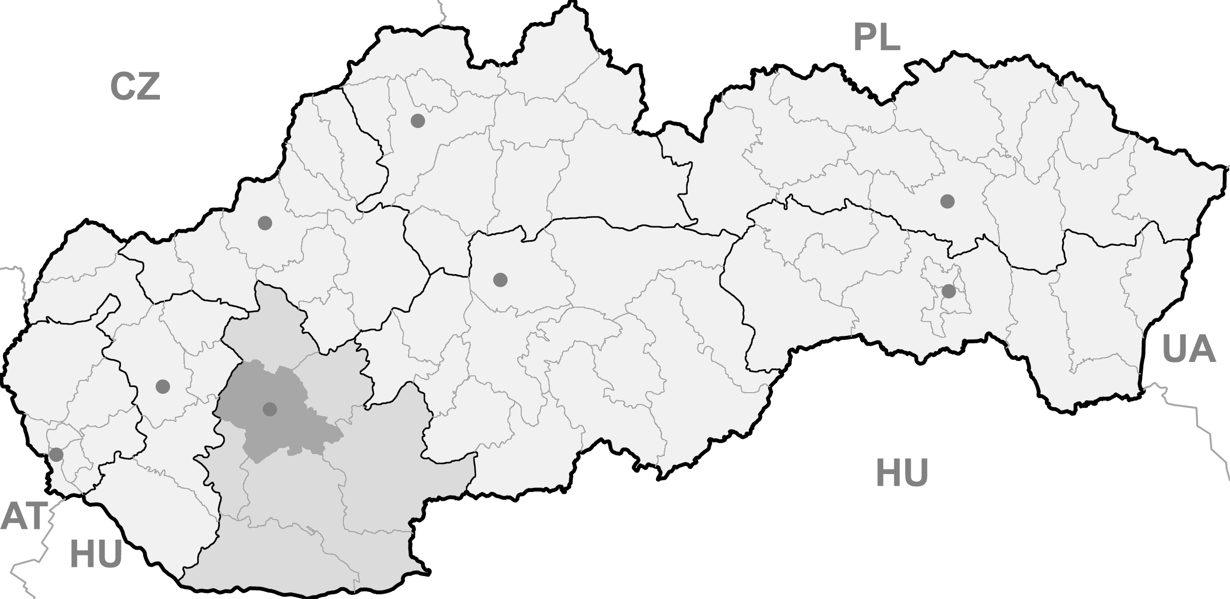
Wappen Karte 

Zbehy BasisdatenKraj: Nitriansky kraj Okres: Nitra Region: Nitra Fläche: 19,558 km² Einwohner: 2.265 (31. Dez. 2010) Bevölkerungsdichte: 115,81 Einwohner je km² Höhe: 144 m n.m. Postleitzahl: 951 42 Telefonvorwahl: 0 37 Geographische Lage: 48° 22′ N, 18° 1′ O48.362518.019444444444144Koordinaten: 48° 21′ 45″ N, 18° 1′ 10″ O Kfz-Kennzeichen: NR Gemeindekennziffer: 500950 StrukturGemeindeart: Gemeinde Gliederung Gemeindegebiet: 2 Gemeindeteile Verwaltung (Stand: April 2011)Bürgermeister: Ivan Habiňák Adresse: Obecný úrad Zbehy
69
951 42 ZbehyGemeindeinformation
auf portal.gov.skStatistikinformation
auf statistics.skZbehy (bis 1927 slowakisch auch „Izbehy“; ungarisch Üzbég) ist eine Gemeinde im Okres Nitra innerhalb des Nitriansky kraj in der Slowakei mit etwa 2.200 Einwohnern.
Geographie
Die Gemeinde liegt im slowakischen Donauhügelland, am Flüsschen Radošinka, zwischen dem Zusammenfluss mit dem Bach Andač und der Mündung in die Nitra. Zbehy ist 10 Kilometer von Nitra und 21 Kilometer von Hlohovec entfernt.
Verwaltungstechnisch ist die Gemeinde in den Hauptort Zbehy sowie den vier Kilometer nordwestlich gelegenen Ortsteil Andač (1986 eingemeindet, ungarisch Kisandacs) gegliedert.
Geschichte
Der Ort wurde zum ersten Mal wohl 1156 als Jegu schriftlich erwähnt.
Gemeinden im Okres NitraAlekšince (Alaxinetz) | Báb | Babindol | Bádice | Branč | Cabaj-Čápor | Čab | Čakajovce | Čechynce | Čeľadice | Čifáre (Fäsch) | Dolné Lefantovce (Unterelefant) | Dolné Obdokovce | Golianovo | Horné Lefantovce (Oberelefant) | Hosťová | Hruboňovo | Ivanka pri Nitre (Iwanka) | Jarok | Jelenec | Jelšovce | Kapince (Kapintz) | Klasov | Kolíňany | Lehota | Lúčnica nad Žitavou | Lukáčovce | Lužianky | Ľudovítová | Malé Chyndice | Malé Zálužie | Malý Cetín (Kleinzitin) | Malý Lapáš | Melek | Mojmírovce | Nitra (Neutra) | Nitrianske Hrnčiarovce | Nová Ves nad Žitavou (Neudorf) | Nové Sady | Paňa | Podhorany | Pohranice (Pogranitz) | Poľný Kesov | Rišňovce (Ritschen) | Rumanová | Svätoplukovo | Štefanovičová | Štitáre | Šurianky | Tajná | Telince | Veľká Dolina | Veľké Chyndice | Veľké Zálužie | Veľký Cetín (Großzitin) | Veľký Lapáš | Vinodol (Sillesch) | Vráble | Výčapy-Opatovce | Zbehy | Žirany | Žitavce
Wikimedia Foundation.
Schlagen Sie auch in anderen Wörterbüchern nach:
Zbehy — (in Hungarian Üzbég or Izbék ) is a village and municipality in the Nitra District in western central Slovakia, in the Nitra Region.HistoryIn historical records the village was first mentioned in 1156.GeographyThe village lies at an altitude of… … Wikipedia
Zbehy (district Nitra) — Zbehy (Village) Administration Pays Slovaquie … Wikipédia en Français
Nitra — Wappen Karte … Deutsch Wikipedia
District de Nitra — Nitra Informations Pays … Wikipédia en Français
Bahnstrecke Lužianky–Leopoldov — Lužianky–Leopoldov Kursbuchstrecke (ZSSK): 141 Streckenlänge: 28,04 km Spurweite: 1435 mm (Normalspur) Legende … Deutsch Wikipedia
Nitra — If you were looking for a chemical, see nitre or nitro. Coordinates: 48°18′25″N 18°05′11″E / 48.30694°N 18.08639°E / 48.30694; 1 … Wikipedia
Nitra Region — Coordinates: 48°18′25″N 18°05′11″E / 48.30694°N 18.08639°E / 48.30694; 18.08639 … Wikipedia
Nitra District — District Country Slovakia Regio … Wikipedia
Melek — This article is about the village. For other uses, see Melek (disambiguation). Levice district in the Nitra region Melek is a municipality and village in the Nitra District of the south west of Slovakia, in the Nitra Region … Wikipedia
List of municipalities and towns in Slovakia — Slovakia This is a comprehensive list of municipalities and towns in Slovakia. For lists of towns and municipalities sorted by Regions see the individual articles on Regions. For an outdated list of towns only in Slovakia see also List of towns… … Wikipedia
Zbehy

18+
© Academic, 2000-2025
- Kontaktieren Sie uns: Unterstützung, Werbung
Wörterbücher Export, schritte mit PHP, Joomla, Drupal, WordPress, MODx.