- Lehota
-
Lehota
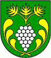
Wappen Karte  Basisdaten
Kraj: Nitriansky kraj Okres: Nitra Region: Nitra Fläche: 11,004 km² Einwohner: 1.965 (31. Dez. 2010) Bevölkerungsdichte: 178,57 Einwohner je km² Höhe: 174 m n.m. Postleitzahl: 951 36 Telefonvorwahl: 037 Geographische Lage: 48° 19′ N, 17° 58′ O48.31361111111117.974166666667174Koordinaten: 48° 18′ 49″ N, 17° 58′ 27″ O Kfz-Kennzeichen: NR Gemeindekennziffer: 500453 StrukturGemeindeart: Gemeinde Verwaltung (Stand: November 2010)Bürgermeister: Pavol Zaujec Adresse: Obecný úrad Lehota
16
95136 LehotaWebpräsenz: www.lehota.sk Gemeindeinformation
auf portal.gov.skStatistikinformation
auf statistics.skLehota (ungarisch Abaszállás - bis 1907 Abalehota) ist eine Gemeinde in der Slowakei. Sie liegt im Okres Nitra in der Westslowakei, 9 km westlich von Landeshauptstadt Nitra, hat etwa 1800 Einwohner und wurde im Jahr 1303 gegründet.
Sehenswürdigkeiten
- barocke Kirche der Heiligen Anna (1755)
- Denkmäler der Gefallenen im Ersten und Zweiten Weltkrieg
Alekšince (Alaxinetz) | Báb | Babindol | Bádice | Branč | Cabaj-Čápor | Čab | Čakajovce | Čechynce | Čeľadice | Čifáre (Fäsch) | Dolné Lefantovce (Unterelefant) | Dolné Obdokovce | Golianovo | Horné Lefantovce (Oberelefant) | Hosťová | Hruboňovo | Ivanka pri Nitre (Iwanka) | Jarok | Jelenec | Jelšovce | Kapince (Kapintz) | Klasov | Kolíňany | Lehota | Lúčnica nad Žitavou | Lukáčovce | Lužianky | Ľudovítová | Malé Chyndice | Malé Zálužie | Malý Cetín (Kleinzitin) | Malý Lapáš | Melek | Mojmírovce | Nitra (Neutra) | Nitrianske Hrnčiarovce | Nová Ves nad Žitavou (Neudorf) | Nové Sady | Paňa | Podhorany | Pohranice (Pogranitz) | Poľný Kesov | Rišňovce (Ritschen) | Rumanová | Svätoplukovo | Štefanovičová | Štitáre | Šurianky | Tajná | Telince | Veľká Dolina | Veľké Chyndice | Veľké Zálužie | Veľký Cetín (Großzitin) | Veľký Lapáš | Vinodol (Sillesch) | Vráble | Výčapy-Opatovce | Zbehy | Žirany | Žitavce
Wikimedia Foundation.

