- Fire Island Pines
-
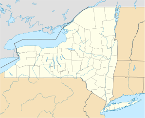
Fire Island Pines Lage in New YorkBasisdaten Staat: Vereinigte Staaten Bundesstaat: New York County: Koordinaten: 40° 40′ N, 73° 4′ W40.665277777778-73.068333333333Koordinaten: 40° 40′ N, 73° 4′ W Zeitzone: Eastern Standard Time (UTC−5) Einwohner: 12 (Stand: 2004) Postleitzahl: 11782 Vorwahl: +1 631 Fire Island Pines ist ein Weiler in der Gemeinde Brookhaven in Suffolk County, New York. Es befindet sich auf Fire Island, einer Nehrungsinsel auf der Südseite von Long Island. Die Volkszählung im Jahr 2000 ergab für die Insel Fire Island eine Bevölkerungszahl von 310 Einwohnern. Dies stellt jedoch nur die Zahl der ganzjährigen Einwohner dar; als Ferienort ist die Zahl der Sommergäste (insbesondere an den Wochenenden) deutlich größer.
Fire Island Pines wird liebevoll „Chelsea mit Sand“ genannt. (Chelsea ist als Schwulenviertel in Manhattan bekannt.) Mit dem benachbarten Weiler Cherry Grove zusammen, bildet Fire Island Pines das Lesben- und Schwulenviertel von Fire Island. Die großen Häuser werden in der Regel von mehreren Parteien als Ferienwohnung angemietet, so dass zum Beispiel ein 5 ZKB Haus in der Regel von 8 Erwachsenen bewohnt wird. Der überwiegende Anteil der Bevölkerung setzt sich aus Schwulen zwischen 20 und 50 Jahren zusammen. Zwei der berühmtesten Ereignisse in den Pines sind die Pines Party, eine Tanzparty jeden August, die am Strand abgehalten wird, und die ganze Nacht durchgeht, sowie die Invasion of the Pines, eine Parade von Drag Queens, die jedes Jahr am 4. Juli (dem US-amerikanischen Nationalfeiertag) abgehalten wird.
Villages: Belle Terre | Bellport | Lake Grove | Old Field | Patchogue | Poquott | Port Jefferson | Shoreham
Hamlets: Blue Point | Brookhaven | Calverton | Canaan Lake | Center Moriches | Centereach | Cherry Grove | Coram | Crystal Brook | Cupsogue Beach | Davis Park | East Moriches | East Patchogue | East Setauket | East Shoreham | Eastport | Farmingville | Fire Island Pines | Gordon Heights | Hagerman | Holbrook | Holtsville | Lake Ronkonkoma | Manorville | Mastic | Mastic Beach | Medford | Middle Island | Miller Place | Moriches | Mount Sinai | North Bellport | North Patchogue | Ocean Bay Park | Point of Woods | Port Jefferson Station | Ridge | Rocky Point | Ronkonkoma | Selden | Setauket | Shirley | Sound Beach | South Haven | Stony Brook | Strongs Neck | Terryville | Upton | Wading River | Water Island | West Manor | Yaphank
Wikimedia Foundation.


