- Stony Brook
-
Stony Brook 
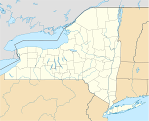
Lage in New York Basisdaten Staat: Vereinigte Staaten Bundesstaat: New York County: Koordinaten: 40° 54′ N, 73° 8′ W40.906388888889-73.12833333333327Koordinaten: 40° 54′ N, 73° 8′ W Zeitzone: Eastern Standard Time (UTC−5) Einwohner: 13.727 (Stand: 2000) Bevölkerungsdichte: 921,3 Einwohner je km² Fläche: 16,0 km² (ca. 6 mi²)
davon 14,9 km² (ca. 6 mi²) LandHöhe: 27 m Postleitzahlen: 11790, 11794 Vorwahl: +1 631 FIPS: 36-71608 GNIS-ID: 0966524 Stony Brook ist ein Ort an der Nordküste von Long Island im US-Bundesstaat New York. Er hat den Status eines unincorporated hamlet innerhalb der Town of Brookhaven im Suffolk County und wird als census-designated place geführt. Bekannt ist er vor allem für die State University of New York at Stony Brook. Nach dem Census von 2000 hatte der Ort 13.727 Einwohner.
Inhaltsverzeichnis
Geographie
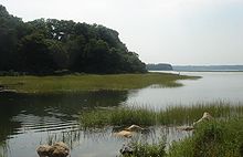
Stony Brook hat ein Gebiet von 16,0 km², davon 14,9 km² Land- und 1,1 km² Wasserfläche. Der Stony Brook Harbor ist eine sumpfige Bucht des Long Island Sounds. Hier liegen die Insel Youngs Island und ein kleiner städtischer Strand, Sand Street Beach. Die umliegenden Orte sind Old Field, Setauket-East Setauket, Centereach, Lake Grove, St. James und Head of the Harbor.
Geschichte
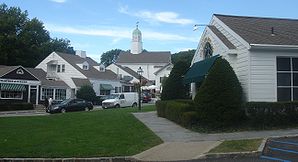
Die Gegend des heutigen Stony Brook war von Setalcott-Indianern besiedelt, die die Umgebung der Bucht als Wopowog, „Land an den Wasserengen“, nannten. Die europäische Besiedlung begann um 1660. Die erste urkundliche Erwähnung bezieht sich auf die heutige Main Street und datiert auf den 25. Mai 1685. 1884 wurde die Schreibweise des Namens von Stoney Brook zur heutigen Form geändert. Um 1855 war Stony Brook ein Standort des Schiffbaus, zwischen 1890 und dem Ersten Weltkrieg zeitweise ein beliebter Tourismusort. Danach lebte es primär nur noch vom Fischfang, bis ab 1939 der ansässige Geschäftsmann Ward Melville ein großangelegtes Entwicklungsprogramm durchführte und unter anderem das heutige Dorfzentrum im Stil des 19. Jahrhunderts errichten ließ. 1962 zog die 1957 gegründete Universität auf ihr heutiges, von Melville gespendetes Gelände auf dem Ortsgebiet um und wurde zum bestimmenden Faktor der Gegend.
Kultur und Sehenswürdigkeiten
Neben der Universität bietet Stony Brook noch das Long Island Museum und eine Wassermühle von 1751.
Infrastruktur
Stony Brook besitzt einen Haltepunkt an der LIRR-Strecke zwischen Port Jefferson und Penn Station.
Weblinks
Villages: Belle Terre | Bellport | Lake Grove | Old Field | Patchogue | Poquott | Port Jefferson | Shoreham
Hamlets: Blue Point | Brookhaven | Calverton | Canaan Lake | Center Moriches | Centereach | Cherry Grove | Coram | Crystal Brook | Cupsogue Beach | Davis Park | East Moriches | East Patchogue | East Setauket | East Shoreham | Eastport | Farmingville | Fire Island Pines | Gordon Heights | Hagerman | Holbrook | Holtsville | Lake Ronkonkoma | Manorville | Mastic | Mastic Beach | Medford | Middle Island | Miller Place | Moriches | Mount Sinai | North Bellport | North Patchogue | Ocean Bay Park | Point of Woods | Port Jefferson Station | Ridge | Rocky Point | Ronkonkoma | Selden | Setauket | Shirley | Sound Beach | South Haven | Stony Brook | Strongs Neck | Terryville | Upton | Wading River | Water Island | West Manor | Yaphank
Wikimedia Foundation.


