- Brookhaven (New York)
-
Brookhaven 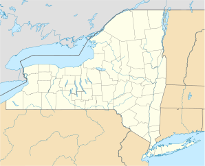

Brookhaven Lage in New YorkBasisdaten Gründung: 1666 / 1788 Staat: Vereinigte Staaten Bundesstaat: New York County: Koordinaten: 40° 51′ N, 72° 58′ W40.843333333333-72.96944444444424Koordinaten: 40° 51′ N, 72° 58′ W Zeitzone: UTC-5 Einwohner: 472.425 (Stand: 2004) Bevölkerungsdichte: 703,4 Einwohner je km² Fläche: 1.376,6 km² (ca. 532 mi²)
davon 671,6 km² (ca. 259 mi²) LandHöhe: 24 m Postleitzahl: 11719 Vorwahl: +1 631 FIPS: 36-09000 GNIS-ID: 0944835 Webpräsenz: www.brookhaven.org Bürgermeister: Town Supervisor Mark Lesko Brookhaven ist eine Stadt (town) im Suffolk County des US-Bundesstaates New York. Sie erstreckt sich von der Nord- bis zur Südküste von Long Island und hat etwa 472.425 Einwohner. Es handelt sich dabei nicht um eine Stadt im eigentlichen Sinne, sondern einen Verwaltungszusammenschluss eines größeren, sehr unterschiedlich besiedelten Gebietes ohne klares Zentrum.
Ein unincorporated hamlet (nicht selbstverwaltete Siedlung) und census-designated place (statistisches Gebiet) innerhalb der Stadt trägt ebenfalls den Namen Brookhaven.
Inhaltsverzeichnis
Geographie
Brookhaven ist mit 1376,6 km² die flächenmäßig größte Stadt des Staates New York. Die Nordküste liegt am Long-Island-Sund, im Süden gehört ein großer Teil der Great South Bay zum Stadtgebiet, sodass 705,1 km² Wasser- und nur 671,6 km² Landfläche sind. Die vorgelagerte Barriereinsel Fire Island trennt die Bucht zum freien Atlantik hin ab.
Die Nachbarstädte sind Smithtown und Islip im Westen sowie Riverhead und Southampton im Osten.
Gliederung
In Brookhaven liegen acht incorporated villages (selbstverwaltete Dörfer) und 36 hamlets (Weiler).
- Villages: Belle Terre, Bellport, Lake Grove, Old Field, Patchogue, Poquott, Port Jefferson, Shoreham
- Hamlets: Blue Point, Brookhaven, Calverton, Center Moriches, Centereach, Coram, East Moriches, East Patchogue, East Setauket, East Shoreham, Eastport, Farmingville, Fire Island Pines, Gordon Heights, Holbrook, Holtsville, Lake Ronkonkoma, Manorville, Mastic, Mastic Beach, Medford, Middle Island, Miller Place, Moriches, Mount Sinai, North Bellport, North Patchogue, Port Jefferson Station, Ridge, Rocky Point, Selden, Setauket, Shirley, Sound Beach, Stony Brook, Terryville, Yaphank. Ferner gibt es die Poospatuck Indian Reservation mit 271 Bewohnern (2004).
Geschichte
Auf dem heutigen Gebiet von Brookhaven lebten ursprünglich verschiedene Stämme der Metoac-Indianer. Als erste europäische Siedlung entstand 1655 das heutige Setauket im Norden unter dem Namen Ashford. Durch das sogenannte Nicolls Patent vom 7. März 1666 wurde erstmals der Name Brookhaven für das größere Gebiet festgeschrieben, die Anerkennung als Stadt bzw. town erfolgte 1788.[1] Bis 1789 befand sich die Stadtregierung in Setauket, wurde dann nach Coram und später weiter nach Medford verlegt.[2]
In früheren Jahrhunderten lebten die meisten Siedlungen Brookhavens von Ackerbau, Fischfang und Schiffbau. Im 20. Jahrhundert verstädterten einige Orte, andere entwickelten sich zu dünn besiedelten Wohngebieten.
Bevölkerungsentwicklung Jahr 1825 1850 1900 1950 1960 1970 1980 1990 2000 Einwohner 5.393 8.595 14.892 44.522 109.900 245.260 364.812 407.779 448.248 Bildung und Wissenschaft
Das Brookhaven National Laboratory ist eine der größten Forschungseinrichtungen der USA, das vor allem für seinen Teilchenbeschleuniger RHIC bekannt ist. Auf Brookhavener Gebiet befindet sich auch der Hauptcampus der State University of New York at Stony Brook.
Infrastruktur
Im teils zu Brookhaven, teils zu Islip gehörenden Ronkonkoma befindet sich der Flughafen Long Island MacArthur Airport (ISP). Die Bahnstrecken der Long Island Rail Road von Penn Station nach Port Jefferson, Greenport (Ronkonkoma branch) und Montauk sowie der Long Island Expressway (Interstate 495) durchqueren das Stadtgebiet. Von Port Jefferson besteht eine Fährverbindung nach Bridgeport in Connecticut.
Bekannte Einwohner Brookhavens
- Alice Boughton, Fotografin
Weblinks
 Commons: Town of Brookhaven, New York – Sammlung von Bildern, Videos und Audiodateien
Einzelnachweise
Orte in der Town of BrookhavenVillages: Belle Terre | Bellport | Lake Grove | Old Field | Patchogue | Poquott | Port Jefferson | Shoreham
Hamlets: Blue Point | Brookhaven | Calverton | Canaan Lake | Center Moriches | Centereach | Cherry Grove | Coram | Crystal Brook | Cupsogue Beach | Davis Park | East Moriches | East Patchogue | East Setauket | East Shoreham | Eastport | Farmingville | Fire Island Pines | Gordon Heights | Hagerman | Holbrook | Holtsville | Lake Ronkonkoma | Manorville | Mastic | Mastic Beach | Medford | Middle Island | Miller Place | Moriches | Mount Sinai | North Bellport | North Patchogue | Ocean Bay Park | Point of Woods | Port Jefferson Station | Ridge | Rocky Point | Ronkonkoma | Selden | Setauket | Shirley | Sound Beach | South Haven | Stony Brook | Strongs Neck | Terryville | Upton | Wading River | Water Island | West Manor | Yaphank
Wikimedia Foundation.
Schlagen Sie auch in anderen Wörterbüchern nach:
Brookhaven, New York — Infobox Settlement official name = Town of Brookhaven, New York settlement type = Town nickname = image town = mapsize1 = map caption1 = image dot dot mapsize = 250px dot map caption = dot x = 203 dot y = 170 imagesize = 250x200px image caption … Wikipedia
New York locations by per capita income — New York is the sixth richest state in the United States of America, with a per capita income of $40,272.29 (2004). [1] New York counties ranked by per capita income There are sixty two counties located in New York, six of which are in the 100… … Wikipedia
New York State Route 27 — Sunrise Highway redirects here. For the Sunrise Highway in San Diego County, California, see County Route S1 (California). NY 27 redirects here. NY 27 may also refer to New York s 27th congressional district. NYS Route 27 … Wikipedia
Brookhaven (CDP), New York — For the larger town known as Brookhaven, see Brookhaven, New York. Infobox Settlement official name = Brookhaven, New York settlement type = CDP nickname = motto = imagesize = image caption = image |pushpin pushpin label position = pushpin map… … Wikipedia
New York state elections, 2010 — Elections in New York Federal offices Presidential elections 1996 · 2000 · 2004 … Wikipedia
New York's 1st State Senate district — Senate District 1 Type District of the Upper House Location Southeastern New York Region served five East End towns of Long Island, New York and the eastern half of the Town of Brookhaven, New York Senator … Wikipedia
New York Blue Gene supercomputer — New York Blue Gene supercomputer, also known as NewYorkBlue, is a 18 rack Blue Gene/L and a 2 rack Blue Gene/P massively parallel supercomputer based on the IBM system on chip technology. It is located in the New York Center for Computational… … Wikipedia
New York's 1st congressional district — Current Representative Tim Bishop (D–Southhampton) … Wikipedia
Coram, New York — CDP U.S. Census Map … Wikipedia
Mastic, New York — CDP Nickname(s): Mas tick (Tidal River) … Wikipedia
Brookhaven (New York)

18+
© Academic, 2000-2026
- Kontaktieren Sie uns: Unterstützung, Werbung
Wörterbücher Export, schritte mit PHP, Joomla, Drupal, WordPress, MODx.