- Firth of Forth
-
56.01-3.17Koordinaten: 56° 0′ 36″ N, 3° 10′ 12″ W
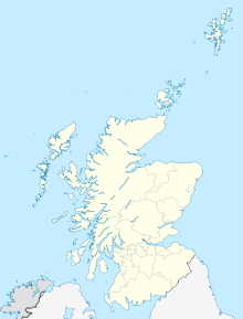
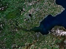
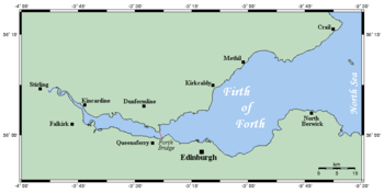
Der Firth of Forth (gäl.: Abhainn Dhubh) ist ein Meeresarm an der Ostküste von Schottland und gleichzeitig die Mündung des Flusses Forth in die Nordsee. Präformiert wurde die Rinne des Firth of Forth in der letzten britischen Eiszeitphase durch den vom Hochland herabwandernden Forth-Gletscher.[1] Darum ist der Firth of Forth geologisch ein Fjord.
Im Norden liegt die Grafschaft Fife, im Süden liegen die Grafschaften East Lothian und West Lothian sowie die Stadt Edinburgh. Die Gezeiten machen sich bis hinauf nach Stirling bemerkbar.
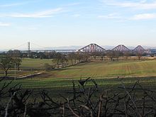
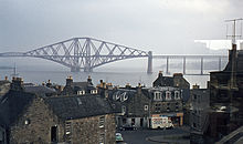
An beiden Ufern liegen zahlreiche Städte, die petrochemischen Werke von Grangemouth, der Hafen von Leith, das Bohrinselwerk von Methil, die Schiffabwrackanlage von Inverkeithing und die Marinewerft von Rosyth. Weitere Industrieanlagen befinden sich im Forth Bridgehead, in Burntisland, in Kirkcaldy, Bo'ness und Leven. Über den Firth of Forth führen die Kincardine Bridge, die Forth Road Bridge und die Forth Bridge.
1850 wurde der Firth of Forth von der ersten Eisenbahnfähre der Welt überquert; das Schiff hieß Leviathan und hatte 417 Bruttoregistertonnen.[2]
Im inneren Teil des Firth, das heißt in der Gegend zwischen Kincardine und den Forth-Brücken, wurde der Meeresarm etwa zur Hälfte durch Landgewinnung zugeschüttet, teilweise für landwirtschaftliche, hauptsächlich aber für industrielle Zwecke und als Deponie für die Kohleschlacke des Longannet-Kraftwerks.
Trotz der starken industriellen Nutzung ist der Firth wichtig für den Naturschutz. Im Firth of Forth Special Protection Area (spezielles Schutzgebiet) halten sich jedes Jahr über 90.000 brütende Seevögel auf. Auf der Isle of May befindet sich eine Vogelbeobachtungsstation.
Inhaltsverzeichnis
Inseln im Firth of Forth
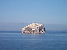
- Bass Rock
- Craigleith
- Cramond
- Eyebroughy
- Fidra
- Inchcolm
- Inchgarvie
- Inchkeith
- Inchmickery
- Isle of May
- The Lamb
Städte und Dörfer am Firth of Forth
Nordufer
- Aberdour
- Anstruther
- Buckhaven
- Burntisland
- Cellardyke
- Crail
- Dalgety Bay
- Dysart
- Earlsferry
- East Wemyss
- Elie
- Inverkeithing
- Kincardine
- Kinghorn
- Kirkcaldy
- Leven
- Lower Largo
- Methil
- North Queensferry
- Pittenweem
- Rosyth
- St. Monans
Südufer
- Aberlady
- Blackness
- Bo'ness
- Cockenzie
- Cramond
- Dunbar
- Edinburgh
- Grangemouth
- Gullane
- Leith
- Musselburgh
- North Berwick
- Port Edgar
- Portobello
- Port Seton
- Prestonpans
- South Queensferry
Referenzen
- ↑ David J.A. Evansa et al.: The last British Ice Sheet: A review of the evidence utilised in the compilation of the Glacial Map of Britain in Earth-Science Reviews Volume 70, Issues 3-4, May 2005, Pages 253-312
- ↑ [1]
Weblinks
Wikimedia Foundation.

