- Güroymak
-
Güroymak 
Hilfe zu Wappen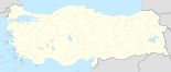

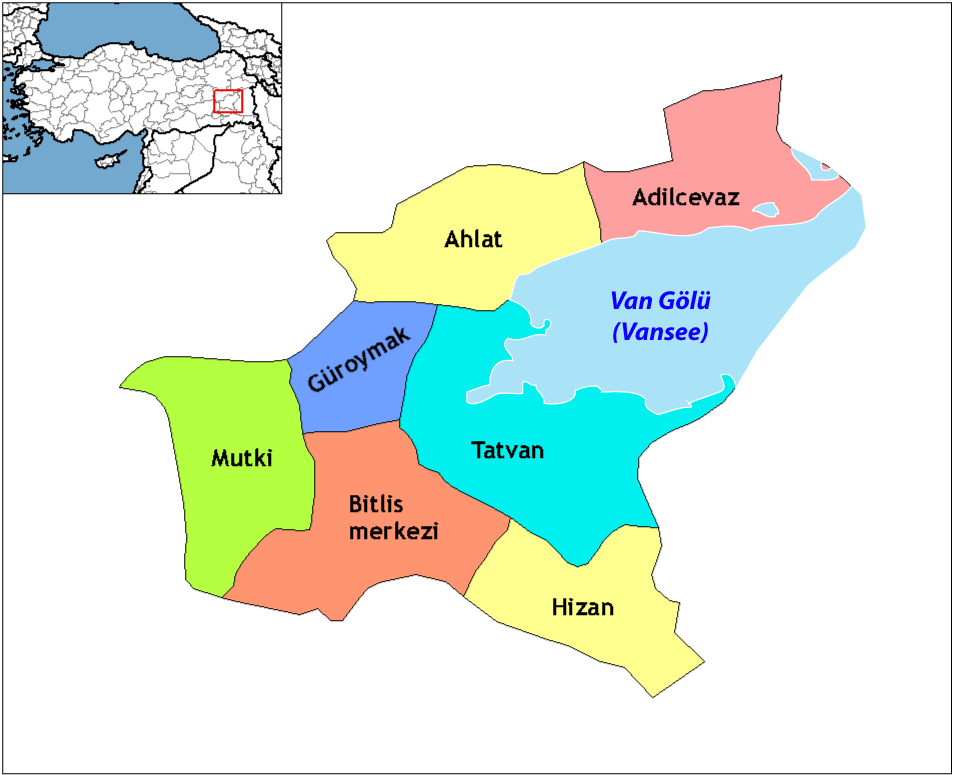
Basisdaten Provinz (il): Bitlis Koordinaten: 38° 42′ N, 42° 2′ O38.742.0333333333331320Koordinaten: 38° 42′ 0″ N, 42° 2′ 0″ O Höhe: 1.320 m Einwohner: 20.607[1] (2010) Telefonvorwahl: (+90) 434 Postleitzahl: 13800 Kfz-Kennzeichen: 13 Struktur und Verwaltung (Stand: 2009) Bürgermeister: Mehmet Emin Özkan (BDP) Webpräsenz: Landkreis Güroymak Einwohner: 44.416[1] (2010) Fläche: 525 km² Bevölkerungsdichte: 85 Einwohner je km² Kaymakam: Turan Yılmaz Webpräsenz (Kaymakam): Güroymak (türkisch) bzw. Norşin (armenisch: "Neues Dorf"[2]; ehemals auch Çukur) ist der Name einer Kreisstadt und eines Landkreises in der türkischen Provinz Bitlis. Güroymak liegt im Westen der Provinz an der Grenze zu Muş. Die Stadt hat 20.607 Einwohner und der Landkreis 44.416 (Stand 2010).
Dynastien und Reiche, die Güroymak beherrschten, waren die Hethiter, Urartäer, Perser, Makedonen, Seleukiden, Rom, Marwaniden, die Ahlatschahs, die Şerefhans, Osmanen, Russen und Türken. Güroymak ist per Gesetz seit 1988 ein Landkreis.
Im Rahmen der „Kurdeninitiative“ der Regierung von Ministerpräsident Recep Tayyip Erdoğan wird die Stadt seit August 2009 auch von offizieller Seite wieder mit ihrem kurdisch-armenischen Namen Norşin bezeichnet.[3]
Einzelnachweise
- ↑ a b Türkisches Institut für Statistik, abgerufen 8. August 2011
- ↑ http://www.taraf.com.tr/sevan-nisanyan/makale-norsin.htm Zeitung Taraf, Sevan Nişanyan "Norşin", vom 11. August 2009, Zugriff am 10. November 2010
- ↑ „Türkei erlaubt erstmals Ortsschilder auf Kurdisch“ (nicht mehr online verfügbar), tagesschau.de, 26. November 2009.
Schlagen Sie auch in anderen Wörterbüchern nach:
Güroymak — Norşîn Administration Pays … Wikipédia en Français
Güroymak — is a district of Bitlis Province, Turkey … Wikipedia
Guroymak — Original name in latin Groymak Name in other language Cukur, Goroymak, Guroymak, Groymak, Groymak, Norsin, Norin, ukur State code TR Continent/City Europe/Istanbul longitude 38.57739 latitude 42.02811 altitude 1321 Population 25826 Date 2012 01… … Cities with a population over 1000 database
Güroymak — is., k ı, öz. Bitlis iline bağlı ilçelerden biri … Çağatay Osmanlı Sözlük
Grand Yuksel Hotel — (Güroymak,Турция) Категория отеля: 3 звездочный отель Адрес: Mus Bulvarı No:47 Guroym … Каталог отелей
Bedlis — Bitlis … Deutsch Wikipedia
Provincia de Bitlis — Saltar a navegación, búsqueda Bitlis İli es una de las 81 provincias de Turquía, situada al Este, en la ribera del Lago Van. Superficie: 8.413 km² Población (2000): 388.678 Densidad de población: 46,20 hab./km² Capital: Bitlis Población (2000):… … Wikipedia Español
List of cities in Turkey — The National Flag of Turkey This list is incomplete; you can help by expanding it. This is a list of cities in Turkey by population. Included are cities that are provincial capitals or have a population of at least 7,000 … Wikipedia
Bitlis Province — Infobox Province TR region = Eastern Anatolia name = Bitlis total population = 413,446 area= 6707 licence = 13 area code= 434|Bitlis is a province of eastern Turkey, located to the west of Lake Van. Ethnic Kurds form the majority of the… … Wikipedia
Mutki — is a town and district of Bitlis Province, Turkey. The mayor is Vahdettin Barlak (of the AKP). Additional sources Website of the Municipality of Mutki Website of the governor … Wikipedia
Güroymak


18+
© Academic, 2000-2026
- Kontaktieren Sie uns: Unterstützung, Werbung
Wörterbücher Export, schritte mit PHP, Joomla, Drupal, WordPress, MODx.