Highway 401 (Ontario)

Highway 401 (Ontario)
Highway 401 als Teil des Netzwerks der 400er Serie

Der Highway 401 oder Macdonald-Cartier Freeway ist eine Autobahn, die sich durch den Süden der kanadischen Provinz Ontario zieht. Sie ist die bei weitem längste Autobahn der 400er-Serie in Ontario und eine der meistbefahrenen der Welt. Zusammen mit der Quebec Autoroute 20 bildet sie das Haupttransportnetz des Québec-Windsor-Korridors, der am dichtesten besiedelten, wohlhabendsten und meist industrialisierten Region des Landes, die sich entlang des Sankt-Lorenz-Stroms erstreckt und in der über die Hälfte der kanadischen Bevölkerung wohnen und drei der vier größten kanadischen Städte, nämlich Québec, Montreal und Toronto, liegen.

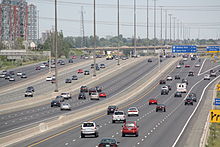
Highway 401 Blick der Erweiterung der Fahrspuren von 10 auf 18
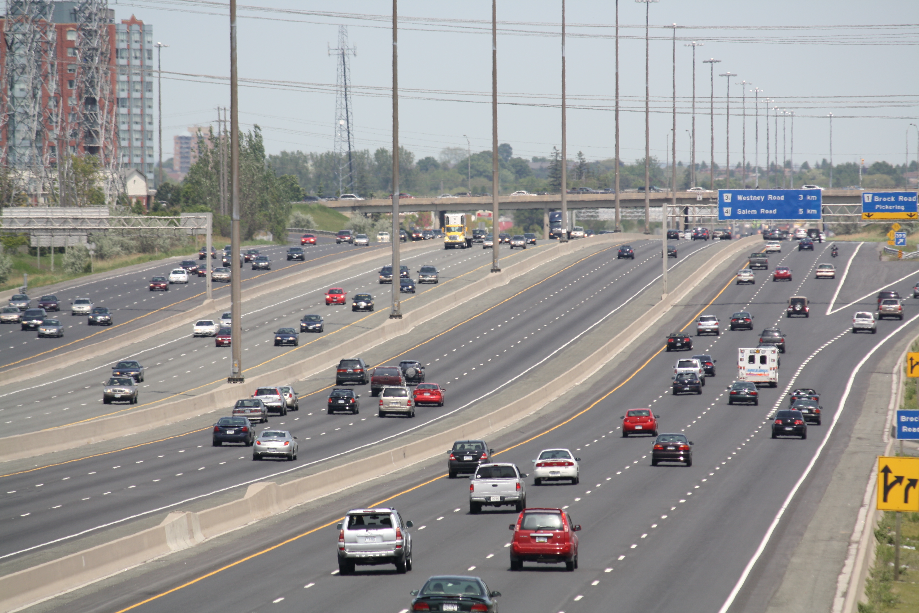
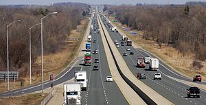
Highway 401 - östlich von London, Ontario

1965 benannte der Premier Ontarios, John Robarts, den Highway 401 zu Ehren der beiden Väter der Konföderation, Sir John Macdonald und Sir George-Étienne Cartier Macdonald-Cartier Freeway. Dies ist der in offiziellen Dokumenten gebräuchliche Name, der jedoch selten auf Straßenschildern oder in Unterhaltungen gebraucht wird.

Überblick

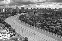
Teilstück des Highway 401

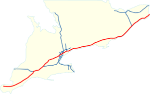
Der Highway 401 beginnt am Highway 3, 13 km entfernt vom Detroit River in den Randbezirken von Windsor und endet nach 815 km an der Grenze zu Québec, hinter der er zur Quebec Autoroute 20 wird. Entlang der Strecke liegen 18 Rastplätze. An der Ivy-Lea-Raststätte, wo der Highway 1965 fertiggestellt wurde, erinnert eine Gedenktafel daran, dass der Highway 401 die längste mautfreie Autobahn unter einer einheitlichen Autobahnverwaltung in Nordamerika ist. Mittlerweile hält diesen Rekord jedoch der texanische Abschnitt der Interstate 10.

Städte entlang der Strecke des Highway 401 sind unter anderem Windsor, Chatham, London, Woodstock, Kitchener, Cambridge, Guelph, Mississauga, Toronto, Oshawa, Cobourg, Belleville, Kingston, Brockville und Cornwall.

Weblinks


Wikimedia Foundation.

Игры ⚽ Поможем написать реферат

Schlagen Sie auch in anderen Wörterbüchern nach:

  • Highway 401 (Ontario) — Infobox road state=ON type=Hwy route=401 alternate name=Macdonald Cartier Freeway Highway of Heroes Express Toll Route length km=815 length ref=Ministry of Transportation of Ontario, [http://www.raqsb.mto.gov.on.ca/techpubs/TrafficVolumes.nsf/tvwe… …   Wikipedia

  • Ontario Highway 401 — Highway 401 redirects here. For other uses, see List of highways numbered 401 …   Wikipedia

  • List of exits on Highway 401 (Ontario) — There are over 150 interchanges, numbered from west to east, on Highway 401 in Ontario. Originally, the freeway had used sequential exit numbering, with roughly 128 numbered exits, before switching to the milemarker system, which in turn led to… …   Wikipedia

  • Highway 403 (Ontario) — Highway 403 is a 400 Series Highway in Ontario, Canada that extends 126 km (78.3 mi.) from Woodstock in the west to Mississauga in the east, branching off from and reuniting with Highway 401 at both ends. It is concurrently signed with the Queen… …   Wikipedia

  • Highway 27 (Ontario) — Highway 27 refers to a major arterial running through the Greater Toronto Area in Ontario, Canada. It is considered an undivided expressway in Toronto s municipal expressway network. Although the Ontario Ministry of Transportation was once… …   Wikipedia

  • Highway 2A (Ontario) — Highway 2A is a short controlled access freeway in Toronto, Ontario that extends from its junction with Kingston Road (formerly part of Highway 2) at the Highland Creek to its junction with Highway 401 (exit 390). It was downloaded to the City of …   Wikipedia

  • Highway 407 (Ontario) — in Brampton jct|state=ON|Hwy|427 in Vaughan jct|state=ON|Hwy|400 in Vaughan jct|state=ON|Hwy|404 in Markham direction b=East terminus b=jct|state=ON|Hwy|7 in Pickering previous type=Hwy previous route=406 next type=Hwy next route=409Highway 407,… …   Wikipedia

  • Highway 427 (Ontario) — The King s Highway 427 is a 400 Series Highway in the Greater Toronto Area of Ontario, Canada, that runs from immediately south of the Queen Elizabeth Way/Gardiner Expressway interchange (its exact southern terminus is on Browns Line at Coules… …   Wikipedia

  • Highway 404 (Ontario) — Infobox road state=ON type=Hwy route=404 alternate name= length km=36.8 length ref=Ministry of Transportation of Ontario, [http://www.raqsa.mto.gov.on.ca/techpubs/TrafficVolumes.nsf/tvweb 2004 Annual Average Daily Traffic] ] length round=1… …   Wikipedia

  • Highway 400 (Ontario) — Infobox road state=ON type=Hwy route=400 alternate name= length km=209 length ref=Ministry of Transportation of Ontario, [http://www.raqsa.mto.gov.on.ca/techpubs/TrafficVolumes.nsf/tvweb 2004 Annual Average Daily Traffic] ] length round=1… …   Wikipedia

Share the article and excerpts

Direct link
Do a right-click on the link above
and select “Copy Link”