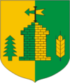
- Koigi
-
Koigi
Wappen
FlaggeStaat: Estland Kreis: Järva Koordinaten: 59° 10′ N, 25° 58′ O59.17166666666725.973055555556Koordinaten: 59° 10′ N, 25° 58′ O Fläche: 204,45 km² Einwohner: 1.114 (2010) Bevölkerungsdichte: 5 Einwohner je km² Zeitzone: EET (UTC+2) Webpräsenz: Koigi (deutsch: Koik) ist eine Landgemeinde im estnischen Kreis Järva mit einer Fläche von 204,45 km². Sie hat 1114 Einwohner (Stand: 2010).
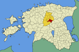
Neben dem Hauptort Koigi (527 Einwohner) gehören zur Gemeinde die Dörfer Huuksi, Kahala, Keri, Lähevere, Prandi, Päinurme, Rutikvere, Silmsi, Sõrandu, Tamsi, Ülejõe, Vaali und Väike-Kareda.
Besonders sehenswert ist das 1771 im frühklassizistischen Stil errichtete Herrenhaus von Koigi mit seinem Portikus aus toskanischen Säulen.
Weblinks
- Internetseite der Gemeinde Koigi (estnisch)
Städte und Gemeinden im Kreis JärvaStadt: Paide
Gemeinden: Albu | Ambla | Imavere | Järva-Jaani | Kareda | Koeru | Koigi | Paide (Gemeinde) | Roosna-Alliku | Türi (Gemeinde) | Väätsa
Wikimedia Foundation.
Schlagen Sie auch in anderen Wörterbüchern nach:
Koigi — Koigi:*Koigi Commune, a commune in Järva County Estonia*Koigi, Koigi, a village in Koigi Commune Järva County Estonia *Koigi, Rapla, a village in Rapla Commune Rapla County Estonia *Koigi, Pöide, a village in Pöide Commune Saare County… … Wikipedia
Koigi wa Wamwere — (born 1949) is a Kenyan politician, journalist and writer. Born in Bahati, Nakuru District, Koigi became famous for opposing both the Jomo Kenyatta and Daniel arap Moi regimes, both of which sent him to detention. Political career Wamwere studied … Wikipedia
Koigi Parish — Koigi ( et. Koigi vald) is a rural municipality of Estonia, in Järva County. It has a population of 1177 (2004) and an area of 204.45 km².Populated placesHuuksi Kahala Keri Koigi Lähevere Prandi Päinurme Rutikvere Silmsi Sõrandu Tamsi Vaali Väike … Wikipedia
Koigi (air base) — Infobox Airport name = Koigi nativename = nativename a = nativename r = image width = caption = IATA = ICAO = type = Military (defunct) owner = operator = Soviet Air Force city served = location = Paide elevation f = 233 elevation m = 71… … Wikipedia
Koigi vald — Admin ASC 2 Code Orig. name Koigi vald Country and Admin Code EE.04.0325 EE … World countries Adminstrative division ASC I-II
Koik — Koigi (deutsch: Koik) ist eine Landgemeinde im estnischen Kreis Järva mit einer Fläche von 204,45 km². Sie hat 1122 Einwohner (Stand: 2005). Neben dem Hauptort Koigi (527 Einwohner) gehören zur Gemeinde die Dörfer Huuksi, Kahala, Keri, Lähevere,… … Deutsch Wikipedia
Pikkjärv — Der Pikkjärv im Winter Geographische Lage Insel Saaremaa, Estland Abfluss Maadevahe … Deutsch Wikipedia
Manoir de Koik — Vue du manoir de Koik Nom local Koigi mõis Période ou style Néogothique Fin construction 1771 Propriétaire initial Johann Adam von Grünewaldt … Wikipédia en Français
Järva County — County of Estonia … Wikipedia
Subukia Constituency — is an electoral constituency in Kenya. It is one of six constituencies in Nakuru District. The constituency has five wards, all of which elect councillors for the Nakuru County Council. The constituency was formerly known as Nakuru North… … Wikipedia