Korinos

Korinos
Stadtgemeinde Korinos
(1997–2010)

Δήμος Κορινού (Κορινός)
Korinos (Griechenland)
Bluedot.svg
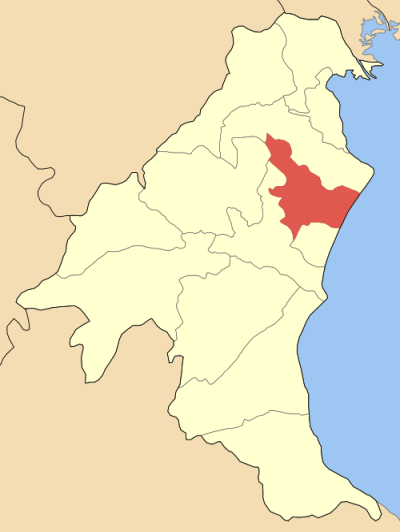
Basisdaten
Staat: Griechenland
Verwaltungsregion: Zentralmakedonien
Präfektur: Pieria
Geographische Koordinaten: 40° 19′ N, 22° 35′ O40.31666666666722.583333333333Koordinaten: 40° 19′ N, 22° 35′ O
Höhe ü. d. M.: 20-220 m
Korinos-Koukkos
Fläche: f470,909
Einwohner: 6.657 (2001)
Bevölkerungsdichte: 93,88
Sitz: Korinos
LAU-1-Code-Nr.: 610700
Gemeindegliederung: 5 Gemeindebezirkef7
Lage in der ehem. Präfektur Pieria
Bild:Dimos Korinou.png

f9f10f3

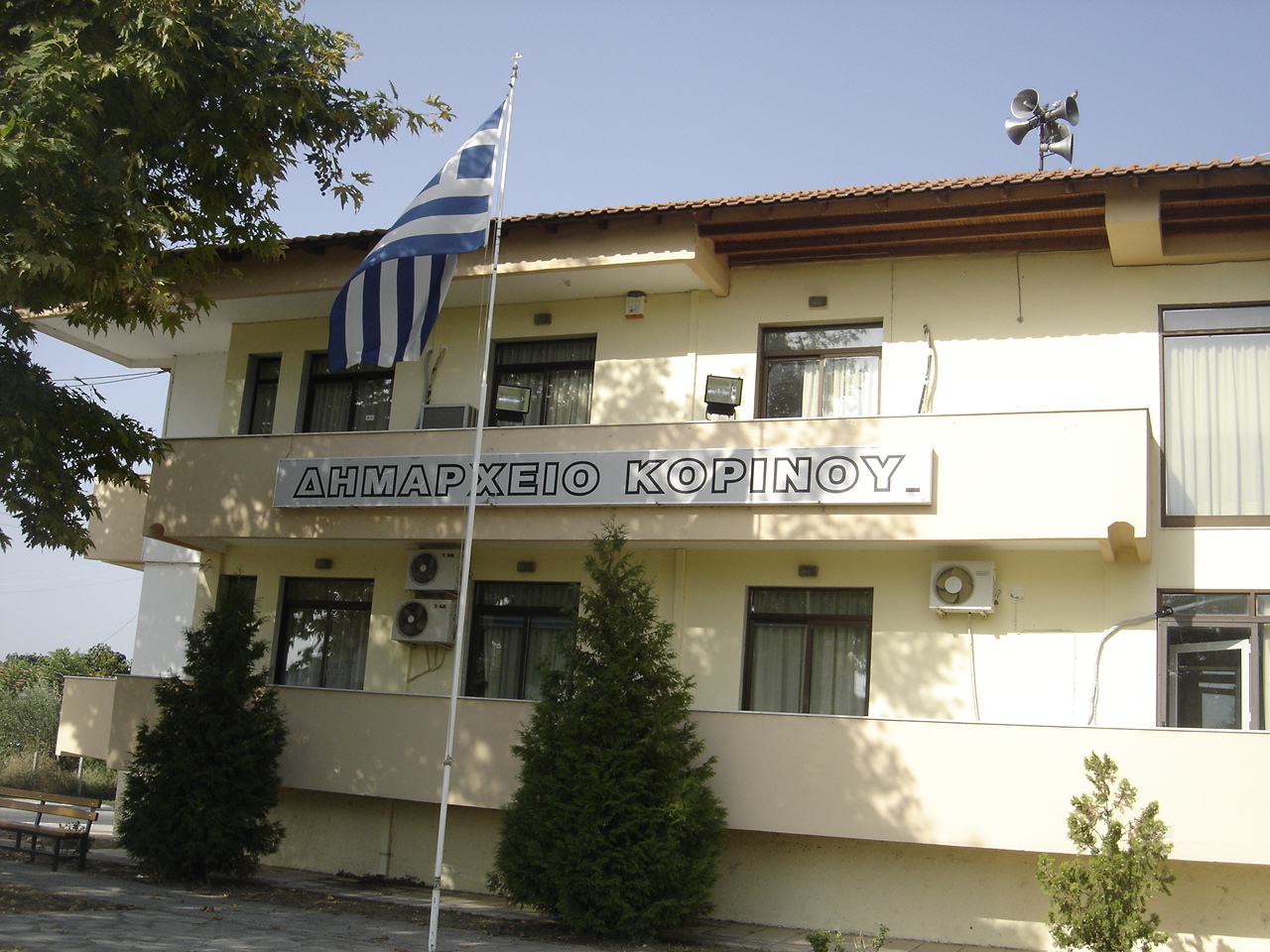
Rathaus (Dimarchio) der ehemaligen Gemeinde Korinos

Korinos (griechisch Κορινός (f. sg)) ist eine Kleinstadt mit rund 4.000 Einwohnern im Regionalbezirk Pieria der griechischen Verwaltungsregion Zentralmakedonien. Seit 1928 selbständige Landgemeinde (kinotita), wurde Korinos 1997 mit der Eingemeindung mehrerer benachbarter Gemeinden zur Stadtgemeinde erhoben. Mit der Verwaltungsreform 2010 wurde Korinos in die Gemeinde Katerini eingemeindet, wo es seither einen von sechs Gemeindebezirken bildet.

Im Westen von Korinos läuft die Autobahn 1 an der Ortschaft von Athen (Süden) nach Thessaloniki (Norden). Die Bahnstrecke Athen-Thessaloniki passiert Korinos ebenfalls.

Städtepartnerschaften


Wikimedia Foundation.

Игры ⚽ Поможем написать курсовую

Schlagen Sie auch in anderen Wörterbüchern nach:

  • Korinos — Infobox Greek Dimos name = Korinos name local = Κορινός periph = Central Macedonia prefec = Pieria province = population = 6611 population as of = 2001 population ref = [http://www.statistics.gr/gr tables/S1101 SAP 1 TB DC 01 03 Y.pdf source] pop …   Wikipedia

  • Korinos — Original name in latin Korins Name in other language Korinos, Korins State code GR Continent/City Europe/Athens longitude 40.315 latitude 22.58528 altitude 18 Population 4191 Date 2012 02 28 …   Cities with a population over 1000 database

  • Korinos — Sp Korinas Ap Κορινός/Korinos L ŠR Graikija …   Pasaulio vietovardžiai. Internetinė duomenų bazė

  • Autobahn 1 Griechenland — Autobahn 1 (Aftokinitodromos 1) Länge: 550 km …   Deutsch Wikipedia

  • Litochoron — Litochoro Δήμος Λιτοχώρου (Λιτόχωρο) DEC …   Deutsch Wikipedia

  • Paralia Katerinis — Gemeinde Paralia (Katerinis) Δήμος Παραλίας Κατερίνης (Παραλία Κατερίνης) DEC …   Deutsch Wikipedia

  • San Pantaleone — Der heilige Pantaleon, Mosaik einer Kirche in Korinos (Griechenland). Pantaleon (Pantaleimon, Panteeleimon) (* Mitte des 3. Jahrhunderts in Nikomedia, heute Izmit/Türkei; † 27. Juli 305) ist ein frühchristlicher Heiliger und Märtyrer …   Deutsch Wikipedia

  • Police (Pologne) — Pour les articles homonymes, voir Police. Police …   Wikipédia en Français

  • List of municipalities and communities in Greece — This is an alphabetical list of municipalities and communities in Greece. For an ordered list of cities with population over 30,000 see List of cities in Greece. A B C D E F G H I K L M N O P R S T V X Y Z See also A Name Greek name Prefecture A …   Wikipedia

  • Pieria — (Syria) was a province of Roman Syria. Infobox Pref GR name = Pieria name local = Nomos Pierias flag reg = Flag of Greek Macedonia.svg periph = Central Macedonia capital = Katerini population = 134,739 population as of = 2005 pop rank = 26th pop… …   Wikipedia

Share the article and excerpts

Direct link
Do a right-click on the link above
and select “Copy Link”