Perranuthnoe

Perranuthnoe
50.1-5.4333333333333
Perranuthnoe
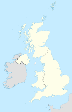
Perranuthnoe (Vereinigtes Königreich)
Perranuthnoe
Perranuthnoe
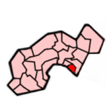
Lage von Perranuthnoe
Lage im District Penwith Lage im ehemaligen District Penwith
Basisdaten
Status Civil Parish
Region South West England
Zerem. Grafschaft Cornwall
Trad. Grafschaft Cornwall
Verwaltungssitz Perranuthnoe
Einwohner 2200 (2001)
Postleitzahl TR20 9xx
Telefonvorwahl 01736
Teilorte Goldsithney, Perran Downs, Rosudgeon
Website -
Perranuthnoe mit Kirche

Perranuthnoe ist eine Gemeinde und ein Ort im ehemaligen District Penwith der Grafschaft Cornwall in England. Sie umfasst die Siedlungen Perranuthnoe, Goldsithney, Perran Downs und Rosudgeon. Erstmals erwähnt wird der Ort im Domesday Book im Jahre 1086. Während des 18. und 19. Jahrhunderts befanden sich um die Gemeinde eine große Anzahl von Zinn- und Kupferminen. Das letzte Bergwerk wurde im Jahr 1900 geschlossen.

Weblinks

 Commons: Perranuthnoe – Sammlung von Bildern, Videos und Audiodateien

Wikimedia Foundation.

Игры ⚽ Поможем написать курсовую

Schlagen Sie auch in anderen Wörterbüchern nach:

  • Perranuthnoe — is a village and civil parish in the Penwith district of Cornwall, United Kingdom. The parish includes the villages of Perranuthnoe, Goldsithney, Perran Downs and part of Rosudgeon. History The first historical mention of Perranuthnoe can be… …   Wikipedia

  • Diocese of Truro — Location Ecclesiastical province Canterbury Archdeaconries Bodmin, Cornwall Coordinates …   Wikipedia

  • An Garrek Los y'n Cos — St. Michael’s Mount von Penzance aus ... und bei Hochwasser (auf einer Postkarte von 1900) Der St …   Deutsch Wikipedia

  • Eglosborrie — 50.075 5.62083333333337Koordinaten: 50° 5′ N, 5° 37′ W St Buryan …   Deutsch Wikipedia

  • Pennsans — DEC …   Deutsch Wikipedia

  • Pensans — DEC …   Deutsch Wikipedia

  • St Michael's Mount — St. Michael’s Mount von Penzance aus ... und bei Hochwasser (auf einer Postkarte von 1900) Der St …   Deutsch Wikipedia

  • South West Coast Path — The starting point at Minehead Length 630 miles (1,014 km) Location England: Somerset, Devon, Cornwall …   Wikipedia

  • Marazion — For the Royal Navy warship, see HMS Marazion (1919). Coordinates: 50°07′31″N 5°28′33″W / 50.125278°N 5.475833°W / 50.125278; 5.475833 …   Wikipedia

  • St Michael's Mount — Infobox UK place static static image caption = St Michael s Mount country = England official name= St Michael s Mount cornish name = Carrack Looz en Cooz latitude= 50.1160 longitude= 5.4772 area total sq mi= 0.09 population density= area… …   Wikipedia

Share the article and excerpts

Direct link
Do a right-click on the link above
and select “Copy Link”