- Sandøy
-
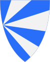
Wappen Karte 

Kommune Sandøy Fylke: Møre og Romsdal Verwaltungssitz: Steinshamn Fläche: 19 km² Kommunen Nr: 1546 Einwohner: 1.276 (2007) Geographische Lage: 62° 47′ N, 6° 28′ O62.7833333333336.4697222222222Koordinaten: 62° 47′ N, 6° 28′ O Offizielle Sprachform: Nynorsk Offizielle Website: Sandoy.kommune.no (nor.) Politik Bürgermeister: Nils Magne Abelseth (H) 2003-2007 Sandøy ist eine Insel und eine aus mehreren Inseln bestehende Kommune im norwegischen Fylke Møre og Romsdal. Das Verwaltungszentrum der Kommune ist Steinshamn auf der größten Insel Harøy.
Geographie
Die kleinste Kommune des Fylke mit bis 156 Metern hohen Felsen liegt etwa in der Mitte von Møre og Romsdal, westlich von Midsund und Molde, direkt am Atlantik. Sandøy dehnt sich von Nord bis Süd über den dazu gehörenden Harøyfjorden um 20,7 und von Ost nach West um 25,1 Kilometer aus. Da die Kommune aus den Inseln Harøy, Havær, Husøy, Lyngvær, Sandøy und einigen kleineren Inseln besteht, hat sie lediglich eine Landfläche von 19 Quadratkilometern.
Die Inseln sind untereinander teilweise mit Brücken, die bekannteste führt von der Insel Harøya nach Finnøya, sowie durch Fährschiffe verbunden.
Die Nachbarkommunen von Sandøy sind Aukra, Haram und Midsund.
Aukra | Aure | Averøy | Eide | Frei | Fræna | Giske | Gjemnes | Halsa | Haram | Hareid | Herøy | Kristiansund | Midsund | Molde | Nesset | Norddal | Rauma | Rindal | Sande | Sandøy | Skodje | Smøla | Stordal | Stranda | Sula | Sunndal | Surnadal | Sykkylven | Tingvoll | Ulstein | Vanylven | Vestnes | Volda | Ørskog | Ørsta | Ålesund
Wikimedia Foundation.
Schlagen Sie auch in anderen Wörterbüchern nach:
Sandoy — Karte der Insel Sandoy (isoliert betrachtet) Gewässer Atlantischer Ozean … Deutsch Wikipedia
Sandoy — Saltar a navegación, búsqueda Mapa de Sandoy Sandoy (en danés: Sandø) es la quinta isla en extensión de las 18 que forman el archipiélago de las Islas Feroe, situado en el Mar de Noruega. Su nombre significa La Isla de la Arena, y hace referencia … Wikipedia Español
Sandoy — Carte de Sandoy. Géographie Pays … Wikipédia en Français
Sandøy — Blason de Sandøy Localisation de Sandøy dans le Møre og Romsdal … Wikipédia en Français
Sandoy — (en danés: Sandø) es la quinta isla en extensión de las 18 que forman el archipiélago de las Islas Feroe, situado en el Mar de Noruega. Su nombre significa La Isla de la Arena, y hace referencia a las playas que se pueden encontrar a lo largo de… … Enciclopedia Universal
Sandøy — Infobox Kommune name=Sandøy idnumber=1546 county=Møre og Romsdal landscape=Romsdal capital=Steinshamn governor=Oddvar Myklebust governor as of=2007 arearank=427 area=20 arealand=20 areapercent=0.01 population as of=2004 populationrank=388… … Wikipedia
Sandoy — Island of the Faroe Islands name = Sandoy municipality = area = 125 area rank = population = 1,494 population rank = population year = 2001 population density = location = coord|61|51|N|6|47|W||Sandoy is a small island that is part of the Faroe… … Wikipedia
Sandoy — 1 Admin ASC 1 Code Orig. name Sandoy Country and Admin Code FO.SA FO 2 Admin ASC 2 Code Orig. name Sandøy Country and Admin Code NO.08.1546 NO … World countries Adminstrative division ASC I-II
Sandoy — Sp Sándojus Ap Sandoy fareriškai L s. Fareruose, Danija … Pasaulio vietovardžiai. Internetinė duomenų bazė
B71 Sandoy — Football club infobox clubname = B71 fullname = Sandoyar Ítróttarfelag, B71 nickname = B71 founded = 01.01.1970 ground = Sandur Stadium Sandur, Faroes capacity = 2,000 chairman = flagicon|Faroe Islands Ragnar Fossdalsá mgrtitle = Head Coach… … Wikipedia
