- Scott County (Minnesota)
-
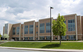 Das Scott County Government Center in Shakopee
Verwaltung US-Bundesstaat: Minnesota Verwaltungssitz: Shakopee Adresse des
Verwaltungssitzes:County Courthouse
200 Fourth Avenue West
Shakopee, MN 55379-1220Gründung: 5. März 1853 Gebildet aus: Dakota County Vorwahl: 001 952 Demographie Einwohner: 129.928 (2010) Bevölkerungsdichte: 140,6 Einwohner/km² Geographie Fläche gesamt: 955 km² Wasserfläche: 31 km² Karte 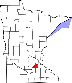
Website: www.co.scott.mn.us Das Scott County[1] ist ein County im US-amerikanischen Bundesstaat Minnesota. Bei der Volkszählung im Jahr 2010 hatte das County 129.928 Einwohner und eine Bevölkerungsdichte von 140,6 Einwohnern pro Quadratkilometer. Der Verwaltungssitz (County Seat) ist Shakopee.
Das Scott County ist Bestandteil der Metropolregion Minneapolis - Saint Paul.
Inhaltsverzeichnis
Geografie
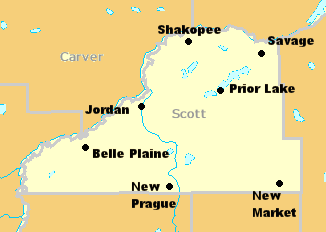
Das County liegt im mittleren Südosten von Minnesota und hat eine Fläche von 955 Quadratkilometern, wovon 31 Quadratkilometer Wasserfläche sind. Es grenzt an folgende Countys:
Carver County Hennepin County Sibley County 
Dakota County Le Sueur County Rice County Geschichte
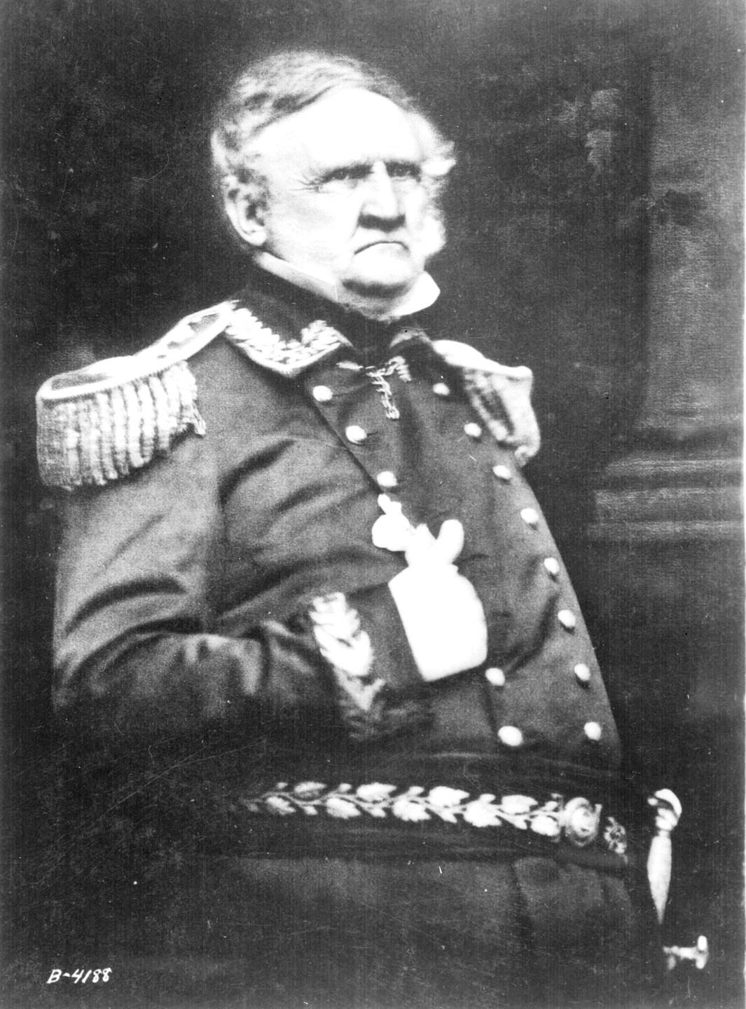
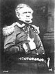 W. Scott
Das Scott County wurde am 5. März 1853 aus Teilen des Dakota County gebildet. Benannt wurde es nach Winfield Scott (1786-1866), einem US-amerikanischen General, der im Amerikanischen Bürgerkrieg den Anakonda - Plan entwarf, um die Konföderierten zu besiegen.
Demografische Daten
Historische Einwohnerzahlen Census Einwohner ± in % 1860 4595 — 1870 11.042 100 % 1880 13.516 20 % 1890 13.831 2 % 1900 15.147 10 % 1910 14.888 -2 % 1920 14.245 -4 % 1930 14.116 -0,9 % 1940 15.585 10 % 1950 16.486 6 % 1960 21.909 30 % 1970 32.423 50 % 1980 43.784 40 % 1990 57.846 30 % 2000 89.498 50 % 2010 129.928 50 % Vor 1900[2] 1900–1990[3] 2000[4] 2010[5] Nach der Volkszählung im Jahr 2000 lebten im Scott County 89.498 Menschen in 30.692 Haushalten und 23.970 Familien. Die Bevölkerungsdichte betrug 97 Einwohner pro Quadratkilometer. Ethnisch betrachtet setzte sich die Bevölkerung zusammen aus 93,65 Prozent Weißen, 0,92 Prozent Afroamerikanern, 0,77 Prozent amerikanischen Ureinwohnern, 2,17 Prozent Asiaten, 0,03 Prozent Bewohnern aus dem pazifischen Inselraum und 1,24 Prozent aus anderen ethnischen Gruppen; 1,21 Prozent stammten von zwei oder mehr Ethnien ab. 2,66 Prozent der Bevölkerung waren spanischer oder lateinamerikanischer Abstammung, die verschiedenen der genannten Gruppen angehörten.
Von den 30.692 Haushalten hatten 45,4 Prozent Kinder unter 18 Jahren, die bei ihnen lebten. 66,9 Prozent davon waren verheiratete, zusammenlebende Paare. 7,4 Prozent waren alleinerziehende Mütter und 21,9 Prozent waren keine Familien. 16,0 Prozent waren Singlehaushalte und in 4,5 Prozent der Haushalte lebten alleinstehende Menschen im Alter von 65 Jahren oder darüber. Die Durchschnittshaushaltsgröße lag bei 2,89 Personen, die durchschnittliche Familiengröße bei 3,25 Personen.
31,2 Prozent der Bevölkerung waren unter 18 Jahre alt. 6,7 Prozent waren zwischen 18 und 24, 37,3 Prozent zwischen 25 und 44, 18,6 Prozent zwischen 45 und 64 und 6,2 Prozent waren älter als 65 Jahre. Das Durchschnittsalter betrug 33 Jahre. Auf 100 weibliche kamen statistisch 101,9 männliche Personen. Auf 100 Frauen im Alter von 18 Jahren oder darüber kamen 100 Männer.
Das jährliche Durchschnittseinkommen eines Haushalts betrug 66.612 USD und das Durchschnittseinkommen einer Familie betrug 72.212 USD. Männer hatten ein Durchschnittseinkommen von 46.593 USD, Frauen 32.482 USD. Das Pro - Kopf - Einkommen betrug 26.418 USD. 2,0 Prozent der Familien und 3,4 Prozent der Einwohner lebten unterhalb der Armutsgrenze.[6]
Städte und Gemeinden
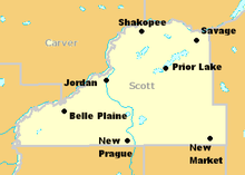
- Belle Plaine
- Elko New Market
- Jordan
- New Prague1
- Prior Lake
- Savage
- Shakopee
1 - teilweise im Le Sueur County
Einzelnachweise
- ↑ GNIS-ID: 659514. Abgerufen am 22. Februar 2011 (englisch).
- ↑ U.S. Census Bureau _ Census of Population and Housing Abgerufen am 17. Februar 2011
- ↑ Auszug aus Census.gov Abgerufen am 17. Februar 2011
- ↑ Auszug aus factfinder.census.gov Abgerufen am 18. Februar 2011
- ↑ United States Census 2010 Abgerufen am 12. August 2011
- ↑ Scott County, Minnesota Datenblatt mit den Ergebnissen der Volkszählung im Jahre 2000 bei factfinder.census.gov
Weblinks
-
 Commons: Scott County, Minnesota – Sammlung von Bildern, Videos und Audiodateien
 - Offizielle Webseite
- www.city-data.com - Scott County

Liste der Countys in Minnesota
Aitkin | Anoka | Becker | Beltrami | Benton | Big Stone | Blue Earth | Brown | Carlton | Carver | Cass | Chippewa | Chisago | Clay | Clearwater | Cook | Cottonwood | Crow Wing | Dakota | Dodge | Douglas | Faribault | Fillmore | Freeborn | Goodhue | Grant | Hennepin | Houston | Hubbard | Isanti | Itasca | Jackson | Kanabec | Kandiyohi | Kittson | Koochiching | Lac qui Parle | Lake | Lake of the Woods | Le Sueur | Lincoln | Lyon | Mahnomen | Marshall | Martin | McLeod | Meeker | Mille Lacs | Morrison | Mower | Murray | Nicollet | Nobles | Norman | Olmsted | Otter Tail | Pennington | Pine | Pipestone | Polk | Pope | Ramsey | Red Lake | Redwood | Renville | Rice | Rock | Roseau | Scott | Sherburne | Sibley | St. Louis | Stearns | Steele | Stevens | Swift | Todd | Traverse | Wabasha | Wadena | Waseca | Washington | Watonwan | Wilkin | Winona | Wright | Yellow Medicine
Wikimedia Foundation.
Schlagen Sie auch in anderen Wörterbüchern nach:
Scott County, Minnesota — Seal … Wikipedia
National Register of Historic Places listings in Scott County, Minnesota — Location of Scott County in Minnesota This is a list of the National Register of Historic Places listings in Scott County, Minnesota. This is intended to be a complete list of the properties and districts on the National Register of Historic… … Wikipedia
Credit River Township, Scott County, Minnesota — Credit River Township, Minnesota Township … Wikipedia
New Market Township, Scott County, Minnesota — New Market Township, Minnesota Township … Wikipedia
List of Registered Historic Places in Scott County, Minnesota — This is a List of Registered Historic Places in Scott County, Minnesota. Scott County is a county located in the southeastern part of the U.S. state of Minnesota, bounded on the northwest side by the Minnesota River, on the east by Dakota County … Wikipedia
Murphy Lake (Scott County, Minnesota) — Murphy Lake Location Scott County, Minnesota Coordinates 44°42′47″N 93°20′29″W … Wikipedia
Belle Plaine Township, Scott County, Minnesota — Infobox Settlement official name = Belle Plaine Township, Minnesota settlement type = Township nickname = motto = imagesize = image caption = image |pushpin pushpin label position =left pushpin map caption =Location within the state of Minnesota… … Wikipedia
Blakeley Township, Scott County, Minnesota — Infobox Settlement official name = Blakeley Township, Minnesota settlement type = Township nickname = motto = imagesize = image caption = image |pushpin pushpin label position =left pushpin map caption =Location within the state of Minnesota… … Wikipedia
Cedar Lake Township, Scott County, Minnesota — Infobox Settlement official name = Cedar Lake Township, Minnesota settlement type = Township nickname = motto = imagesize = image caption = image |pushpin pushpin label position =left pushpin map caption =Location within the state of Minnesota… … Wikipedia
Helena Township, Scott County, Minnesota — Infobox Settlement official name = Helena Township, Minnesota settlement type = Township nickname = motto = imagesize = image caption = image |pushpin pushpin label position =left pushpin map caption =Location within the state of Minnesota… … Wikipedia
Scott County (Minnesota)


18+
© Academic, 2000-2026
- Kontaktieren Sie uns: Unterstützung, Werbung
Wörterbücher Export, schritte mit PHP, Joomla, Drupal, WordPress, MODx.