- Sestrunj
-
Insel Sestrunj 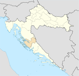
 44.12543333333314.945288888889Koordinaten: 44° 7′ 32″ N, 14° 56′ 43″ O
Basisdaten Meer: Adriatisches Meer Lage: Mittlere Adria Staat:  Kroatien
Gespanschaft:  Zadar
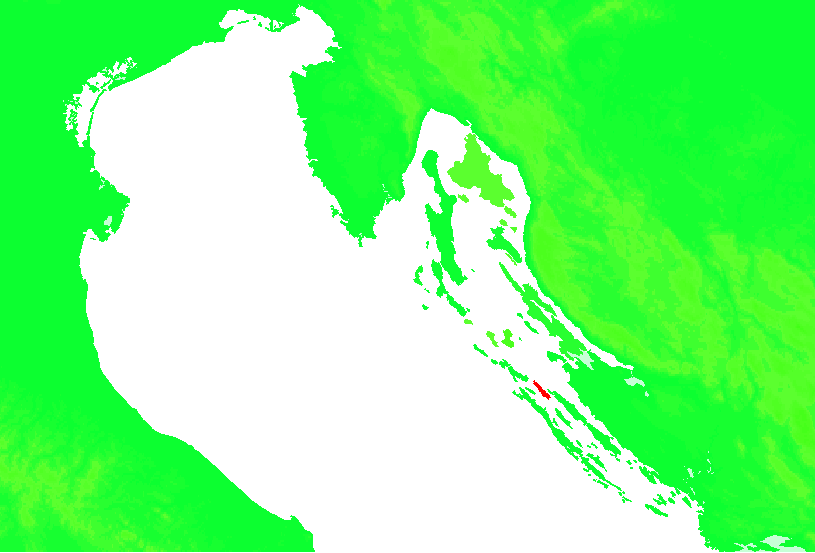
ZadarFläche: 15,4 km² Länge: 11 km Breite: 2 km Einwohner: 48 (2001) Bevölkerungsdichte: 3 Einwohner je km² Größte Ortschaft: Sestrunj Höchster Punkt: Obrucar (186 m) Webpräsenz: 
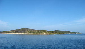
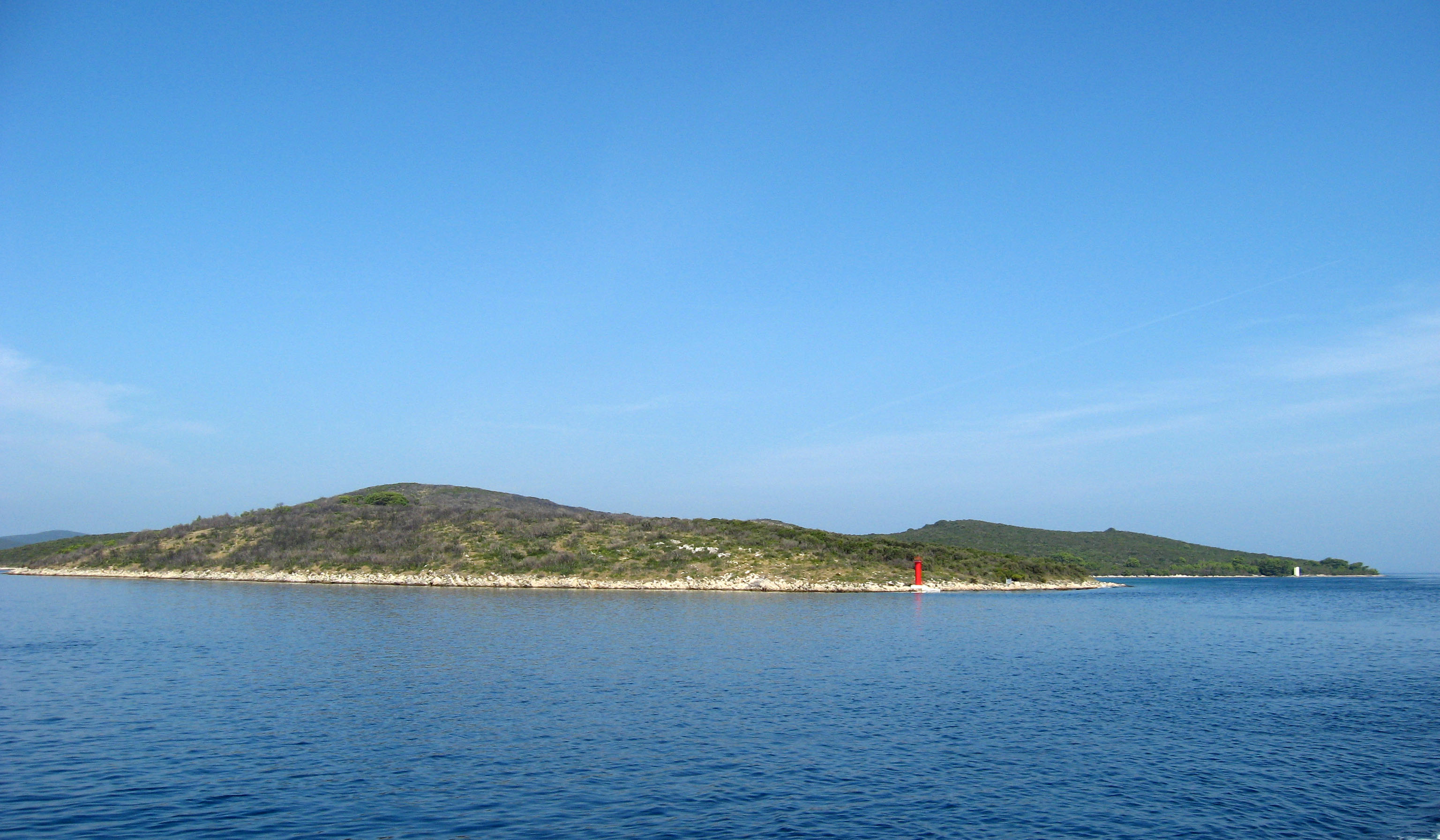
Sestrunj (Ital.: Sestrugno) ist eine Insel des Archipels vor Zadar in Kroatien.
Lage und Einwohner
Die kleine, etwa 15 km2 große Insel liegt zwischen den Inseln Dugi Otok, Rivanj und Ugljan. Es besteht eine Schiffsverbindung nach Zadar. Sestrunj ist auch der Name des einzigen Dorfes auf der Insel, mit 48 Einwohner.
Geschichte
Die Insel war schon früh von Illyrern besiedelt. Einzelne Hügelgräber sind heute noch zu besichtigen.
Weblinks
- Webseite kroatisch
- Webseite über die Insel deutsch
 Sestrunj
Bewohnte Inseln: Biševo | Brač | Brijuni | Cres | Drvenik Mali | Drvenik Veli | Dugi Otok | Hvar | Ilovik | Ist | Iž | Kaprije | Koločep | Kornat | Korčula | Krapanj | Krk | Lastovo | Lopud | Lošinj | Male Srakane | Mljet | Molat | Murter | Olib | Pag | Pašman | Premuda | Rab | Rava | Rivanj | Sestrunj | Silba | Susak | Ugljan | Unije | Vele Srakane | Vir | Vis | Vrgada | Zlarin | Zverinac | Čiovo | Šipan | Šolta | Žirje
Unbewohnte Inseln: Arta Vela | Dolin | Drvenik | Goli otok | Jakljan | Kakan | Katina | Kurba Vela | Lavdara Vela | Lavsa | Levrnaka | Mali Brijun | Maun | Mrčara | Piškera | Planik | Plavnik | Prežba | Prvić (Krk) | Prvić (Šibenik) | Sit | Smokvica Vela | Sušac | Svetac | Sveti Andrija | Sveti Grgur | Sveti Klement | Tijat | Tun Veli | Vele Orjule | Veli Brijun | Zeča | Zmajan | Škarda | Škrda | Šćedro | Žut
Eilande und Felsen: Palagruža
Wikimedia Foundation.
Schlagen Sie auch in anderen Wörterbüchern nach:
Sestrunj — Sp Sestrùnis Ap Sestrunj L s. Adrijos j., Kroatija … Pasaulio vietovardžiai. Internetinė duomenų bazė
Sestrunj (island) — Sestrunj (Italian: Sestrugno ) is an island in Croatian part of Adriatic Sea. It is situated in Zadar archipelago, between Ugljan, Rivanj and Dugi Otok. Its area is 11.1 km²hr icon [http://peljar.cvs.hr/show place info.php?id=49 First Croatian… … Wikipedia
Kroatische Inseln — Übersicht über die Inselwelt Kroatiens Die Kroatischen Inseln (kroatisch Hrvatski otoci) befinden sich vor der Küste Kroatiens im Adriatischen Meer, einem Ausläufer des Mittelmeeres. Die kroatische Küste gilt weltweit als eine der zerklüftetsten… … Deutsch Wikipedia
Сеструнь — Координаты … Википедия
List of islands in the Mediterranean — This is a list of the islands in the Mediterranean Sea: Contents 1 By area 2 By country 2.1 Albania 2.2 Croatia 2.3 … Wikipedia
Liste kroatischer Inseln — Die Kroatischen Inseln (kroatisch Hrvatski otoci) befinden sich vor der Küste Kroatiens im Adriatischen Meer, einem Ausläufer des Mittelmeeres. Die kroatische Küste gilt weltweit als eine der zerklüftetsten Küsten überhaupt. Man könnte sie… … Deutsch Wikipedia
Liste des îles de Croatie — Carte des principales îles de Croatie La Croatie compte 698 îles, 389 îlots et 78 récifs[1] ce qui fait de l archipel croate le plus important de la mer Adriati … Wikipédia en Français
D407 road (Croatia) — D407 state road Route information Length: 3.8 km (2.4 mi) Major junctions … Wikipedia
Список обитаемых островов Хорватии — Карта островов Хорватии в Адриатическом море В данной статье перечислены обитаемые острова Хорватии, отсортированный по количеству жителей на 31 марта 2001 года. В хорватской части Адриатического моря … Википедия
Korčula — This article is about the Croatian island of Korčula. For the town of the same name, see Korčula (town). Korčula Korčula (town) … Wikipedia
Sestrunj

18+
© Academic, 2000-2026
- Kontaktieren Sie uns: Unterstützung, Werbung
Wörterbücher Export, schritte mit PHP, Joomla, Drupal, WordPress, MODx.