- Cahokia (Illinois)
-

Dieser Artikel wurde aufgrund von inhaltlichen Mängeln auf der Qualitätssicherungsseite des Projektes USA eingetragen. Hilf mit, die Qualität dieses Artikels auf ein akzeptables Niveau zu bringen, und beteilige dich an der Diskussion! 
Cahokia 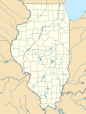

Cahokia Lage in IllinoisBasisdaten Staat: Vereinigte Staaten Bundesstaat: Illinois County: Koordinaten: 38° 34′ N, 90° 11′ W38.562777777778-90.176666666667124Koordinaten: 38° 34′ N, 90° 11′ W Zeitzone: Central Standard Time (UTC−6) Einwohner: 15.430 (Stand: Schätzung von Juli 2006) Bevölkerungsdichte: 593,5 Einwohner je km² Fläche: 26,00 km² (ca. 10 mi²)
davon 26,0 km² (ca. 10 mi²) LandHöhe: 124 m Postleitzahlen: 62200-62299 Vorwahl: +1 618 FIPS: 17-10370 GNIS-ID: 426287 Bürgermeister: Frank Bergman Cahokia ist eine Stadt im St. Clair County im US-Bundesstaat Illinois. Laut offizieller Schätzung aus dem Jahr 2006 betrug die Einwohnerzahl 15.430, was einem Bevölkerungsrückgang von 5,9 % entspricht.[1]
Die Stadt liegt im Metro-East genannten östlichen Teil der Metropolregion Greater St. Louis um die Stadt 6 km nordwestlich gelegene Stadt St. Louis im benachbarten Missouri.
Demografische Daten
Altersstruktur
Bevölkerung Jahre Anteil unter 18 33,40% von 18 - 24 8,70% von 25 - 44 29,40% von 45 - 64 16,90% über 65 11,60% Einzelnachweise
Städte und Gemeinden im St. Clair County (Illinois)Citys: | Belleville | Centreville | Collinsville | Columbia | East St. Louis | Fairview Heights | Lebanon | Madison | Mascoutah | O'Fallon
Villages: | Alorton | Brooklyn | Cahokia | Caseyville | Dupo | East Carondelet | Fairmont City | Fayetteville | Freeburg | Hecker | Lenzburg | Marissa | Millstadt | New Athens | New Baden | Sauget | Shiloh | Smithton | St. Libory | Summerfield | Swansea | Washington Park
Wikimedia Foundation.
Schlagen Sie auch in anderen Wörterbüchern nach:
Cahokia, Illinois — Geobox|Settlement name = Cahokia native name = other name = category = Village etymology = official name = motto = nickname = image caption = symbol = country = United States state = Illinois region = St. Clair region type = County district =… … Wikipedia
Cahokia (Illinois) — Pour les articles homonymes, voir Cahokia. Cahokia est une ville de l Illinois, dans le Comté de Saint Clair aux États Unis. Au XIe siècle, des Indiens fondèrent une ville qui allait compter jusqu à 15 000 habitants. Son influence s étendit… … Wikipédia en Français
Illinois locations by per capita income — Illinois is the eleventh richest state in the United States of America, with a per capita income of $23,104 (2000). Illinois Places by Per Capita Income # Kenilworth, Illinois ndash; $101,086 # Glencoe, Illinois ndash; $84,134 # North Barrington … Wikipedia
Cahokia — This article is about a Native American site at Cahokia Mounds. For the modern city located about ten miles (16 km) to the southwest, see Cahokia, Illinois. For the extinct Native American tribe unrelated to the builders of the Cahokia Mounds,… … Wikipedia
Cahokia — 38.654722222222 90.059444444444 Koordinaten: 38° 39′ 17″ N, 90° 3′ 34″ W … Deutsch Wikipedia
Cahokia — 38° 39′ 14″ N 90° 03′ 52″ W / 38.6539, 90.0644 … Wikipédia en Français
Cahokia High School — Infobox Secondary school name = Cahokia High School motto = established = principal = type = Public secondary grades = 9–12 city = 800 Range Lane Cahokia state = Illinois country = USA enrollment = 1,363 faculty = campus = Rural mascot =… … Wikipedia
Illinois Route 157 — Infobox Illinois state route article route = 157 length mi = 35.50 length round = 2 length ref = cite web |author=Illinois Technology Transfer Center |url=http://www.dot.state.il.us/gist2/select.html |title=T2 GIS Data |accessdate=2007 11 08… … Wikipedia
Illinois — • One of the United States of America, bounded on the north by Wisconsin, on the west by the Mississippi, which separates it from Iowa and Missouri, on the south by the confluent waters of the Mississippi and the Ohio, which separate it from… … Catholic encyclopedia
Illinois campaign — Part of the American Revolutionary War The Fall of Fort Sackville, Frederick C. Yohn, 1923 … Wikipedia
Cahokia (Illinois)


18+
© Academic, 2000-2026
- Kontaktieren Sie uns: Unterstützung, Werbung
Wörterbücher Export, schritte mit PHP, Joomla, Drupal, WordPress, MODx.