- Cornwall Island
-
Cornwall Island Satellitenbild der Cornwall-Insel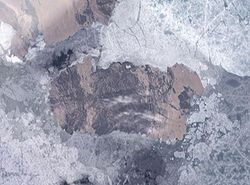
Gewässer Arktischer Ozean Inselgruppe Königin-Elisabeth-Inseln Geographische Lage 77° 37′ N, 94° 52′ W77.620833333333-94.864722222222400Koordinaten: 77° 37′ N, 94° 52′ W 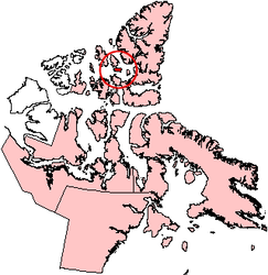
Länge 90 km Breite 39 km Fläche 2.358 km² Höchste Erhebung McLeod Head
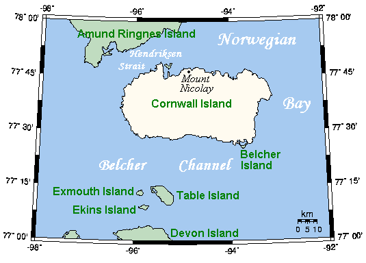
400 mEinwohner (unbewohnt) Karte der Insel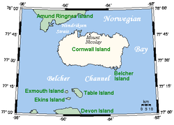
Cornwall Island ist eine Insel im Territorium Nunavut, Kanada und gehört zu den Königin-Elisabeth-Inseln. Nordwestlich der Insel liegt Amund Ringnes Island, südlich Devon Island, im Nordosten Axel Heiberg Island und im Osten Ellesmere Island.
Die Insel wurde am 30. August 1852 von Sir Edward Belcher entdeckt und nach Prince Edward, Prince of Wales and Duke of Cornwall, benannt. Sie ist 2.358 km² groß, 90 km lang und 13 bis 39 km breit. Sie erreicht im McLeod Head eine Höhe von etwa 400 m.
Ellesmere Island
Parry-Inseln: Devon Island | Melville-Insel | Bathurst Island | Prinz-Patrick-Insel | Cornwallis Island | Mackenzie-King-Insel | Borden-Insel | Cornwall Island | Eglinton Island | Graham Island | Lougheed Island | Byam Martin Island | Île Vanier | Cameron Island | Meighen Island | Brock-Insel | North Kent Island | Emerald Isle | Alexander Island | Massey Island | Little Cornwallis Island | Coburg Island | Helena Island | Baillie-Hamilton Island | Griffith Island | Hoved Island | Lowther Island | Buckingham Island
Sverdrup-Inseln: Axel Heiberg Island | Ellef Ringnes Island | Amund Ringnes Island | King Christian Island | Stor Island


Wikimedia Foundation.