- Drahovce
-
Drahovce
Wappen Karte 
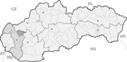

Drahovce BasisdatenKraj: Trnavský kraj Okres: Piešťany Region: Dolné Považie Fläche: 24,041 km² Einwohner: 2.615 (31. Dez. 2010) Bevölkerungsdichte: 108,77 Einwohner je km² Höhe: 153 m n.m. Postleitzahl: 922 41 Telefonvorwahl: 0 33 Geographische Lage: 48° 31′ N, 17° 48′ O48.51777777777817.805153Koordinaten: 48° 31′ 4″ N, 17° 48′ 18″ O Kfz-Kennzeichen: PN Gemeindekennziffer: 506991 StrukturGemeindeart: Gemeinde Gliederung Gemeindegebiet: 2 Gemeindeteile Verwaltung (Stand: April 2011)Bürgermeister: Juraj Klein Adresse: Obecný úrad Drahovce
Hlavná 429/127
92241 DrahovceWebpräsenz: www.drahovce.com Gemeindeinformation
auf portal.gov.skStatistikinformation
auf statistics.skDrahovce (deutsch Drachowitz, ungarisch Vágdebrőd - bis 1907 Drahóc) ist eine Gemeinde im Okres Piešťany innerhalb des Trnavský kraj in der Slowakei mit etwa 2.600 Einwohnern.
Geographie
Die Gemeinde liegt im nördlichen Teil des slowakischen Donautieflands, im Donauhügelland. Sie liegt gleich nebenan der Waag, genauer des Kanals Drahovský kanál; auf der anderen Seite des Flusses erhebt sich der Inowetz, während nach Nordwesten sind die Kleinen Karpaten sichtbar. Der Ort ist neun Kilometer von Piešťany und neun Kilometer von Leopoldov entfernt.
Zur Gemeinde gehört neben dem Hauptort auch der Teil Voderady, der hinter der Autobahn liegt.
Geschichte
Der Ort wurde zum ersten Mal 1113 als Debret, 1246 dann als Scepdras schriftlich erwähnt. Die Einwohner beschäftigten sich mit der Landwirtschaft und es wurden auch Wassermühlen an der Waag nachgewiesen. Der Ort wurde in der Vergangenheit mehrmals von der Waag-Hochwasser in die Mitleidenschaft gezogen, wie zum Beispiel im Jahr 1813. Das Ende der Hochwassergefahr kam erst nach 1961, als vom Stausee Sĺňava ausgehend der Drahovský kanál zum neuen Wasserkraftwerk bei Madunice errichtet wurde.
Bis 1918 lag der Ort innerhalb des Komitats Neutra im Königreich Ungarn, danach kam er zur Tschechoslowakei und ist seit 1993 Teil der heutigen Slowakei.
Banka | Bašovce | Borovce (Borowitz) | Dolný Lopašov | Drahovce (Drachowitz) | Dubovany (Dubowan) | Ducové (Dutzo) | Hubina | Chtelnica (Tellnitz) | Kočín-Lančár | Krakovany | Moravany nad Váhom | Nižná | Ostrov (Ostrowe) | Pečeňady | Piešťany (Pistyan) | Prašník | Rakovice | Ratnovce | Sokolovce (Sockolowetz) | Šípkové | Šterusy | Trebatice (Trebatitz) | Veľké Kostoľany (Großkostolan) | Veľké Orvište (Großorwische) | Veselé | Vrbové (Werbau)


Wikimedia Foundation.