- Greenwich Island
-
Greenwich Island Blick von Livingston Island auf Greenwich Island. Im Vordergrund Half Moon Island.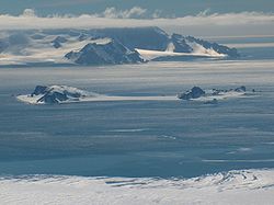
Gewässer Südlicher Ozean Inselgruppe Südliche Shetlandinseln Geographische Lage 62° 31′ S, 59° 47′ W-62.516666666667-59.783333333333520Koordinaten: 62° 31′ S, 59° 47′ W 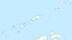

Länge 24 km Breite 10 km Fläche 173,8 km² Höchste Erhebung Mount Plymouth
520 mEinwohner (unbewohnt) Hauptort (Arturo-Prat-Station) Karte von Greenwich Island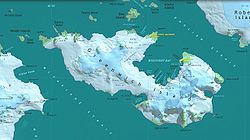
Greenwich Island (historische Namen: Sartorius Island, Berezina Island) ist eine Insel der Südlichen Shetlandinseln. Sie hat eine Länge von 24 km, eine Breite zwischen 0,8 und 10 km und weist eine Fläche von 173,8 km² auf.[1] Sie liegt zwischen Robert Island und Livingston Island in der Südgruppe des Archipels. Die höchste Erhebung der stark vergletscherten Insel ist der 520 m hohe Mount Plymouth.
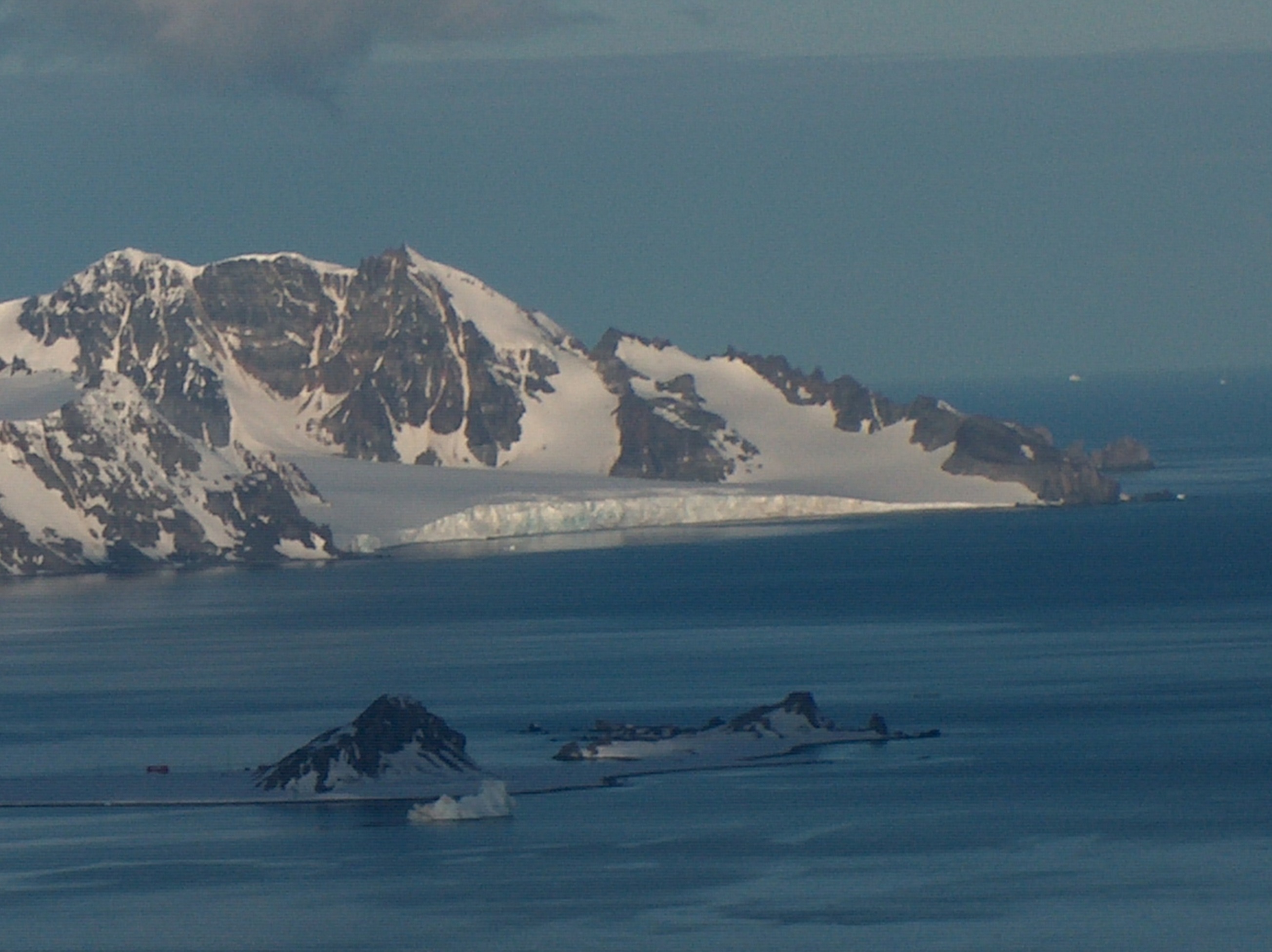
Die chilenische Forschungsstation Arturo Prat und die ecuadorianische Station Pedro Vicente Maldonado liegen an der Discovery Bay im Nordosten der Insel.
Die Bezeichnung Greenwich Island datiert zurück auf das Jahr 1821 oder noch früher und hat sich als gängiger Name der Insel durchgesetzt.
-

Zheravna-Gletscher
-

Breznik Heights
Karten
- L.L. Ivanov et al., Antarctica: Livingston Island and Greenwich Island, South Shetland Islands (from English Strait to Morton Strait, with illustrations and ice-cover distribution). Scale 1:100000 topographic map. Sofia: Antarctic Place-names Commission of Bulgaria, 2005.
- L.L. Ivanov, Antarctica: Livingston Island and Greenwich, Robert, Snow and Smith Islands. Scale 1:120000 topographic map. Troyan: Manfred Wörner Foundation, 2009. ISBN 978-954-92032-6-4
Weblinks
 Commons: Greenwich Island – Sammlung von Bildern, Videos und Audiodateien
Einzelnachweise
- ↑ UNEP Islands (englisch)
 Inseln der Südlichen Shetlandinseln
Nordgruppe: Clarence | Cornwallis | Elephant | Gibbs | Rowett
Südgruppe: Bridgeman | Deception | Greenwich | Half Moon | King George | Livingston | Low | Nelson | Penguin | Robert | Rugged | Smith | Snow
Wikimedia Foundation.
Schlagen Sie auch in anderen Wörterbüchern nach:
Greenwich Island (South Shetland Islands) — Greenwich Island (variant historical names Sartorius Island , Berezina Island ) is an island 15 miles (24 km) long and from 0.5 to 6 miles (0.8 to 10 km) wide, lying between Robert Island and Livingston Island in the South Shetland Islands. The… … Wikipedia
Greenwich — hat folgende Bedeutungen: In London Greenwich (London), Stadtteil Londons London Borough of Greenwich, Stadtbezirk von Greater London (seit 1965) Metropolitan Borough of Greenwich, ehemaliger Stadtbezirk der County of London (1889–1965) Orte in… … Deutsch Wikipedia
Greenwich village — Pour les articles homonymes, voir Greenwich. 40°44′N 74°00′W / … Wikipédia en Français
Greenwich Mean Time — (GMT) is a term originally referring to mean solar time at the Royal Observatory in Greenwich, London. It is now often used to refer to Coordinated Universal Time (UTC) when this is viewed as a time zone, although strictly UTC is an atomic time… … Wikipedia
Greenwich (disambiguation) — Greenwich is a town in London. It may also refer to: *London Borough of Greenwich, the London borough of the town s namesake. **Metropolitan Borough of Greenwich, the local authority, prior to 1965.Places outside of the United KingdomSeveral… … Wikipedia
Greenwich University — is a now inactive correspondence school. While Greenwich University was legally established in the Australian jurisdiction of Norfolk island, its programs were never listed on the Australian Qualifications Framework register nor was it ever… … Wikipedia
Greenwich Market — is a covered market in Greenwich, south east London, which specialises in antiques, arts, and crafts.There has been a market at Greenwich since the 14th century, but the history of the present market dates from 1700 when a charter to run two… … Wikipedia
Greenwich, Prince Edward Island — Greenwich is an unincorporated Canadian rural community located in eastern Prince Edward Island, Canada.Located on the Greenwich Peninsula, which extends northwest from St. Peters, creating St. Peters Bay, the community of Greenwich is located in … Wikipedia
Island Gardens — is a public park located at the southern end of the Isle of Dogs hence the name Island in the London Borough of Tower Hamlets on the north bank of the River Thames. The park was formally opened on 3 August 1895 by prominent local politician Will… … Wikipedia
Greenwich Village — (pronEng|ˌgrɛnɪtʃ ˈvɪlɪdʒ), often simply called the Village, is a largely residential area on the west side of downtown (southern) Manhattan in New York City named seemingly after Greenwich, London, England. However, it was called Noortwijck or… … Wikipedia
-
Greenwich Island


18+
© Academic, 2000-2026
- Kontaktieren Sie uns: Unterstützung, Werbung
Wörterbücher Export, schritte mit PHP, Joomla, Drupal, WordPress, MODx.