- Geopotential
-
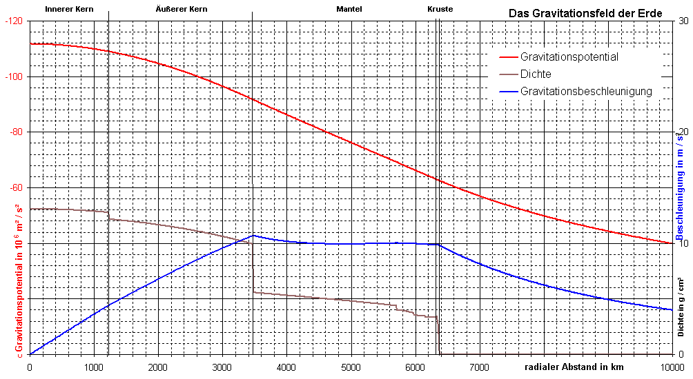
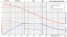 Potential (rote Kurve) im Erdgravitationsfeld
Als Geopotential W bezeichnet man in der Geophysik das Schwerepotential der Erde. Es setzt sich aus dem Gravitationspotential V und dem Zentrifugalpotential Φ zusammen. Jede Bewegung eines massebehafteten Körpers im Erdschwerefeld entgegen der Schwerebeschleunigung
 , also das Anheben des Höhenniveaus, erfordert das Aufwenden von Arbeit. Der Betrag dieser Arbeit wird in jedem Punkt des Raumes durch das Erdschwerefeld bestimmt, weshalb dieses ein Potentialfeld darstellt. Eine Fläche gleichen Geopotentials bezeichnet man dabei als Äquipotentialfläche. Jedes Teilchen auf dieser Äquipotentialfläche hat also bei gleicher Masse gleiche potentielle Energie im Schwerefeld der Erde. Das Geopotential ist nicht zu verwechseln mit dem Erdpotential der Elektrotechnik.
Geopotentielle Kote
Da die Schwerebeschleunigung am Äquator ihren geringsten Wert aufweist, liegen dort auch die Geopotentialflächen etwas weiter vom Erdmittelpunkt entfernt als an den Polen. Der globale Mittelwert der Schwerebeschleunigung wird als g0 bezeichnet, das ist jene Schwerebeschleunigung, die auf dem 45. Breitengrad herrscht. Er beträgt 9,80665 m/s². Die negative Potentialdifferenz zum Geoid
wird geopotentielle Kote genannt. Da es sich um eine Schwerepotentialdifferenz handelt, ist die SI-Einheit Joule pro Kilogramm (J/kg). Wird die geopotentielle Kote durch den globalen Mittelwert der Schwerebeschleunigung geteilt, so ergibt sich die dynamische Höhe. Für mittlere Breiten entsprechen diese dynamischen Höhen ungefähr der metrischen Höhe über dem Meeresspiegel. Zum Teil werden auch geopotentielle Koten in der Einheit geopotentieller Meter (gpm) angegeben. 1 gpm entspricht 9,80665 J/kg. Der Betrag entspricht dann dem der dynamischen Höhe.
Anwendung in der Meteorologie
Das Geopotential wird vor allem in der Meteorologie für die Beschreibung der potentiellen Energie der Luft in einer bestimmten Höhe verwendet. Die Geopotentialflächen verlaufen auf der Erde nicht genau parallel zur Meeresoberfläche. Linien gleicher potentieller Höhe nennt man Isohypsen (auch Isopotentiale genannt), die auf Karten verzeichnet werden.
Die Geopotentialtendenzgleichung ermöglicht prognostische Aussagen über das Geopotentialfeld und ist eines der wichtigsten Instrumente zur Erstellung von Rechenmodellen zur Wettervorhersage.
Siehe auch


Wikimedia Foundation.