- Igitkin Island
-
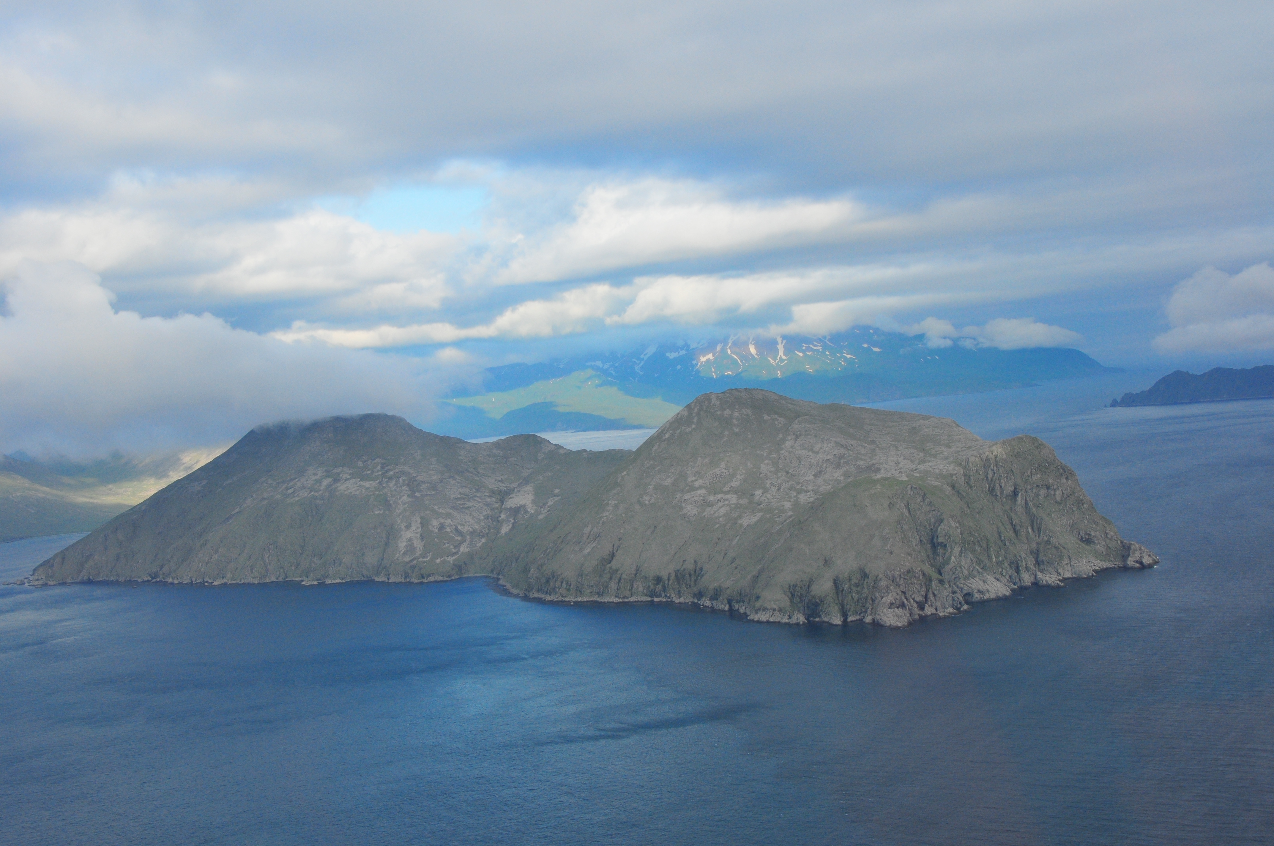
Igitkin Island Igitkin Island, im Hintergrund Great Sitkin Island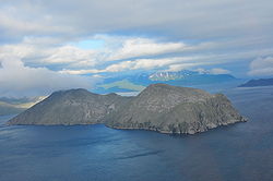
Gewässer Pazifischer Ozean Inselgruppe Aleuten Geographische Lage 51° 59′ N, 175° 54′ W51.9819444-175.8955556Koordinaten: 51° 59′ N, 175° 54′ W 

Länge 10,8 km Einwohner (unbewohnt) Igitkin Island ist eine unbewohnte Insel der Andreanof Islands, die zu den Aleuten gehören.
Die 10,8 km lange und knapp über dem Meeresspiegel gelegene Insel befindet sich zwischen Adak Island und Atka Island, 4,8 km südöstlich von Great Sitkin Island. Igitkin wird durch einen etwa 1 km breiten Isthmus in zwei gleich große Teile getrennt.
Die Insel wurde unter ihrem aleutischen Namen Egilka 1790 von Joseph Billings erstmals in den Seekarten verzeichnet.
Weblinks
- Igitkin Island auf Oceandots.com (engl.)
- Igitkin Island im Geographic Names Information System des United States Geological Survey
Inseln und Inselgruppen der Andreanof IslandsAdak | Agligadak | Amatigis Islands | Amlia | Anagaksik | Argonne | Asuksak | Atka | Aziak | Barbara | Black | Bobrof | Bolshoi Islands | Box | Castle | Chaika Rock | Channel | Chisak | Chugul | Cone | Cormorant | Crone | Delarof Islands | Dora | Eddy | Elf | Fenimore Rock | Gramp Rock | Great Sitkin | Green | Igitkin | Ikiginak | Ina | Kagalaska | Kanaga | Kanu | Kasatochi | Koniuji | Little Tanaga | North | Oglodak | Plum | Ringgold | Sadatanek | Sagchudak | Sagigik | Salt | Sea Parrot | Seguam | Silak | South | Staten | Tagadak | Tagalak | Tanaga | Tanaklek | The Signals | The Three Sisters | Tidgituk | Umak | Uyak | Whip
Wikimedia Foundation.
Schlagen Sie auch in anderen Wörterbüchern nach:
Igitkin Island — Location map Alaska label= lat=52.381941 long= 176.295554 position=right width=250 float=right caption=Location in AlaskaIgitkin Island (Igitxix̂ [Bergsland, K Aleut Dictionary Fairbanks: Alaska Native Language Center, 1994] in Aleut) is a small… … Wikipedia
Île Igitkin — L île vue d avion Géographie Pays … Wikipédia en Français
Ikiginak Island — Vorlage:Infobox Insel/Wartung/Bild fehltVorlage:Infobox Insel/Wartung/Fläche fehlt Ikiginak Island Gewässer Pazifischer Ozean Inselgruppe Aleuten Geographische Lage … Deutsch Wikipedia
Chugul Island — Location in Alaska Chugul i … Wikipedia
Chugul Island — Vorlage:Infobox Insel/Wartung/Fläche fehltVorlage:Infobox Insel/Wartung/Höhe fehlt Chugul Island NASA Bild von Chugul Island … Deutsch Wikipedia
Nunivak Island — Nunivak Maskette – Nunivak … Wikipedia
Medny Island — Map showing position of Commander Islands to the east of Kamchatka. The smaller island in the east is Medny and the larger island is Bering Island. Medny Island (also spelled Mednyy, Russian: остров Медный, sometimes called Copper Island in… … Wikipedia
Unalaska Island — Unalaska Native name: Nawan Alaxsxa[1] Map of the island … Wikipedia
Nelson Island (Alaska) — Nelson Native name: Qaluyaaq … Wikipedia
Adak Island — Mount Adagdak Gewässer Pazifischer Ozean Inselgruppe … Deutsch Wikipedia
Igitkin Island

18+
© Academic, 2000-2026
- Kontaktieren Sie uns: Unterstützung, Werbung
Wörterbücher Export, schritte mit PHP, Joomla, Drupal, WordPress, MODx.