- Inagi
-
Inagi-shi
稲城市
Geographische Lage in Japan Region: Kantō Präfektur: Tokio Koordinaten: 35° 38′ N, 139° 30′ O35.637938888889139.5046Koordinaten: 35° 38′ 17″ N, 139° 30′ 17″ O Basisdaten Fläche: 17,97 km² Einwohner: 85.581
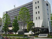
(1. Oktober 2011)Bevölkerungsdichte: 4.762 Einwohner je km² Gemeindeschlüssel: 13225-0 Symbole Flagge/Wappen: Baum: Ginkgo Blume: Nashi Rathaus Adresse: Inagi City Hall
2111 Higashinaganuma
Inagi-shi
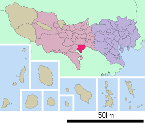
Tokio 206-8601Webadresse: http://www.city.inagi.tokyo.jp Lage Inagis in der Präfektur Tokio 
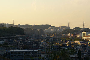
Inagi (jap. 稲城市, -shi) ist eine Stadt in der japanischen Präfektur Tokio westlich von Tokio.
Inhaltsverzeichnis
Geographie
Inagi liegt westlich von Tokio, nördlich von Machida und östlich von Hachiōji. Der Fluss Tama fließt durch die Stadt von Nordwesten nach Nordosten.
Geschichte
Die Stadt wurde im 1. November 1971 gegründet.
Sehenswürdigkeiten
In Inari befindet sich der Freizeitpark Yomiuriland mit der Achterbahn Bandit, die zum Zeitpunkt ihrer Fertigstellung die höchste und schnellste der Welt war.
Verkehr
- Zug:
- Keio Sagamihara-Linie: nach Sagamihara und Shinjuku
- Odakyū Tama-Linie: nach Tama und Shinjuku
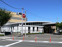
- JR Nambu-Linie: nach Kawasaki und Tachikawa
Angrenzende Städte und Gemeinden
- Präfektur Tokio
- Präfektur Kanagawa
Weblinks
Bezirke (ku): Adachi | Arakawa | Bunkyō | Chiyoda | Chūō | Edogawa | Itabashi | Katsushika | Kita | Kōtō | Meguro | Minato | Nakano | Nerima | Ōta | Setagaya | Shibuya | Shinagawa | Shinjuku (Verwaltungssitz) | Suginami | Sumida | Toshima | Taitō
Kreisfreie Städte (shi): Akiruno | Akishima | Chōfu | Fuchū | Fussa | Hachiōji | Hamura | Higashikurume | Higashimurayama | Higashiyamato | Hino | Inagi | Kiyose | Kodaira | Koganei | Kokubunji | Komae | Kunitachi | Machida | Mitaka | Musashimurayama | Musashino | Nishitōkyō | Ōme | Tachikawa | Tama
Nishitama-gun: Hinohara | Hinode | Mizuho | Okutama
Gemeinden auf Inseln (tōsho chō-son): Aogashima | Hachijō | Mikurajima | Miyake | Ogasawara | Kozushima | Niijima | Ōshima | Toshima
- Zug:
Wikimedia Foundation.


