- Prince of Wales-Hyder Census Area
-
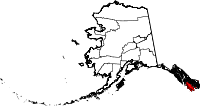
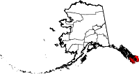
Der Prince of Wales-Hyder Census Area ist ein Census Area im US-Bundesstaat Alaska im Südosten des Alaska Panhandle. Am 19. Mai 2008 fielen große Teile des Census Areas, der bis dahin Prince of Wales-Outer Ketchikan hieß, an den Ketchikan Gateway Borough. Weil auch die Region Outer Ketchikan ausgegliedert worden war, kam es zur Namensänderung auf Prince of Wales-Hyder. [1]
Während der Prince of Wales-Outer Ketchikan Census Area ein zusammenhängendes Gebiet darstellte, das den Ketchikan Gateway Borough umschloss, besteht der Prince of Wales-Hyder Census Area hauptsächlich aus der Prince-of-Wales-Insel und einem kleinen Gebiet um die Ortschaft Hyder an der Grenze zur kanadischen Provinz British Columbia.
Im Jahr 2010 betrug die Bevölkerungszahl 5.559. Der Prince of Wales-Outer Ketchikan Census Area hatte eine Fläche von 32.909 km², wovon 19.193 km² auf Land und 13.716 km² auf Wasser entfallen.
Prince of Wales-Hyder gehört zum Unorganized Borough und hat somit keinen Verwaltungssitz.
Teile des Alaska Maritime National Wildlife Refuge, des Misty Fjords National Monument und des Tongass National Forest liegen im Census Area.
Einzelnachweise
Weblinks
- QuickFacts auf census.gov (englisch)
- Karte des Prince of Wales-Hyder Census Area (pdf-Datei; 365 kB)
Regionen: Alaskan Bush | Interior | North Slope | Panhandle | South Central | Tanana Valley
Boroughs: Aleutians East | Anchorage | Bristol Bay | Denali | Fairbanks North Star | Haines | Juneau | Kenai Peninsula | Ketchikan Gateway | Kodiak Island | Lake and Peninsula | Matanuska-Susitna | North Slope | Northwest Arctic | Skagway | Sitka | Wrangell | Yakutat | Unorganized Borough
Census Areas: Aleutians West | Bethel | Dillingham | Hoonah-Angoon | Nome | Petersburg | Prince of Wales-Hyder | Southeast Fairbanks | Valdez-Cordova | Wade Hampton | Yukon-Koyukuk
Wichtige Städte: Anchorage | Barrow | Bethel | Fairbanks | Homer | Juneau | Kenai | Ketchikan | Kodiak | Kotzebue | Nome | Palmer | Petersburg | Seward | Sitka | Unalaska | Valdez | Wasilla
Wikimedia Foundation.


