- Rawaki
-
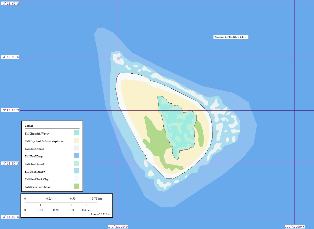
Rawaki Karte der Insel Rawaki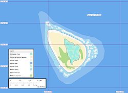
Gewässer Pazifischer Ozean Inselgruppe Phoenixinseln Geographische Lage 3° 43′ 0″ S, 170° 43′ 0″ W-3.7166666666667-170.71666666667Koordinaten: 3° 43′ 0″ S, 170° 43′ 0″ W 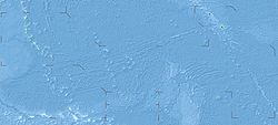

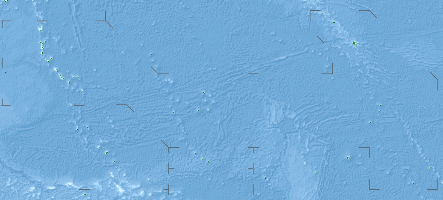
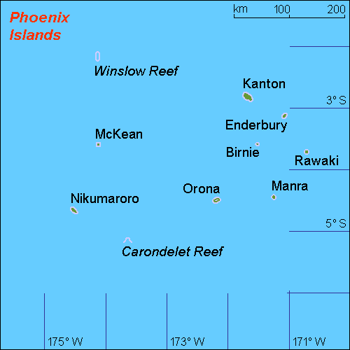
Länge 1,2 km Breite 800 m Einwohner (unbewohnt) Karte der Phoenixinseln, Rawaki ganz im Osten
Rawaki (englisch Rawaki Island, früher Phoenix-Insel) ist die östlichste, und mit 1,2 × 0,8 km auch die zweitkleinste Koralleninsel innerhalb der Gruppe der kiribatischen Phoenixinseln. Sie liegt im zentralen Pazifischen Ozean, etwa 410 km südlich des Äquator und 90 km östlich von Birnie.
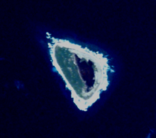 NASA-Astronautenbild von Rawaki
Rawaki wurde am 23. Februar 1824 von John Palmer, dem Kapitän des britischen Walfangschiffs Phoenix aus London entdeckt. Es ist ein unbewohntes, gehobenes Atoll mit dem stark salzhaltigen Rest einer kleinen Lagune, die vom Meer vollständig getrennt ist.
Literatur
- Dalton, William: The Dalton journal : two whaling voyages to the South seas, 1823 - 1829 / ed. by Niel Gunson; [Sydney] : National Library of Australia, 1990 ISBN 0-642-10505-7
Weblinks

Gilbertinseln: Abaiang | Abemama | Aranuka | Arorae | Beru | Butaritari | Kuria | Maiana | Makin | Marakei | Nikunau | Nonouti | Onotoa | Tabiteuea | Tamana | Tarawa
Line Islands: Caroline | Flint | Kiritimati | Malden | Starbuck | Tabuarean | Teraina | Vostok
Phoenixinseln: Birnie | Enderbury | Kanton | McKean | Manra | Nikumaroro | Orona | Rawaki
weitere Insel: Banaba
Wikimedia Foundation.
Schlagen Sie auch in anderen Wörterbüchern nach:
Rawaki — Island (en) Carte de Rawaki. Géographie Pays … Wikipédia en Français
Rawaki — Admin ASC 2 Code Orig. name Rawaki Country and Admin Code KI.03.RA KI … World countries Adminstrative division ASC I-II
Rawaki Island — is one of the Phoenix Islands in the Republic of Kiribati, also known by its previous name of Phoenix Island. It is a small, uninhabited atoll, approximately 1.2 by 0.8 km in size and 65 hec. in area, with a shallow, brackish central lagoon that… … Wikipedia
Isla Rawaki — La Isla Rawaki es una isla del grupo de islas Fénix en la República de Kiribati, previamente conocida como Isla Fénix. Es un atolón pequeño y deshabitado, de aproximadamente 1,2 por 0,8 km, con 65 ha, con una laguna central que no se comunica con … Wikipedia Español
Phoenix Islands — The Phoenix Islands are a group of eight atolls and two submerged coral reefs, lying in the central Pacific Ocean east of the Gilbert Islands and west of the Line Islands. They are a part of the Republic of Kiribati. During the late 1930s they… … Wikipedia
Phoenix-Insel — NASA Bild der Insel Rawaki Rawaki (engl.: Rawaki Island, früher Phoenix Insel) ist die östlichste, und mit 1,2 km mal 0,8 km auch die zweitkleinste Koralleninsel innerhalb der Gruppe der kiribatischen Phoenixinseln. Sie liegt im zentralen… … Deutsch Wikipedia
Phoenix Island — NASA Bild der Insel Rawaki Rawaki (engl.: Rawaki Island, früher Phoenix Insel) ist die östlichste, und mit 1,2 km mal 0,8 km auch die zweitkleinste Koralleninsel innerhalb der Gruppe der kiribatischen Phoenixinseln. Sie liegt im zentralen… … Deutsch Wikipedia
Islas Fénix — (o Phoenix o Rawaki) Localización geográfica / administrativa Océano (mar) Océano Pacífico Continente (sub) Oceanía … Wikipedia Español
Nikomaruru — Lage der Phoenixinseln im zentralen Pazifik Lage der einzelnen Atolle und Riffe Die Gruppe der Phoenixinseln sind eine von drei Inselgruppen des Inselstaats … Deutsch Wikipedia
Phoenix-Inseln — Lage der Phoenixinseln im zentralen Pazifik Lage der einzelnen Atolle und Riffe Die Gruppe der Phoenixinseln sind eine von drei Inselgruppen des Inselstaats … Deutsch Wikipedia
Rawaki

18+
© Academic, 2000-2026
- Kontaktieren Sie uns: Unterstützung, Werbung
Wörterbücher Export, schritte mit PHP, Joomla, Drupal, WordPress, MODx.