- Manra
-
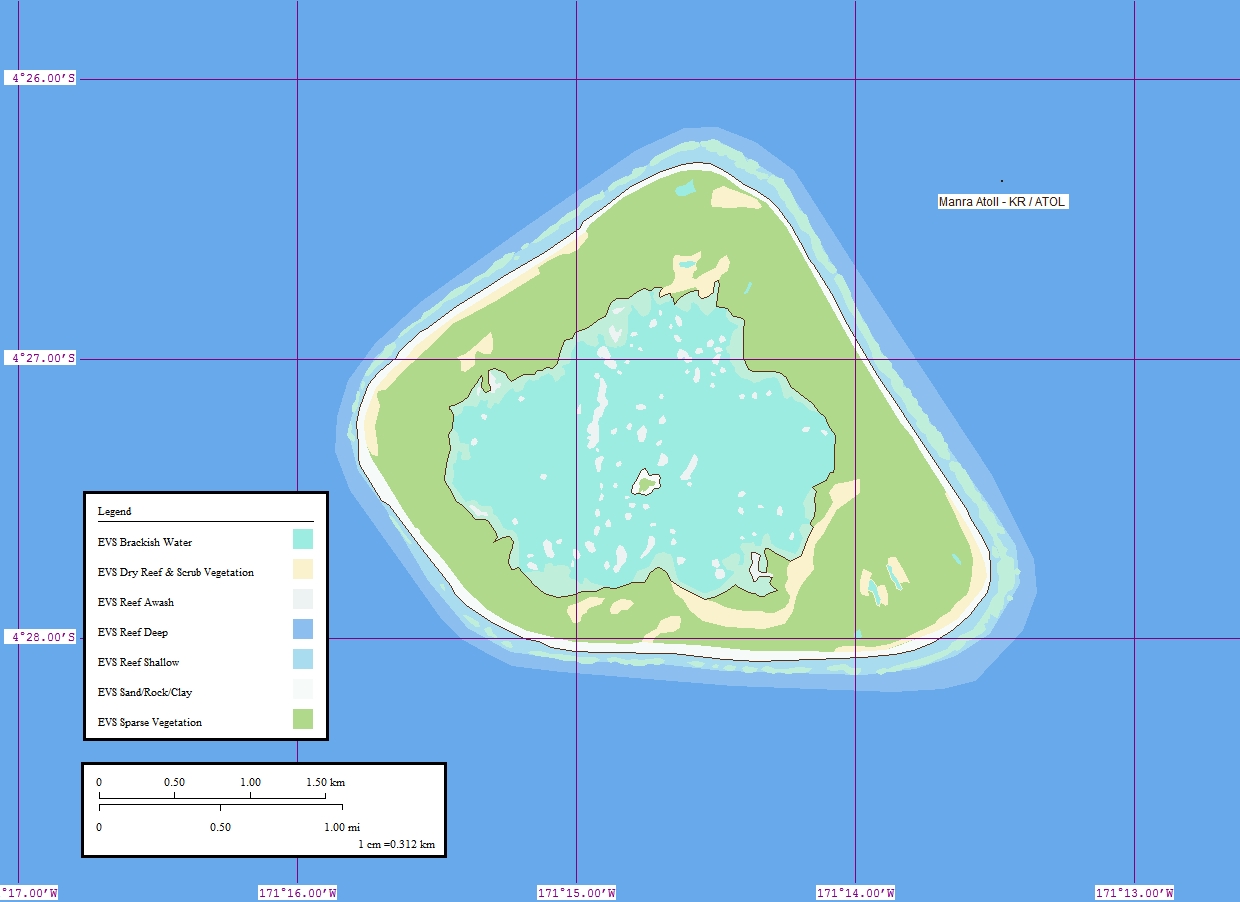
Manra Karte von Manra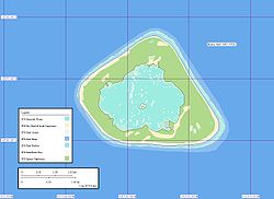
Gewässer Pazifischer Ozean Inselgruppe Phoenixinseln Geographische Lage 4° 27′ 15″ S, 171° 14′ 45″ W-4.4541666666667-171.24583333333Koordinaten: 4° 27′ 15″ S, 171° 14′ 45″ W 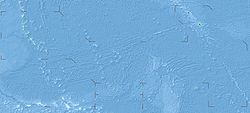

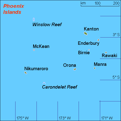
Länge 3,2 km Breite 2,8 km Fläche 4,4 km² Einwohner (unbewohnt) Karte der Phoenixinseln, Manra im Osten
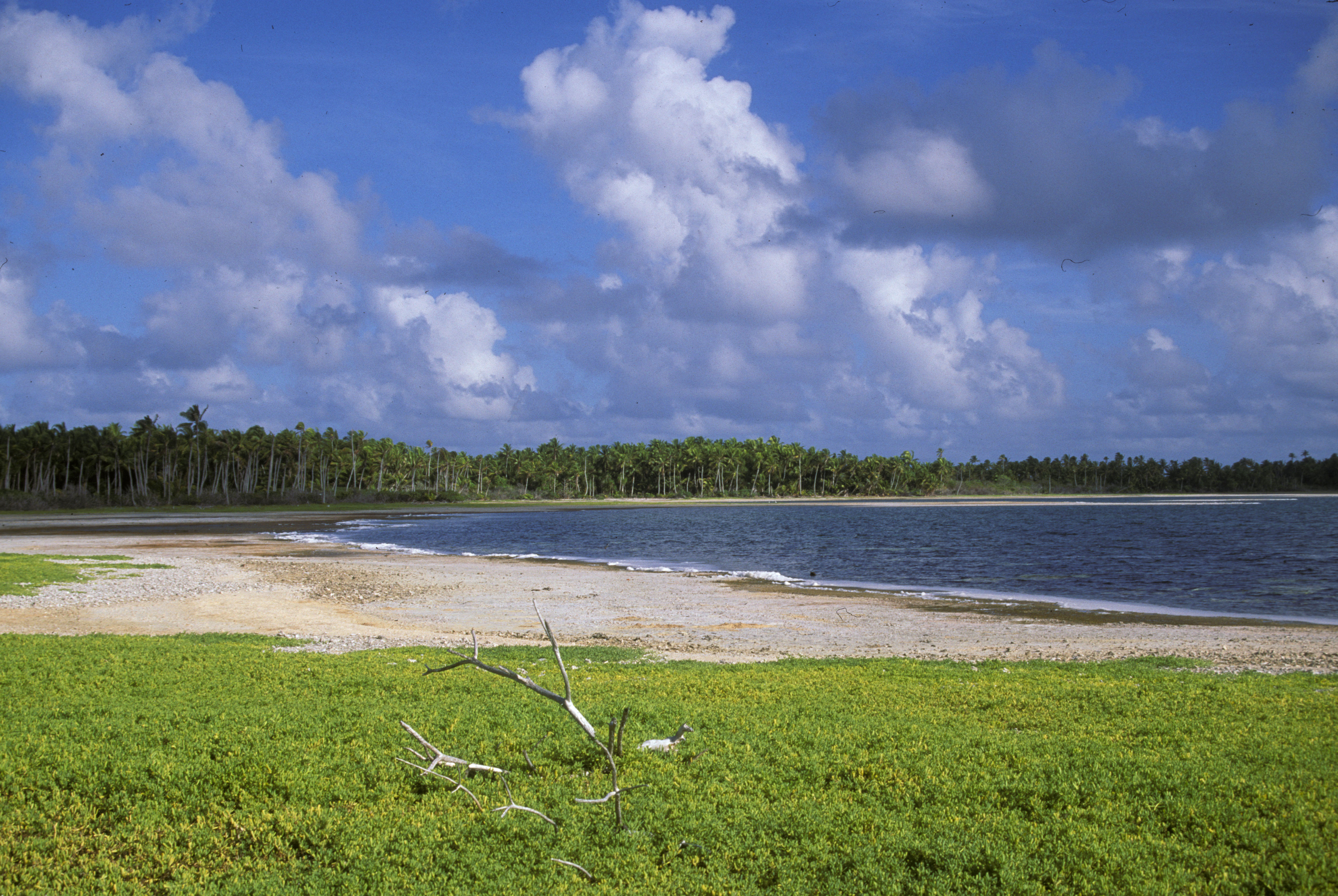
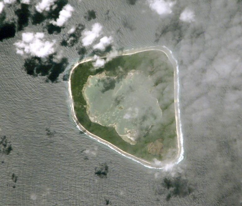
Manra (englisch Manra Island, früher Sydney Island) ist das südöstlichste Atoll der kiribatischen Phoenixinseln. Es liegt im Pazifischen Ozean, etwa 490 km südlich des Äquator. Die Lagune hat keinen Zugang zum Meer und bildet einen stark salzhaltigen See, dessen Wasserspiegel etwas tiefer als der des umgebenden Meeres liegt. Auf diesem See befinden sich zahlreiche kleine Sandinseln (Motus).
Manra wurde 1823 von dem Londoner Walfangschiff Sydney Packet, T. Emmett Master, entdeckt und Sydney benannt.
Die (einschließlich Lagune) etwa 4,5 km² große Insel war nur zwischen 1938 und 1963 bewohnt. Sie war damals Zielort eines von den britischen Kolonialisten eingeleiteten Umsiedlungsprogramms, des sogenannten "Phoenix Islands Settlement Scheme"), um der Überbevölkerung auf den nordwestlich gelegenen Gilbertinseln Herr zu werden. Nach dem Scheitern des Projekts verließen aber nach und nach die Siedler die drei betroffenen Inseln Manra (Sydney), Nikumaroro und Orona (Hull) wieder.
Die Inseln sind heute unbewohnt, dienen allerdings zahlreichen Seevögeln als Brutplatz; seit 1975 ist Manra ein offizielles Naturreservat.
- Galerie
-
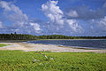
Die innere Lagune von Manra
-
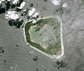
NASA-Aufnahme des Manra-Atolls
-
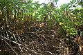
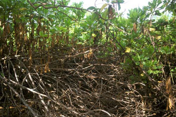
Dichter Scaevola-Bewuchs auf Manra
Literatur
- Maude, Henry Evans: Of islands and men : studies in Pacific history; Melbourne [u.a.] : Oxford Univ. Pr., 1968
- Jones, A. G. E.: Ships employed in the South Seas trade Vol. 1: 1775 - 1861; Canberra 1986 & Vol. 2: 1775 - 1859; Burwood, Vic. [1992]
Weblinks
- Karten und weitere Informationen (englisch)
- Manra auf oceandots.com (englisch)

Gilbertinseln: Abaiang | Abemama | Aranuka | Arorae | Beru | Butaritari | Kuria | Maiana | Makin | Marakei | Nikunau | Nonouti | Onotoa | Tabiteuea | Tamana | Tarawa
Line Islands: Caroline | Flint | Kiritimati | Malden | Starbuck | Tabuarean | Teraina | Vostok
Phoenixinseln: Birnie | Enderbury | Kanton | McKean | Manra | Nikumaroro | Orona | Rawaki
weitere Insel: Banaba
Wikimedia Foundation.
Schlagen Sie auch in anderen Wörterbüchern nach:
Manra — Island (en) Carte de Manra. Géographie Pays … Wikipédia en Français
Manra — Admin ASC 2 Code Orig. name Manra Country and Admin Code KI.03.MA KI … World countries Adminstrative division ASC I-II
Manra Island — Coordinates: 4°27′S 171°16′W / 4.45°S 171.267°W / 4.45; 171.267 … Wikipedia
Isla Manra — Isla Manra, imagen cortesía del Image Science and Analysis Laboratory, Johnson Space Center. La Isla Manra (también conocida como Isla Sidney) es una isla del grupo de islas Fénix, pertenecientes a la República de Kiribati. En 1938, fue una de… … Wikipedia Español
Phoenix Islands — The Phoenix Islands are a group of eight atolls and two submerged coral reefs, lying in the central Pacific Ocean east of the Gilbert Islands and west of the Line Islands. They are a part of the Republic of Kiribati. During the late 1930s they… … Wikipedia
Sydney-Insel — Karte des Manra Atolls NASA Aufnahme des Manra Atolls Manra (engl.: Manra Island, früher Sydney Insel) ist das südöstlichste Atoll der kiribatischen … Deutsch Wikipedia
Sydney Island — Karte des Manra Atolls NASA Aufnahme des Manra Atolls Manra (engl.: Manra Island, früher Sydney Insel) ist das südöstlichste Atoll der kiribatischen … Deutsch Wikipedia
Gerald Gallagher — Gerald Bernard Gallagher (6 July 1912 – 27 September 1941, Nikumaroro), the son of Gerald Hugh Gallagher (a doctor in the West African Medical Service) and Edith Gallagher, attended Stonyhurst College, the University of Cambridge (Downing… … Wikipedia
Orona — Main articles: Kiribati and Phoenix Islands Orona atoll, also known as Hull Island,[1] is one of the Phoenix Islands in the Republic of Kiribati. measures approximately 8.8 km by 4 km, and like Kanton, is a narrow ribbon of land… … Wikipedia
Hull-Insel — Karte der Phoenixinseln, Orona etwa in der Mitte Satellitenbild des Orona Atolls Orona (früher Hull Island) ist nach Kanton das zweitgrößte Atoll der … Deutsch Wikipedia
Manra
18+
© Academic, 2000-2025
- Kontaktieren Sie uns: Unterstützung, Werbung
Wörterbücher Export, schritte mit PHP, Joomla, Drupal, WordPress, MODx.