- Abemama
-
Abemama Das Abemama-Atoll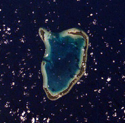
Gewässer Pazifischer Ozean Archipel Gilbertinseln Geographische Lage 0° 24′ N, 173° 53′ O0.399624173.876839Koordinaten: 0° 24′ N, 173° 53′ O 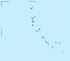

Anzahl der Inseln 5 Hauptinsel Tabiang Landfläche 16 km² Einwohner 3404 (2005) Umrißkarte von Abemama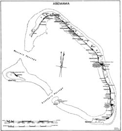
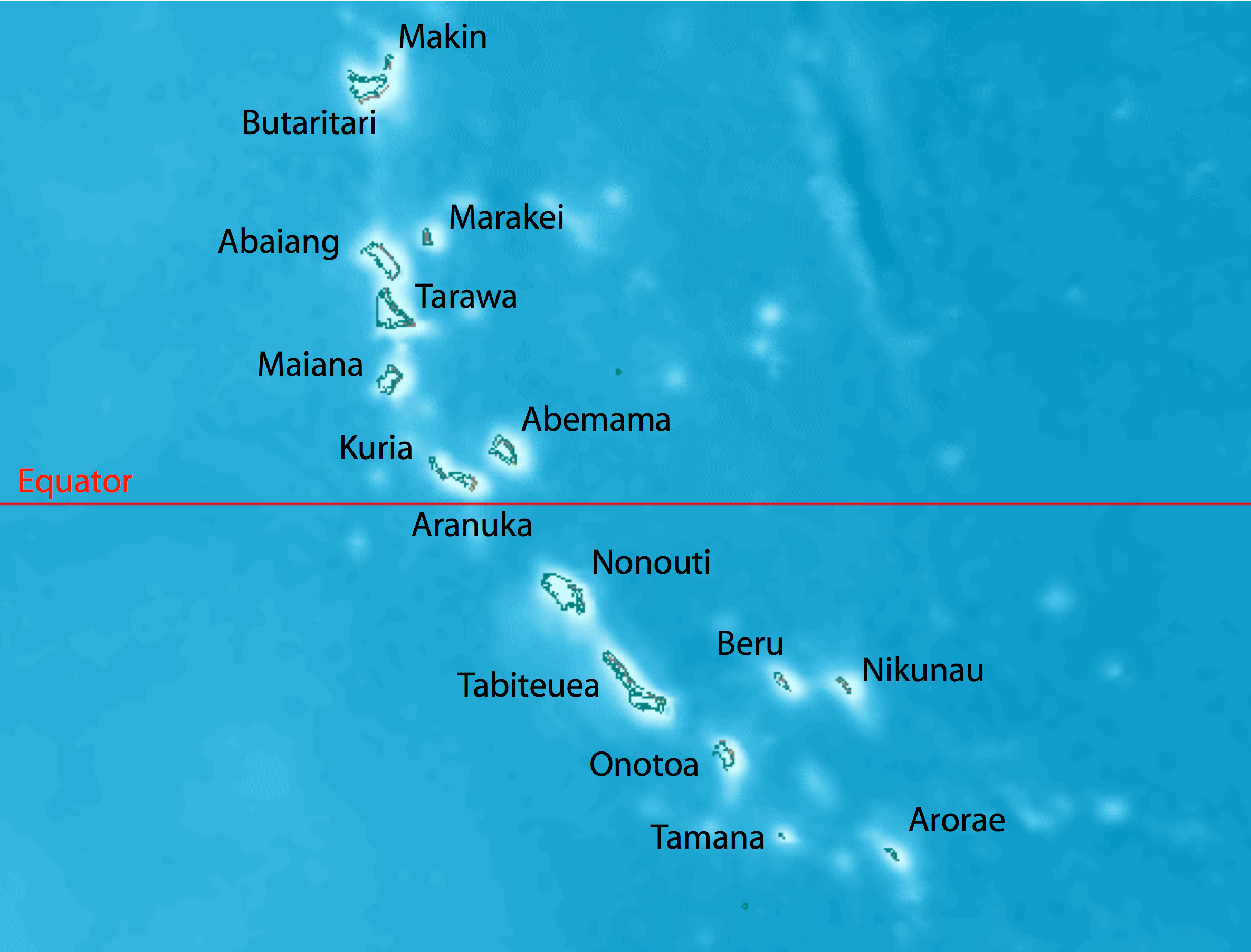
 Abemama gehört zu den zentralen Gilbertinseln, oberhalb des Äquators
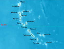
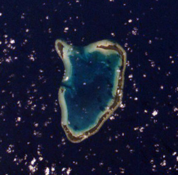
Abemama (auch unter den Namen Apemama, Abamama, Apamama, Dundas, Hopper Island, Roger Simpson Island oder Simpson Island bekannt) ist ein Atoll im Zentrum des Archipels der Gilbertinseln, die den Staat Kiribati bilden. Das Atoll liegt ca. 150 km südöstlich des Hauptstadt-Atolls Tarawa gerade oberhalb des Äquators.
Das Dorf Kariatebike dient als Regierungszentrum des Atolls mit Verwaltungsgebäuden, einer Polizeistation und einem Krankenhaus.
Inhaltsverzeichnis
Geographie
Die Landfläche des Atoll beträgt 16 km². Es hatte laut Volkszählung von 2005 eine Bevölkerung von 3.404 Einwohnern. Die Inseln des Atolls umschließen eine tiefe Lagune. Die Inseln im östlichen Teil des Atolls sind mit Stegen und Brücken miteinander verbunden, so dass man mit dem Auto von einer Insel auf die nächste gelangen kann. Die etwas abseits gelegenen Inseln Abatiku und Bike, in neuerer Schreibung auch Biike, liegen an der südwestlichen Seite des Atolls.
Bevölkerung
Bevölkerungsstatistik
Siedlungen und Einwohnerzahlen Zensus 1978[1] 2005[2] Abatiku 191 191 Tabiang 520 591 Tekatirirake 333 486 Kauma 20 172 Karekentekabaia 74 – Baretoa 194 310 Tabontebike 99 305 Binoinano 231 – Kariatebike – 140 Bangotantekabaia – 336 Tebanga 376 246 Manoku 158 247 Kabangaki – 363 Bike/Biike (1978 mit Kabangaki) 215 17 Gesamt 2411 3404 Bevölkerungsentwicklung
Abemama: Bevölkerungsentwicklung für die Jahre 1931–2005[3][4] Zensus 1931 1947 1963 1968 1973 1978 1985 1990 1995 2000 2005 Gesamt 893 1174 2060 2126 2300 2411 2966 3218 3442 3142 3404 Geschichte
Bekannt wurde Abemama durch die Erklärung zum britischen Protektorat durch Kapitän Davis vom Schiff Royalist am 27. Mai 1892. Im Jahr 1889 wohnte Robert Louis Stevenson hier. Nahe dem Ort Tabontebike ist das Grab des Tyrannenherrschers Tem Binoka (auch in der Schreibung Tembinok'), der durch Stevensons Novelle In the South Seas berühmt wurde.
Während des Zweiten Weltkrieges stand Abemama unter japanischer Besatzung und wurde 1943 im Pazifikkrieg von den Amerikanern befreit.
Nach dem Zweiten Weltkrieg stand Abemama neben Tarawa als neuer Verwaltungssitz der Kolonie zur Entscheidung, wegen der besseren Hafenbedingungen fiel die Wahl jedoch auf South Tarawa.
Verkehr
Im Norden der Insel, nahe dem Ort Tabiang liegt der Flugplatz Abemama. Abemama wird viermal wöchentlich von der Air Kiribati vom Drehkreuz Bonriki International Airport in South Tarawa angeflogen, ab Januar 2009 auch von der privaten Fluglinie Coral Sun Airways.
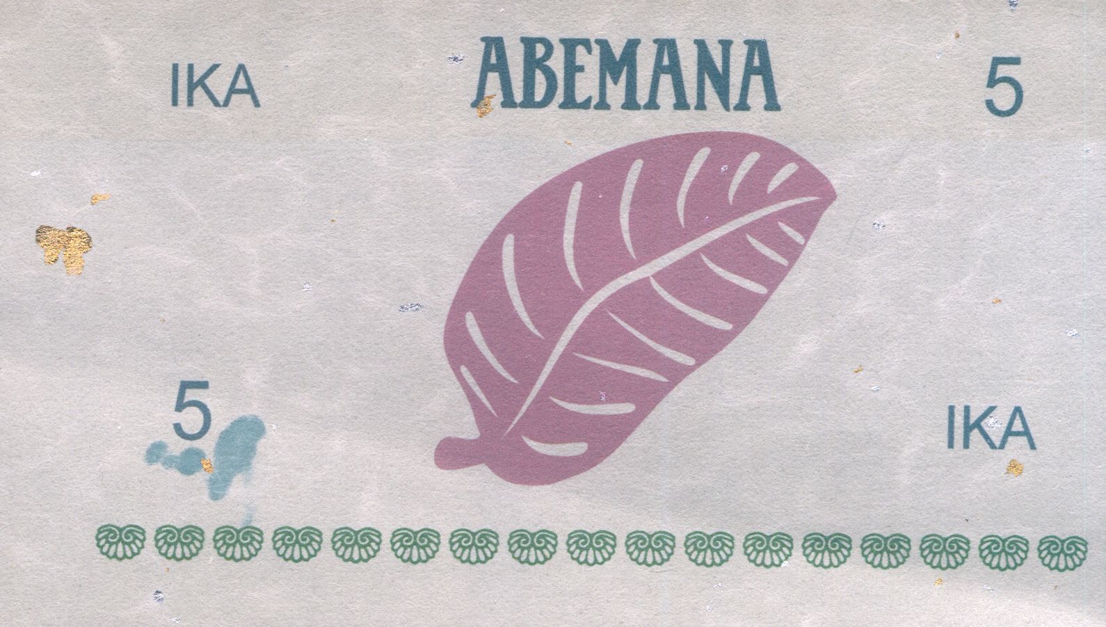
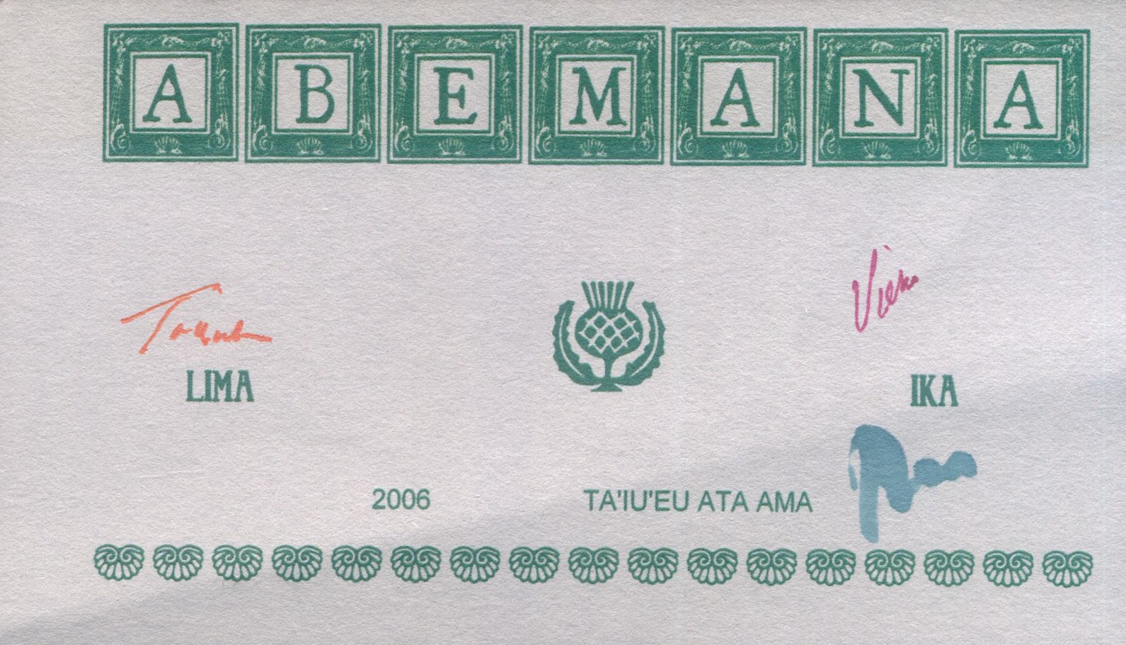
Banknoten
In Abemana wurden im Jahre 2006 auch Banknoten ausgegeben. Es existieren 9 Werte zu 1, 2, 5, 10, 20, 50, 100, 200 und 500 Ika. Diese Geldscheine bestehen aus 100% recyceltem Papier. Deutlich sind Reste von Aluminium-Folie zu sehen. Weiterhin sind die Unterschriften des Finanzchefs mit UV-reagierender Farbe versehen.
-
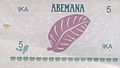
Vorderseite 5 IKA
-
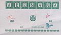
Rückseite 5 IKA
Literatur
- Ernest Sabatier: Le Poème de l'île Apemama du Pacifique, îles Gilbert. Préface de Serge Barrault. G. Enault, Paris 1929.
- Ray Watters, Kabiritaake Banibati: Abemama report. In: Rural socio-economic change in the Gilbert and Ellice Islands. Team report. Gilbert Islands Government, May 1979.
Weblinks
- Encyclopaedia Britannica, Abemama Atoll (englisch)
- Abemama Oceandot.com (Abgerufen 20. April 2010)
- Abemama janeresture.com. Historische Fakten ((Abgerufen 20. April 2010)
- Deklaration zum Protektorat durch Kapitän Davis (Abgerufen 20. April 2010)
- Über die Ika-Geldnoten und -Münzen (englisch)
Einzelnachweise
- ↑ Report of the 1978 Census of population and housing. Republic of Kiribati 1980, Vol. 1, S. 9 (Zeitpunkt Unabhängigkeit)
- ↑ Kiribati 2005 Census of Population and Housing. Provisional Tables. (Abgerufen am 29. März 2010)
- ↑ Henry Evans Maude: Report on the 1931 Census of the Gilbert, Ellice and Phoenix Islands. Western Pacific High Commission, Suva 1932. Angaben für 1931 auch in: Rural socio-economic change in the Gilbert and Ellice islands. 1979, S. 19.
- ↑ Kiribati: 2005 Census. Vol. 2: Analytical Report. 2007 Final Report, S. 114 (für die Jahre 1947-2005) (Abgerufen am 17. April 2010)

Gilbertinseln: Abaiang | Abemama | Aranuka | Arorae | Beru | Butaritari | Kuria | Maiana | Makin | Marakei | Nikunau | Nonouti | Onotoa | Tabiteuea | Tamana | Tarawa
Line Islands: Caroline | Flint | Kiritimati | Malden | Starbuck | Tabuarean | Teraina | Vostok
Phoenixinseln: Birnie | Enderbury | Kanton | McKean | Manra | Nikumaroro | Orona | Rawaki
weitere Insel: Banaba
Wikimedia Foundation.
Schlagen Sie auch in anderen Wörterbüchern nach:
Abemama — Roger Simpson Island (en) Image satellite d Abemama. Géographie Pays … Wikipédia en Français
Abemama — (also Abamama, Apamama, Dundas, Hopper Island, Roger Simpson Island or Simpson Island) is an atoll in the central part of the Kiribati (Gilberts) Group located 152 kilometres southeast of Tarawa and just north of the Equator. Geography It has an… … Wikipedia
Abemama — Aldeas de la isla Abemama. Abemama (también conocido como Abamama, Apamama, Dundas, Isla Hopper, Isla Roger Simpson o Isla Simpson) es un atolón coralino perteneciente a la República de Kiribati localizado en el centro del conjunto de las Islas… … Wikipedia Español
Abemama — Admin ASC 2 Code Orig. name Abemama Country and Admin Code KI.01.AM KI … World countries Adminstrative division ASC I-II
Abemama Atoll Airport — IATA: AEA – ICAO: NGTB Summary Airport type Public Serves Abemama Location Tabi … Wikipedia
Abemama Atoll — Abemama Abemama Abemama (anciennement Roger Simpson) est un atoll des Kiribati, dans l archipel des îles Gilbert (partie centrale). Sa superficie est de 16 km² pour une population de 3 608 Gilbertins. C est le lieu de proclamation, par le… … Wikipédia en Français
Abemama Atoll — ▪ atoll, Kiribati also spelled Apamama , formerly Roger Simpson Island coral atoll of the northern Gilbert Islands, part of Kiribati, in the west central Pacific Ocean. Capt. Charles Bishop, who reached the atoll in 1799, named it Roger… … Universalium
Flugplatz Abemama — Abemama Atoll Airport BW … Deutsch Wikipedia
Gefecht um Abemama — Teil von: Zweiter Weltkrieg, Pazifikkrieg … Deutsch Wikipedia
Flughafen Abemama — Flughafen Aranuka … Deutsch Wikipedia
-
Abemama


18+
© Academic, 2000-2026
- Kontaktieren Sie uns: Unterstützung, Werbung
Wörterbücher Export, schritte mit PHP, Joomla, Drupal, WordPress, MODx.