- Vuktyl
-
Stadt Wuktyl
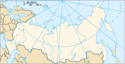
ВуктылFöderationskreis Nordwestrussland Republik Komi Bürgermeister Jaroslaw Sinjak Gegründet 1968 Stadt seit 1989 Fläche 22.480 km² Höhe des Zentrums 100 m Bevölkerung 13.712 Einw. (Stand: 2006) Bevölkerungsdichte 1 Ew./km² Zeitzone UTC+3 (Sommerzeit: UTC+4) Telefonvorwahl (+7)82146 Postleitzahl 169570 Kfz-Kennzeichen 11, 111 OKATO 87 412 Geographische Lage Koordinaten: 63° 52′ N, 57° 19′ O63.86666666666757.316666666667100Koordinaten: 63° 52′ 0″ N, 57° 19′ 0″ O Liste der Städte in Russland Wuktyl (russisch Вуктыл) ist eine Stadt in der nordwestrussischen Republik Komi mit 13.712 Einwohnern (Berechnung 2006).
Inhaltsverzeichnis
Geografie
Die Stadt liegt im Vorland des Nordurals etwa 575 km nordöstlich der Republikhauptstadt Syktywkar am rechten Ufer der Petschora, unweit der Mündung des namensgebenden Nebenflusses Wuktyl.
Wuktyl ist der Republik administrativ direkt unterstellt. Zur Stadt gehört ein 22.480 km² großes dünn besiedeltes Territorium.
Die Stadt ist über eine Straße mit der 230 km entfernten Stadt Sosnogorsk an der Petschoraeisenbahn verbunden.
Geschichte
Wuktyl entstand 1968 im Zusammenhang mit der Erschließung eines Erdgaskondensatfeldes und erhielt 1989 Stadtrecht.
Einwohnerentwicklung
Jahr Einwohnerzahlen 1959 100 * 1979 16.800 * 1989 19.330 ** 2002 14.472 ** 2006 13.712 Anmerkung: * Volkszählung (gerundet) ** Volkszählung
Kultur und Sehenswürdigkeiten
Nordöstlich der Stadt erstreckt sich der fast zwei Millionen Hektar große Nationalpark Jugyd Wa, dessen Verwaltung sich in Wuktyl befindet. Der am 23. April 1994 gegründete Park ist seit 1995 Teil des UNESCO-Weltnaturerbe-Gebietes Urwälder von Komi.
Entlang der Ufer der Petschora wurden Überreste mehrerer prähistorischer Siedlungen entdeckt.
Im zur Stadt gehörenden Dorf Podtscherje gibt es ein Heimatmuseum.
Wirtschaft
Hauptwirtschaftszweig ist die Erdgasförderung. Hier beginnt die Erdgaspipeline Nordlicht (Sewernoje sijanije) Wuktyl–Uchta–Torschok. Daneben gibt es Holzwirtschaft und in der Umgebung Landwirtschaft lokaler Bedeutung.
Weblinks
- Inoffizielles Portal (russisch)
- Wuktyl auf mojgorod.ru (russisch)
Hauptstadt: Syktywkar
Inta | Jarega | Jemwa | Krasnosatonski | Mikun | Nischni Odes | Objatschowo | Petschora | Scheschart | Sewerny | Sosnogorsk | Troizko-Petschorsk | Uchta | Ussinsk | Ussogorsk | Ust-Kulom | Ust-Zilma | Wisinga | Wodny | Worgaschor | Workuta | Wuktyl | Wylgort
Wikimedia Foundation.

