- Binmaley
-
Municipality of Binmaley Lage von Binmaley in der Provinz Pangasinán 
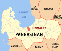
Basisdaten Bezirk: Ilocos-Region Provinz: Pangasinán Barangays: 33 Distrikt: 2. Distrikt von Pangasinán PSGC: 015513000 Einkommensklasse: 2. Einkommensklasse Haushalte: 13.415 Zensus 1. Mai 2000Einwohnerzahl: 76.214 Zensus 1. August 2007Bevölkerungsdichte: 1245 Einwohner je km² Fläche: 61,2 km² Koordinaten: 16° 2′ N, 120° 16′ O16.0325120.27111111111Koordinaten: 16° 2′ N, 120° 16′ O Postleitzahl: 2417 Vorwahl: +63 75 Geographische Lage auf den Philippinen Binmaley ist eine Stadtgemeinde in der philippinischen Provinz Pangasinán und liegt am Golf von Lingayen. Die meisten Menschen leben von Fischerei und Reisanbau. Das flache feuchte Gelände ist für den Reisanbau besonders gut geeignet.
Binmaley ist in folgende 33 Baranggays aufgeteilt:
- Amancoro
- Balagan
- Balogo
- Basing
- Baybay Lopez
- Baybay Polong
- Biec
- Buenlag
- Calit
- Caloocan Dupo
- Caloocan Norte
- Caloocan Sur
- Camaley
- Canaoalan
- Dulag
- Gayaman
- Linoc
- Lomboy
- Nagpalangan
- Malindong
- Manat
- Naguilayan
- Pallas
- Papagueyan
- Parayao
- Poblacion
- Pototan
- Sabangan
- Salapingao
- San Isidro Norte
- San Isidro Sur
- Santa Rosa
- Tombor
Städte: Alaminos | Dagupan | San Carlos City | Urdaneta
Stadtgemeinden: Agno | Aguilar | Alcala | Anda | Asingan | Balungao | Bani | Basista | Bautista | Bayambang | Binalonan | Binmaley | Bolinao | Bugallon | Burgos | Calasiao | Dasol | Infanta | Labrador | Laoac | Lingayén | Mabini | Malasiqui | Manaoag | Mangaldan | Mangatarem | Mapandan | Natividad | Pozzorubio | Rosales | San Fabian | San Jacinto | San Manuel | San Nicolas | San Quintin | Santa Barbara | Santa Maria | Santo Tomas | Sison | Sual | Tayug | Umingan | Urbiztondo | Villasis
Wikimedia Foundation.

