- Columbia (South Carolina)
-
Columbia Spitzname: The Capital of Southern Hospitality (Offiziell), The Big Friendly, Cola Town 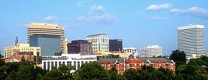
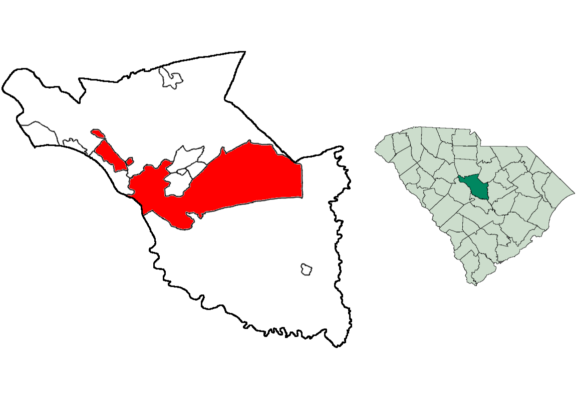
Finlay-SkylineLage in South Carolina 
Basisdaten Staat: Vereinigte Staaten Bundesstaat: South Carolina Countys: Koordinaten: 34° 0′ N, 81° 2′ W34.000680555556-81.03526944444489Koordinaten: 34° 0′ N, 81° 2′ W Zeitzone: Eastern Standard Time (UTC−5) Einwohner:
– Metropolregion:129.272 (Stand: 2010)
767.598Bevölkerungsdichte: 380,1 Einwohner je km² Fläche: 346,5 km² (ca. 134 mi²)
davon 340,1 km² (ca. 131 mi²) LandHöhe: 89 m Vorwahl: +1 803 FIPS: 45-16000 GNIS-ID: 1245051 Bürgermeister: Steve Benjamin Columbia ist die Hauptstadt des US-Bundesstaates South Carolina und der Amtssitz von Richland County. Sie liegt im geographischen Zentrum des Staates, nahe am Fluss Congaree.
In Columbia befindet sich der Hauptcampus der University of South Carolina. Im östlichen Teil des Stadtgebietes liegt das größte Grundausbildungslager des US-Heeres, das Fort Jackson.
Columbia, South Carolina Klimadiagramm (Erklärung) J F M A M J J A S O N D 1121301051511222068325109429151223219140332115532219330177725107420591152Temperatur in °C, Niederschlag in mm Quelle: National Weather Service, US Dept of Commerce Inhaltsverzeichnis
Geographie
Columbia liegt etwa auf halben Weg zwischen dem Atlantischen Ozean und den Blue Ridge Mountains an der Fall Line, der Grenzlinie zur Küstenebene, über die Flüsse „fallen“ (daher der Name). Diese Linie bildete deswegen einst auch den westlichsten Punkt der Schifffahrt östlich der Appalachen. Columbia entstand am Endpunkt der Schifffahrt auf dem Congaree River, der durch den Zusammenfluss von Broad River und Saluda River entsteht. Die Wasserkraft trieb auch die ersten Baumwollmühlen in der Stadt an.
Nach den Angaben des United States Census Bureaus hat die Stadt, die 89 m hoch liegt, eine Fläche von 346,5 km², wovon 340,1 km² auf Land und 6,4 km² (= 1,96 %) auf Gewässer entfallen. Von der Landfläche gehören rund zwei Drittel zur Fort Jackson Military Installation, die großteils aus unbewohntem Gebiet besteht.
Geschichte
Columbia wurde im frühen 17. Jahrhundert von europäischen Siedlern gegründet. Am 26. März 1786 wurde sie als Planstadt ausgebaut, um die alte Hauptstadt Charleston abzulösen. Die Stadt wurde nach Christoph Kolumbus benannt. Während des Bürgerkriegs wurde die Stadt am 17. Februar 1865 von Unionstruppen des General William Tecumseh Sherman eingenommen und zerstört. Unter anderem wurde das alte Kongresshaus total vernichtet.
Historische Objekte
- An der Wilwood Avenue auf Nummer 801, befindet sich das historische Ensor-Keenan House. Das Gebäude wurde 1979 vom National Register of Historic Places aufgenommen.[1]
National Register of Historic Places
Als National Historic Landmark sind fünf Bauten Columbias eingetragen:
- South Carolina State Capitol
- Robert Mills House
- First Baptist Church (Columbia)
- Chapelle Administration Building
- Mills Building, South Carolina State Hospital
Insgesamt sind 116 Bauwerke in Columbia (Stand Juli 2010) in das National Register of Historic Places aufgenommen, darunter
Sehenswürdigkeiten
- Riverbanks Zoo
- Finley Park
- South Carolina State Museum (größtes Museum im Südosten der Vereinigten Staaten)
- Lake Murray
- University of South Carolina
- Congaree Vista
- Five Points
Sport
Das größte Interesse erwecken die Teams der Universität, auch Gamecocks genannt. Das Football Stadium fasst über 84.000 Zuschauer und die Basketball-Arena 18.000. Die Baseball- und Leichtathletik-Teams sind auch sehr erfolgreich. Unter anderem trainieren die US-Olympioniken Allen Johnson und Terrence Tremmell hier. Die Capital City Bombers (Baseball) und die Columbia Inferno (Eishockey) aus der ECHL spielen auch in Columbia.
Söhne und Töchter der Stadt
- Cedric Adderley, Komponist und Musikpädagoge
- Bill Anderson, Country-Sänger und Songwriter
- James Mark Baldwin, Philosoph und Psychologe
- Joseph Louis Bernardin, Erzbischof von Chicago
- Kristin Davis, Schauspielerin
- Stanley Donen, Regisseur und Choreograf
- Lillian Ellison, Wrestler „The Fabulous Moolah“
- Wade Hampton III., General der Konföderierten im Amerikanischen Bürgerkrieg
- Jermaine O’Neal, Basketballspieler (Toronto Raptors)
- Susan Reed, Folksängerin
- Ann Savage, Filmschauspielerin
- Angie Stone, Hip-Hop-, R'n'B- und Soul-Sängerin
- Robin Swicord, Regisseurin und Drehbuchautorin
- Samuel Beam, Singer/Songwriter
- Young Jeezy, Rapper
Partnerstädte
- Columbia hat vier internationale Partnerstädte:
 Kaiserslautern, Deutschland
 Cluj-Napoca, Rumänien
 Plowdiw, Bulgarien
 Tscheljabinsk, Russland
Weblinks
Fußnoten
Kategorien:- Ort in South Carolina
- Columbia (South Carolina)
- Hauptstadt in den Vereinigten Staaten
- County Seat in South Carolina

Wikimedia Foundation.