- Lee County (Iowa)
-
Verwaltung US-Bundesstaat: Iowa Verwaltungssitz: Fort Madison Adresse des
Verwaltungssitzes:County Office Building
933 Avenue H
Fort Madison, IA 52627-4540Gründung: 7. Dezember 1836 Gebildet aus: Des Moines County Vorwahl: 001 319 Demographie Einwohner: 35.862 (2010) Bevölkerungsdichte: 26,8 Einwohner/km² Geographie Fläche gesamt: 1.395 km² Wasserfläche: 55 km² Karte 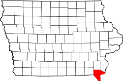
Website: www.leecounty.org Das Lee County[2] ist ein County im US-Bundesstaat Iowa der Vereinigten Staaten von Amerika. Im Jahr 2010 hatte das County 35.862 Einwohner und eine Bevölkerungsdichte von 26,8 Einwohnern pro Quadratkilometer. Das Lee County hat zwei Verwaltungssitze: Fort Madison und Keokuk.
Inhaltsverzeichnis
Geografie
Das County liegt im äußersten Südosten von Iowa, grenzt im Südwesten an Missouri, im Osten an Illinois, wobei die Grenze durch den Mississippi River gebildet wird. Das Lee County hat eine Fläche von 1395 Quadratkilometern, wovon 55 Quadratkilometer Wasserfläche sind. Es grenzt im Uhrzeigersinn an folgende Countys: Henry County, Des Moines County, Henderson County (Illinois), Hancock County (Illinois), Clark County (Missouri) und Van Buren County.
Geschichte
Lee County wurde am 7. Dezember 1836 gebildet.
Demografische Daten
Historische Einwohnerzahlen Census Einwohner ± in % 1840 6093 — 1850 18.861 200 % 1860 29.232 50 % 1870 37.210 30 % 1880 34.859 -6 % 1890 37.715 8 % 1900 39.719 5 % 1910 36.702 -8 % 1920 39.676 8 % 1930 41.268 4 % 1940 41.074 -0,5 % 1950 43.102 5 % 1960 44.207 3 % 1970 42.996 -3 % 1980 43.106 0,3 % 1990 38.687 -10 % 2000 38.052 -2 % 2010 35.862 -6 % Vor 1900[3] Nach der Volkszählung im Jahr 2000 lebten im Lee County 38.052 Menschen. Davon wohnten 1.583 Personen in Sammelunterkünften, die anderen Einwohner lebten in 15.161 Haushalten und 10.248 Familien. Die Bevölkerungsdichte betrug 28 Einwohner pro Quadratkilometer. Ethnisch betrachtet setzte sich die Bevölkerung zusammen aus 94,24 Prozent Weißen, 2,80 Prozent Afroamerikanern, 0,26 Prozent amerikanischen Ureinwohnern, 0,39 Prozent Asiaten, 0,06 Prozent Bewohnern aus dem pazifischen Inselraum und 1,03 Prozent aus anderen ethnischen Gruppen; 1,21 Prozent stammten von zwei oder mehr Ethnien ab. 2,37 Prozent der Bevölkerung waren spanischer oder lateinamerikanischer Abstammung, die verschiedenen der genannten Gruppen angehörten.
Von den 15.161 Haushalten hatten 30,4 Prozent Kinder und Jugendliche unter 18 Jahre, die bei ihnen lebten. 53,7 Prozent waren verheiratete, zusammenlebende Paare, 10,3 Prozent waren allein erziehende Mütter, 32,4 Prozent waren keine Familien, 28,3 Prozent waren Singlehaushalte und in 13,5 Prozent lebten Menschen im Alter von 65 Jahren oder darüber. Die Durchschnittshaushaltsgröße betrug 2,41 und die durchschnittliche Familiengröße lag bei 2,93 Personen.
Auf das gesamte County bezogen setzte sich die Bevölkerung zusammen aus 24,4 Prozent Einwohnern unter 18 Jahren, 7,8 Prozent zwischen 18 und 24 Jahren, 26,7 Prozent zwischen 25 und 44 Jahren, 24,6 Prozent zwischen 45 und 64 Jahren und 16,5 Prozent waren 65 Jahre oder darüber. Das Durchschnittsalter betrug 40 Jahre. Auf 100 weibliche Personen kamen statistisch 97,9 männliche Personen. Auf 100 Frauen im Alter von 18 Jahren oder darüber kamen 96,4 Männer.
Das jährliche Durchschnittseinkommen eines Haushalts betrug 36.193 USD, das Durchschnittseinkommen der Familien betrug 42.658 USD. Männer hatten ein Durchschnittseinkommen von 32.286 USD, Frauen 21.821 USD. Das Pro-Kopf-Einkommen betrug 18.430 USD. 7,1 Prozent der Familien und 9,7 Prozent der Bevölkerung lebten unterhalb der Armutsgrenze. [6]
Städte und Gemeinden
- Argyle
- Augusta
- Bluff Park
- Charleston
- Denmark
- Donnellson
- Fort Madison
- Franklin
- Galland
- Houghton
- Keokuk
- Montrose
- Mooar
- New Boston
- Pilot Grove
- Primrose
- Saint Paul
- Sand Prairie
- Sandusky
- Sawyer
- Summitville
- West Point
- Wever
Einzelnachweise
- ↑ Auszug aus dem National Register of Historic Places. Abgerufen am 13. März 2011
- ↑ Lee County im Geographic Names Information System des United States Geological Survey. Abgerufen am 27. Februar 2011
- ↑ U.S. Census Bureau - Census of Population and Housing. Abgerufen am 15. März 2011
- ↑ Auszug aus Census.gov Abgerufen am 16. Februar 2011
- ↑ [1] Abgerufen am 27. Februar 2011
- ↑ Lee County, Iowa, Datenblatt mit den Ergebnissen der Volkszählung im Jahre 2000 bei factfinder.census.gov.
Weblinks
-
 Commons: Lee County, Iowa – Sammlung von Bildern, Videos und Audiodateien
 - Offizielle Webseite
- www.city-data.com

Liste der Countys in Iowa
Adair | Adams | Allamakee | Appanoose | Audubon | Benton | Black Hawk | Boone | Bremer | Buchanan | Buena Vista | Butler | Calhoun | Carroll | Cass | Cedar | Cerro Gordo | Cherokee | Chickasaw | Clarke | Clay | Clayton | Clinton | Crawford | Dallas | Davis | Decatur | Delaware | Des Moines | Dickinson | Dubuque | Emmet | Fayette | Floyd | Franklin | Fremont | Greene | Grundy | Guthrie | Hamilton | Hancock | Hardin | Harrison | Henry | Howard | Humboldt | Ida | Iowa | Jackson | Jasper | Jefferson | Johnson | Jones | Keokuk | Kossuth | Lee | Linn | Louisa | Lucas | Lyon | Madison | Mahaska | Marion | Marshall | Mills | Mitchell | Monona | Monroe | Montgomery | Muscatine | O'Brien | Osceola | Page | Palo Alto | Plymouth | Pocahontas | Polk | Pottawattamie | Poweshiek | Ringgold | Sac | Scott | Shelby | Sioux | Story | Tama | Taylor | Union | Van Buren | Wapello | Warren | Washington | Wayne | Webster | Winnebago | Winneshiek | Woodbury | Worth | Wright
Wikimedia Foundation.
Schlagen Sie auch in anderen Wörterbüchern nach:
Lee County, Iowa — Infobox U.S. County county = Lee County state = Iowa seallink = map size = 250 founded = 1836 seat = Fort Madison and Keokuk largest city = area total sq mi = 539 area total km2 = 1395 area land sq mi = 517 area land km2 = 1340 area water sq mi … Wikipedia
National Register of Historic Places listings in Lee County, Iowa — Location of Lee County in Iowa This is a list of the National Register of Historic Places listings in Lee County, Iowa. This is intended to be a complete list of the properties and districts on the National Register of Historic Places in Lee… … Wikipedia
Lee County — is the name of twelve counties in the United States: Lee County, Alabama Lee County, Arkansas Lee County, Florida Lee County, Georgia Lee County, Illinois Lee County, Iowa Lee County, Kentucky Lee County, Mississippi Lee County, North Carolina… … Wikipedia
Iowa County (Iowa) — Iowa County Courthouse in Marengo, gelistet im NRHP Nr. 81000247[1] Verwaltung … Deutsch Wikipedia
Lee County — Es gibt in den Vereinigten Staaten zwölf Countys mit dem Namen Lee County: Lee County (Alabama) Lee County (Arkansas) Lee County (Florida) Lee County (Georgia) Lee County (Illinois) Lee County (Iowa) Lee County (Kentucky) Lee County (Mississippi) … Deutsch Wikipedia
Lee County Courthouse — can refer to:* Lee County Courthouse (Alabama) * Lee County Courthouse (Arkansas) * Old Lee County Courthouse (Florida) * Lee County Courthouse (Georgia) * Lee County Courthouse (Iowa) * Lee County Courthouse (Mississippi) * Lee County Courthouse … Wikipedia
Lee County Courthouse — bezeichnet mehrere gleichnamige, im NRHP gelistete, Objekte: Lee County Courthouse (Alabama), ID Nr. 73000353 Lee County Courthouse (Arkansas), ID Nr. 95001090 Lee County Courthouse (Florida), ID Nr. 89000196 Lee County Courthouse (Georgia), ID… … Deutsch Wikipedia
Lee Township, Adair County, Iowa — Infobox Settlement official name = Lee Township, Adair County settlement type = Township nickname = motto = imagesize = image caption = image imagesize = image caption = image mapsize = map caption = mapsize1 = map caption1 = subdivision type =… … Wikipedia
Lee Township, Buena Vista County, Iowa — Infobox Settlement official name = Lee Township, Buena Vista County settlement type = Township nickname = motto = imagesize = image caption = image imagesize = image caption = image mapsize = map caption = mapsize1 = map caption1 = subdivision… … Wikipedia
Lee County — Comté de Lee Cette page d’homonymie répertorie les différents comtés partageant un même nom. Douze comtés des États Unis portent le nom de comté de Lee (Lee County) : le comté de Lee, situé dans l État de l Alabama ; le comté de… … Wikipédia en Français
Lee County (Iowa)

18+
© Academic, 2000-2026
- Kontaktieren Sie uns: Unterstützung, Werbung
Wörterbücher Export, schritte mit PHP, Joomla, Drupal, WordPress, MODx.