- Beaufort County (North Carolina)
-
Verwaltung US-Bundesstaat: North Carolina Verwaltungssitz: Washington Adresse des
Verwaltungssitzes:County Courthouse
P.O. Box 1027
Washington, NC 27889-1027Gründung: 3. Dezember 1705 Gebildet aus: Bath County Vorwahl: 001 252 Demographie Einwohner: 44.985 (2000) Bevölkerungsdichte: 21 Einwohner/km² Geographie Fläche gesamt: 2.483 km² Wasserfläche: 339 km² Karte 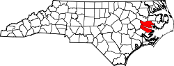
Website: www.co.beaufort.nc.us Beaufort County[1] ist ein County im Bundesstaat North Carolina der Vereinigten Staaten von Amerika. Der Verwaltungssitz (County Seat) ist Washington.
Inhaltsverzeichnis
Geografie
Das County liegt im Osten von North Carolina, ist etwa 120 km vom Atlantik entfernt und hat eine Fläche von 2483 Quadratkilometern, wovon 339 Quadratkilometer Wasserfläche sind. Es grenzt im Uhrzeigersinn an folgende Countys: Washington County, Hyde County, Pamlico County, Craven County, Pitt County und Martin County.
Geschichte
Beaufort County wurde am 3. Dezember 1705 aus Teilen des Bath County gebildet. Benannt wurde es nach dem Henry Somerset, 2nd Duke of Beaufort.
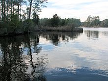 Goose Creek im Goose Creek State Park
Demografische Daten
Historische Einwohnerzahlen Census Einwohner ± in % 1790 5462 — 1800 6242 10 % 1810 7203 20 % 1820 9850 40 % 1830 10.969 10 % 1840 12.225 10 % 1850 13.816 10 % 1860 14.766 7 % 1870 13.011 -10 % 1880 17.474 30 % 1890 21.072 20 % 1900 26.404 30 % 1910 30.877 20 % 1920 31.024 0,5 % 1930 35.026 10 % 1940 36.431 4 % 1950 37.134 2 % 1960 36.014 -3 % 1970 35.980 -0,09 % 1980 40.355 10 % 1990 42.283 5 % 2000 44.958 6 % Vor 1900[2] Nach der Volkszählung im Jahr 2000 lebten im Beaufort County 44.958 Menschen in 18.319 Haushalten und 12.951 Familien. Die Bevölkerungsdichte beträgt 21 Einwohner pro Quadratkilometer. Ethnisch betrachtet setzt sich die Bevölkerung zusammen aus 68,44 Prozent Weißen, 29,03 Prozent Afroamerikanern, 0,16 Prozent amerikanischen Ureinwohnern, 0,22 Prozent Asiaten, 0,02 Prozent Bewohnern aus dem pazifischen Inselraum und 1,42 Prozent aus anderen ethnischen Gruppen; 0,71 Prozent stammten von zwei oder mehr Ethnien ab. 3,24 Prozent der Bevölkerung waren spanischer oder lateinamerikanischer Abstammung.
Von den 18.319 Haushalten hatten 28,8 Prozent Kinder unter 18 Jahren, die bei ihnen lebten. 53,6 Prozent davon waren verheiratete, zusammenlebende Paare, 13,3 Prozent waren allein erziehende Mütter und 29,3 Prozent waren keine Familien. 25,7 Prozent waren Singlehaushalte und in 11,5 Prozent lebten Menschen mit 65 Jahren oder älter. Die Durchschnittshaushaltsgröße betrug 2,42 und die durchschnittliche Familiengröße war 2,89 Personen.
23,4 Prozent der Bevölkerung waren unter 18 Jahre alt. 7,7 Prozent zwischen 18 und 24 Jahre, 26,1 Prozent zwischen 25 und 44 Jahre, 26,9 Prozent zwischen 45 und 64, und 15,9 Prozent waren 65 Jahre alt oder Älter. Das Durchschnittsalter betrug 40 Jahre. Auf alle weibliche Personen kamen 91,1 männliche Personen. Auf alle Frauen im Alter von 18 Jahren oder darüber kamen 87,5 Männer.
Das jährliche Durchschnittseinkommen eines Haushalts betrug 31.066 USD und das jährliche Durchschnittseinkommen einer Familie betrug 37.893 $. Männer hatten ein durchschnittliches Einkommen von 30.483 $ gegenüber den Frauen mit 21.339 $. Das Prokopfeinkommen betrug 16.722 $. 19,5 Prozent der Bevölkerung und 15,2 Prozent der Familien lebten unterhalb der Armutsgrenze. 27,6 Prozent von ihnen sind Kinder und Jugendliche unter 18 Jahre und 19,3 Prozent sind 65 Jahre oder älter. [5]
Städte und Gemeinden
- Aurora
- Bath
- Belhaven
- Chocowinity
- Pantego
- Washington Park
- Washington
Siehe auch
Einzelnachweise
- ↑ GNIS-ID: 1026333. Abgerufen am 22. Februar 2011 (englisch).
- ↑ U.S. Census Bureau - Census of Population and Housing. Abgerufen am 15. März 2011
- ↑ Auszug aus Census.gov. Abgerufen am 20. Februar 2011
- ↑ Auszug aus factfinder.census.gov Abgerufen am 20. Februar 2011
- ↑ Beaufort County, North Carolina, Datenblatt mit den Ergebnissen der Volkszählung im Jahre 2000 bei factfinder.census.gov.

Liste der Countys in North Carolina
Alamance | Alexander | Alleghany | Anson | Ashe | Avery | Beaufort | Bertie | Bladen | Brunswick | Buncombe | Burke | Cabarrus | Caldwell | Camden | Carteret | Caswell | Catawba | Chatham | Cherokee | Chowan | Clay | Cleveland | Columbus | Craven | Cumberland | Currituck | Dare | Davidson | Davie | Duplin | Durham | Edgecombe | Forsyth | Franklin | Gaston | Gates | Graham | Granville | Greene | Guilford | Halifax | Harnett | Haywood | Henderson | Hertford | Hoke | Hyde | Iredell | Jackson | Johnston | Jones | Lee | Lenoir | Lincoln | Macon | Madison | Martin | McDowell | Mecklenburg | Mitchell | Montgomery | Moore | Nash | New Hanover | Northampton | Onslow | Orange | Pamlico | Pasquotank | Pender | Perquimans | Person | Pitt | Polk | Randolph | Richmond | Robeson | Rockingham | Rowan | Rutherford | Sampson | Scotland | Stanly | Stokes | Surry | Swain | Transylvania | Tyrrell | Union | Vance | Wake | Warren | Washington | Watauga | Wayne | Wilkes | Wilson | Yadkin | Yancey
Wikimedia Foundation.
Schlagen Sie auch in anderen Wörterbüchern nach:
Beaufort County, North Carolina — Infobox U.S. County county = Beaufort County state = North Carolina map size = 250 founded = 1712 seat = Washington | area total sq mi =959 area water sq mi =131 area percentage = 13.64% census yr = 2000 pop = 44958 density km2 =21 web =… … Wikipedia
National Register of Historic Places listings in Beaufort County, North Carolina — Map of all coordinates from Google Map of all coordinates from Bing … Wikipedia
Royal, Beaufort County, North Carolina — Royal (formerly, Dublin) is an unincorporated community in Beaufort County, North Carolina. It lies at an elevation of 3 feet (1 m).References*gnis|1022435 … Wikipedia
Beaufort County, South Carolina — Infobox U.S. County county = Beaufort County state = South Carolina map size = 225 founded = 1769 seat = Beaufort | area total sq mi =923 area land sq mi =587 area water sq mi =336 area percentage = 36.41% census yr = 2000 pop = 120937 (137,849… … Wikipedia
Martin County, North Carolina — This article is about Martin County, North Carolina. See Martin County for uses in other states. Martin County, North Carolina Location in the state of North Carolina … Wikipedia
Hyde County, North Carolina — Infobox U.S. County county = Hyde County state = North Carolina map size = 250 founded = 1705 seat = Swan Quarter | area total sq mi =1424 area water sq mi =811 area percentage = 56.97% census yr = 2000 pop = 5826 density km2 =4 web =… … Wikipedia
Pitt County, North Carolina — Infobox U.S. County county = Pitt County state = North Carolina map size = 250 founded = 1760 seat = Greenville | area total sq mi =655 area land sq mi =652 area water sq mi =3 area percentage = 0.49% census yr = 2000 pop = 133798 density km2 =79 … Wikipedia
Pamlico County, North Carolina — Infobox U.S. County county = Pamlico County state = North Carolina map size = 250 founded = 1872 seat = Bayboro | area total sq mi =566 area water sq mi =229 area percentage = 40.49% census yr = 2000 pop = 12934 density km2 =15 web =… … Wikipedia
Washington County, North Carolina — Infobox U.S. County county = Washington County state = North Carolina map size = 250 founded = 1799 seat = Plymouth | area total sq mi =424 area water sq mi =76 area percentage = 17.89% census yr = 2000 pop = 13723 density sq mi =39 web =… … Wikipedia
Carteret County, North Carolina — Coordinates: 34°44′N 76°46′W / 34.733°N 76.767°W / 34.733; 76.767 … Wikipedia
Beaufort County (North Carolina)


18+
© Academic, 2000-2026
- Kontaktieren Sie uns: Unterstützung, Werbung
Wörterbücher Export, schritte mit PHP, Joomla, Drupal, WordPress, MODx.