Bobrof

Bobrof

Vorlage:Infobox Insel/Wartung/Bild fehltVorlage:Infobox Insel/Wartung/Fläche fehlt

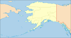
Bobrof Island
Gewässer Pazifischer Ozean
Inselgruppe Aleuten
Geographische Lage 51° 54′ 22″ N, 177° 26′ 47″ W51.9061111-177.4463889597Koordinaten: 51° 54′ 22″ N, 177° 26′ 47″ W
Bobrof Island (Alaska)
DEC
Bobrof Island
Länge 4 km
Höchste Erhebung 597 m
Einwohner (unbewohnt)

Bobrof Island ist eine kleine unbewohnte Vulkan-Insel der Andreanof Islands, die zu den Aleuten gehört. Die etwa 4 km lange Insel liegt zwischen Kanaga Island und Tanaga Island.

Bobrof wurde 1852 von Mikhail Tebenkov als „Ostrov Bobrovoy Vilga“, zu deutsch Otter-Insel, erstmals in den Seekarten verzeichnet.

Weblinks


Wikimedia Foundation.

Игры ⚽ Нужно сделать НИР?

Schlagen Sie auch in anderen Wörterbüchern nach:

  • Bobrof Island — Vorlage:Infobox Insel/Wartung/Fläche fehlt Bobrof Island NASA Bild von Bobrof Island Gewässer …   Deutsch Wikipedia

  • Bobrof Island — Location map Alaska label= lat=52.105964 long= 180.945335 position=right width=250 float=right caption=Location in AlaskaBobrof Island (Walĝa [Bergsland, K Aleut Dictionary Fairbanks: Alaska Native Language Center, 1994] in Aleut) is one of the… …   Wikipedia

  • Bobrów — Bobrow steht für: Bobrow, Stadt in der Oblast Woronesch, Russland Bobrów, Ortschaft in Miłkowice, Polen Bobrów, Ortschaft in Mysłakowice, Polen Bobrów, Siedlung in Ciasna, Polen Bobrow ist Familienname von Wsewolod Michailowitsch Bobrow,… …   Deutsch Wikipedia

  • Great Sitkin (Vulkan) — Vorlage:Infobox Insel/Wartung/Bild fehlt Great Sitkin Island Gewässer Pazifischer Ozean Inselgruppe Aleuten Geographische Lage …   Deutsch Wikipedia

  • Mount Kanaga — Vorlage:Infobox Insel/Wartung/Bild fehlt Kanaga Island Gewässer Pazifischer Ozean Inselgruppe Aleuten Geographische Lage …   Deutsch Wikipedia

  • Mount Tanaga — Vorlage:Infobox Insel/Wartung/Bild fehltVorlage:Infobox Insel/Wartung/Fläche fehlt Tanaga Island Gewässer Pazifischer Ozean Inselgruppe Aleuten Geographische Lage …   Deutsch Wikipedia

  • Pyre Peak — Vorlage:Infobox Insel/Wartung/Bild fehltVorlage:Infobox Insel/Wartung/Höhe fehlt Seguam Island Gewässer Pazifischer Ozean Inselgruppe Aleuten Geographische Lage …   Deutsch Wikipedia

  • Liste von Vulkanen in den USA —  Karte mit allen Koordinaten: OSM, Google oder …   Deutsch Wikipedia

  • Бобров, Виктор Алексеевич — акварелист и академик живописи; родился в Петербургской губ., Петергофском уезде, в селе Гатобуже, в 1842 г.; воспитывался в Ларинской и 2 й петербургской гимназии. В 1860 г. поступил в Академию художеств, где получил пять серебряных медалей. В… …   Большая биографическая энциклопедия

  • Diomede Islands — Russian: острова Гвоздева Inupiaq: ? Diomede Islands: Little Diomede (left) and Big Diomede (right) …   Wikipedia

Share the article and excerpts

Direct link
Do a right-click on the link above
and select “Copy Link”