- Brown County (Ohio)
-
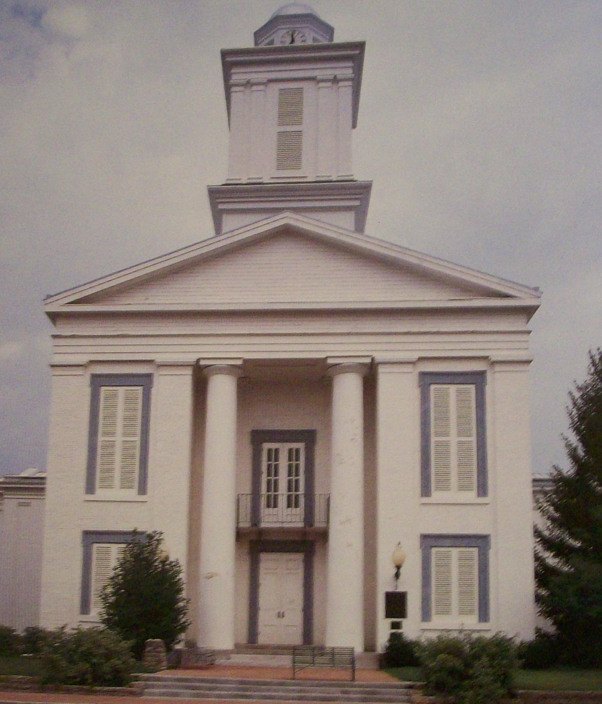
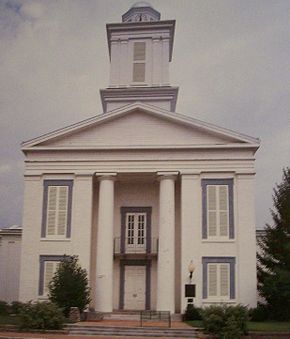 Brown County Courthouse in Georgetown
Verwaltung US-Bundesstaat: Ohio Verwaltungssitz: Georgetown Adresse des
Verwaltungssitzes:County Administration Building
800 Mount Orab Pike
Georgetown, OH 45121-1184Gründung: 27. Dezember 1817 Gebildet aus: Adams County
Clermont CountyVorwahl: 001 937 Demographie Einwohner: 44.398 (2005) Bevölkerungsdichte: 34,8 Einwohner/km² Geographie Fläche gesamt: 1.283 km² Wasserfläche: 9 km² Karte 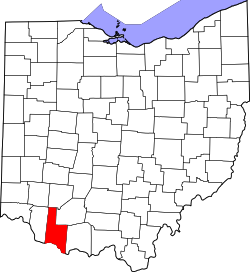
Brown County[1] ist ein County im Bundesstaat Ohio der Vereinigten Staaten von Amerika. Der Verwaltungssitz (County Seat) ist Georgetown.
Inhaltsverzeichnis
Geografie
Das County liegt südsüdwestlich in Ohio, grenzt an Kentucky und hat eine Fläche von 1283 Quadratkilometern, wovon 9 Quadratkilometer Wasserfläche sind. Es grenzt im Uhrzeigersinn an folgende Countys: Clinton County, Highland County, Adams County, Mason County (Kentucky), Bracken County (Kentucky) und Clermont County.
Geschichte
Brown County wurde am 27. Dezember 1817 aus Teilen des Adams County und des Clermont County gebildet. Benannt wurde es nach Jacob Brown, einem Generalmajor im Britisch-Amerikanischen Krieg, der bei der Schlacht bei Lundy's Lane verwundet wurde.
Demographie
Historische Einwohnerzahlen Census Einwohner ± in % 1820 13.356 — 1830 17.867 30 % 1840 22.715 30 % 1850 27.332 20 % 1860 29.958 10 % 1870 30.802 3 % 1880 32.911 7 % 1890 29.899 -9 % 1900 28.237 -6 % 1910 24.832 -10 % 1920 22.621 -9 % 1930 20.148 -10 % 1940 21.638 7 % 1950 22.221 3 % 1960 25.178 10 % 1970 26.635 6 % 1980 31.920 20 % 1990 34.966 10 % 2000 42.285 20 % Vor 1900[2]  Alterspyramide für das Brown County
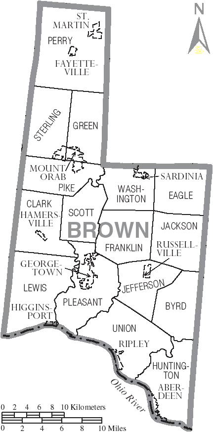
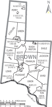 Karte des Brown County.
Nach der Volkszählung im Jahr 2000 lebten im Brown County 42.285 Menschen in 15.555 Haushalten und 11.790 Familien. Die Bevölkerungsdichte betrug 33 Einwohner pro Quadratkilometer. Ethnisch betrachtet setzte sich die Bevölkerung zusammen aus 98,08 Prozent Weißen, 0,92 Prozent Afroamerikanern, 0,18 Prozent amerikanischen Ureinwohnern, 0,13 Prozent Asiaten und 0,08 Prozent aus anderen ethnischen Gruppen; 0,60 Prozent stammten von zwei oder mehr Ethnien ab. 0,44 Prozent der Bevölkerung waren spanischer oder lateinamerikanischer Abstammung.
Von den 15.555 Haushalten hatten 37,1 Prozent Kinder und Jugendliche unter 18 Jahre, die bei ihnen lebten. 61,3 Prozent waren verheiratete, zusammenlebende Paare, 10,0 Prozent waren allein erziehende Mütter, 24,2 Prozent waren keine Familien, 20,2 Prozent waren Singlehaushalte und in 8,5 Prozent lebten Menschen im Alter von 65 Jahren oder darüber. Die Durchschnittshaushaltsgröße betrug 2,69 und die durchschnittliche Familiengröße lag bei 3,09 Personen.
Auf das gesamte County bezogen setzte sich die Bevölkerung zusammen aus 27,6 Prozent Einwohnern unter 18 Jahren, 8,1 Prozent zwischen 18 und 24 Jahren, 30,3 Prozent zwischen 25 und 44 Jahren, 22,4 Prozent zwischen 45 und 64 Jahren und 11,6 Prozent waren 65 Jahre alt oder darüber. Das Durchschnittsalter betrug 35 Jahre. Auf 100 weibliche Personen kamen 96,8 männliche Personen. Auf 100 Frauen im Alter von 18 Jahren oder darüber kamen statistisch 94,8 Männer.
Das jährliche Durchschnittseinkommen eines Haushalts betrug 38.303 USD, das Durchschnittseinkommen der Familien betrug 43.040 USD. Männer hatten ein Durchschnittseinkommen von 32.647 USD, Frauen 22.483 USD. Das Prokopfeinkommen betrug 17.100 USD. 8,8 Prozent der Familien und 11,6 Prozent der Bevölkerung lebten unterhalb der Armutsgrenze. Davon waren 15,2 Prozent Kinder oder Jugendliche unter 18 Jahre und 9,4 Prozent waren Menschen über 65 Jahre. [5]
Orte in Brown County
Dörfer
- Aberdeen
- Fayetteville
- Georgetown
- Hamersville
- Higginsport
- Mount Orab
- Ripley
- Russellville
- Sardinia
- St. Martin
Townships
Einzelnachweise
- ↑ Brown County im Geographic Names Information System des United States Geological Survey. Abgerufen am 22. Februar 2011
- ↑ U.S. Census Bureau _ Census of Population and Housing. Abgerufen am 17. Februar 2011
- ↑ Auszug aus Census.gov. Abgerufen am 21. Februar 2011
- ↑ Auszug aus factfinder.census.gov Abgerufen am 21. Februar 2011
- ↑ Brown County, Ohio, Datenblatt mit den Ergebnissen der Volkszählung im Jahre 2000 bei factfinder.census.gov.

Liste der Countys in Ohio
Adams | Allen | Ashland | Ashtabula | Athens | Auglaize | Belmont | Brown | Butler | Carroll | Champaign | Clark | Clermont | Clinton | Columbiana | Coshocton | Crawford | Cuyahoga | Darke | Defiance | Delaware | Erie | Fairfield | Fayette | Franklin | Fulton | Gallia | Geauga | Greene | Guernsey | Hamilton | Hancock | Hardin | Harrison | Henry | Highland | Hocking | Holmes | Huron | Jackson | Jefferson | Knox | Lake | Lawrence | Licking | Logan | Lorain | Lucas | Madison | Mahoning | Marion | Medina | Meigs | Mercer | Miami | Monroe | Montgomery | Morgan | Morrow | Muskingum | Noble | Ottawa | Paulding | Perry | Pickaway | Pike | Portage | Preble | Putnam | Richland | Ross | Sandusky | Scioto | Seneca | Shelby | Stark | Summit | Trumbull | Tuscarawas | Union | Van Wert | Vinton | Warren | Washington | Wayne | Williams | Wood | Wyandot
Wikimedia Foundation.
Schlagen Sie auch in anderen Wörterbüchern nach:
Brown County, Ohio — Infobox U.S. County county = Brown County state = Ohio founded year = 1819cite web|url = http://www.odod.state.oh.us/research/FILES/S0/Brown.pdf|title = Ohio County Profiles: Brown County |accessdate = 2007 04 28 |publisher = Ohio Department of… … Wikipedia
National Register of Historic Places listings in Brown County, Ohio — Location of Brown County in Ohio This is a list of the National Register of Historic Places listings in Brown County, Ohio. This is intended to be a complete list of the properties and districts on the National Register of Historic Places in… … Wikipedia
Clark Township, Brown County, Ohio — Township Municipalities and townships of Brown County … Wikipedia
Huntington Township, Brown County, Ohio — Infobox Settlement official name = Huntington Township, Ohio settlement type = Township nickname = motto = imagesize = image caption = image mapsize = 250x200px map caption = Municipalities and townships of Brown County. mapsize1 = map caption1 … Wikipedia
Perry Township, Brown County, Ohio — Infobox Settlement official name = Perry Township, Brown County, Ohio settlement type = Township nickname = motto = imagesize = 250px image caption = Countryside in central Perry Township, with Fayetteville in the middle image mapsize = 250px map … Wikipedia
Pleasant Township, Brown County, Ohio — Infobox Settlement official name = Pleasant Township, Ohio settlement type = Township nickname = motto = imagesize = image caption = image mapsize = 250x200px map caption = Municipalities and townships of Brown County. mapsize1 = map caption1 =… … Wikipedia
Union Township, Brown County, Ohio — Infobox Settlement official name = Union Township, Ohio settlement type = Township nickname = motto = imagesize = image caption = image mapsize = 250x200px map caption = Municipalities and townships of Brown County. mapsize1 = map caption1 =… … Wikipedia
Lewis Township, Brown County, Ohio — Infobox Settlement official name = Lewis Township, Ohio settlement type = Township nickname = motto = imagesize = image caption = image mapsize = 250x200px map caption = Municipalities and townships of Brown County. mapsize1 = map caption1 =… … Wikipedia
Perry Township (Brown County, Ohio) — Perry Township … Deutsch Wikipedia
Eagle Township (Brown County, Ohio) — Eagle Township … Deutsch Wikipedia
Brown County (Ohio)


18+
© Academic, 2000-2026
- Kontaktieren Sie uns: Unterstützung, Werbung
Wörterbücher Export, schritte mit PHP, Joomla, Drupal, WordPress, MODx.