- Monroe County (Ohio)
-
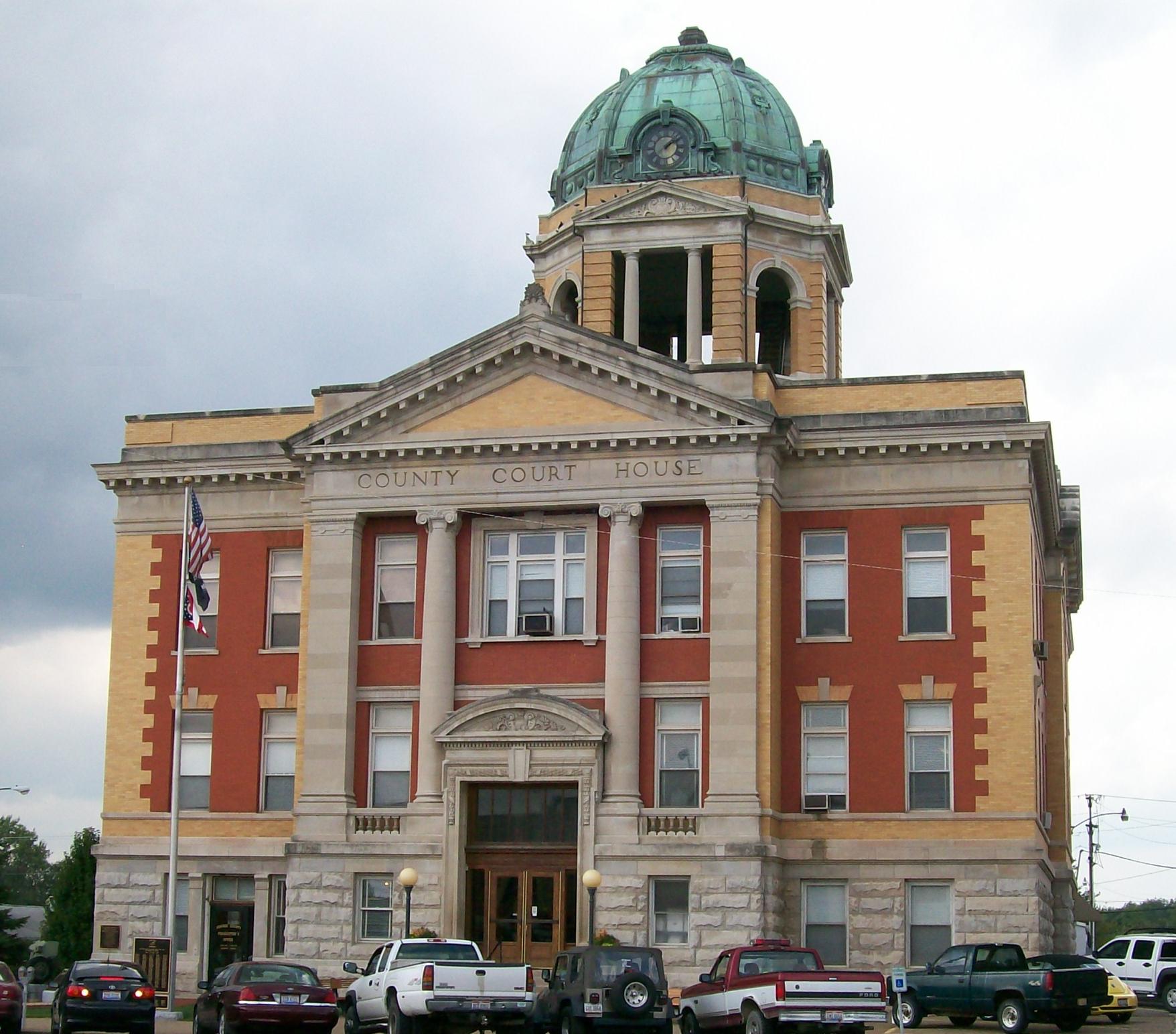
Verwaltung US-Bundesstaat: Ohio Verwaltungssitz: Woodsfield Adresse des
Verwaltungssitzes:County Courthouse
101 N. Main Street
Woodsfield, OH 43793-1070Gründung: 29. Januar 1813 Gebildet aus: Belmont County
Guernsey County
Washington CountyVorwahl: 001 740 Demographie Einwohner: 14.642 (2010) Bevölkerungsdichte: 12,4 Einwohner/km² Geographie Fläche gesamt: 1.185 km² Wasserfläche: 6 km² Karte 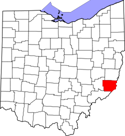
Website: www.monroecountyohio.net Das Monroe County[2] ist ein County im US-amerikanischen Bundesstaat Ohio. Bei der Volkszählung im Jahr 2010 hatte das County 14.642 Einwohner und eine Bevölkerungsdichte von 12,4 Einwohnern pro Quadratkilometer. Der Verwaltungssitz (County Seat) ist Woodsfield.[3]
Inhaltsverzeichnis
Geografie
Das County liegt im Osten von Ohio und wird durch den Ohio River vom Northern Panhandle von West Virginia getrennt. Es hat eine Fläche von 1.185 Quadratkilometern, wovon 5 Quadratkilometer Wasserfläche sind. An das Monroe County grenzen folgende Countys:
Belmont County Marshall County
(West Virginia)Noble County 
Wetzel County
(West Virginia)Washington County Tyler County
(West Virginia)Geschichte
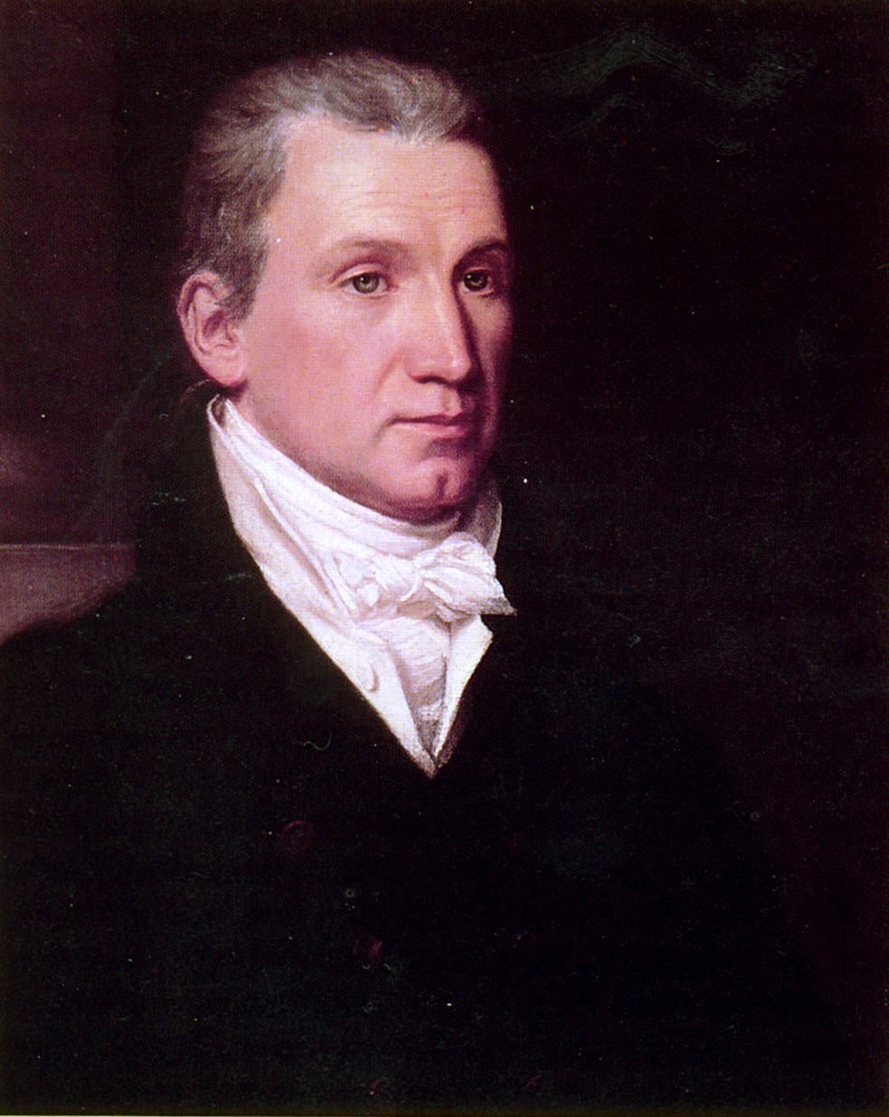
 J. Monroe
Das Monroe County wurde am 28. Januar 1813 aus Teilen des Belmont-, Guernsey- und des Washington County gebildet. Benannt wurde es nach James Monroe (1758–1831), dem fünften Präsidenten der Vereinigten Staaten (1817–1825).
Demografische Daten
Historische Einwohnerzahlen Census Einwohner ± in % 1820 4645 — 1830 8768 90 % 1840 18.521 100 % 1850 28.351 50 % 1860 25.741 -9 % 1870 25.779 0,1 % 1880 26.496 3 % 1890 25.175 -5 % 1900 27.031 7 % 1910 24.244 -10 % 1920 20.660 -10 % 1930 18.426 -10 % 1940 18.641 1 % 1950 15.362 -20 % 1960 15.268 -0,6 % 1970 15.739 3 % 1980 17.382 10 % 1990 15.497 -10 % 2000 15.180 -2 % 2010 14.642 -4 % Vor 1900[4] 1900–1990[5] 2000[6] 2010[7] Nach der Volkszählung im Jahr 2010 lebten im Monroe County 14.642 Menschen in 5.972 Haushalten. Die Bevölkerungsdichte betrug 12,4 Einwohner pro Quadratkilometer.
Ethnisch betrachtet setzte sich die Bevölkerung zusammen aus 98,1 Prozent Weißen, 0,4 Prozent Afroamerikanern, 0,1 Prozent amerikanischen Ureinwohnern, 0,1 Prozent Asiaten sowie aus anderen ethnischen Gruppen; 1,2 Prozent stammten von zwei oder mehr Ethnien ab. Unabhängig von der ethnischen Zugehörigkeit waren 0,4 Prozent der Bevölkerung spanischer oder lateinamerikanischer Abstammung.
In den 5.972 Haushalten lebten statistisch je 2,35 Personen.
21,5 Prozent der Bevölkerung waren unter 18 Jahre alt, 59,1 Prozent waren zwischen 18 und 64 und 19,4 Prozent waren 65 Jahre oder älter. 50,2 Prozent der Bevölkerung war weiblich.
Das jährliche Durchschnittseinkommen eines Haushalts lag bei 36.729 USD. Das Pro - Kopf - Einkommen betrug 18.248 USD. 16,6 Prozent der Einwohner lebten unterhalb der Armutsgrenze.[8]
Städte und Gemeinden
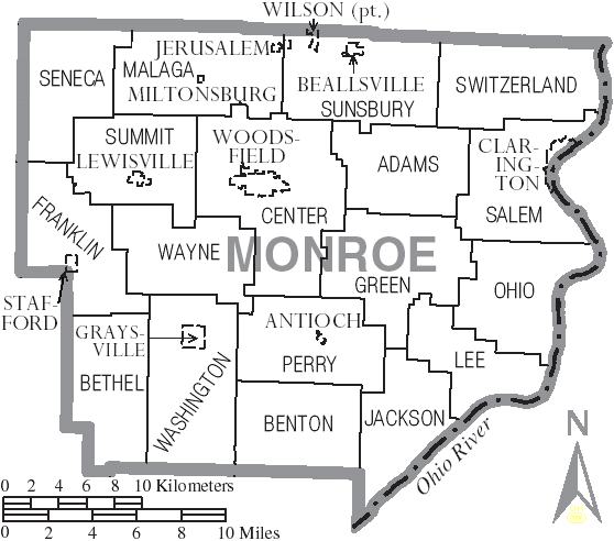
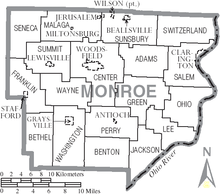 Orte und Townships im Monroe County
- Antioch
- Beallsville
- Clarington
- Graysville
- Jerusalem
- Lewisville
- Miltonsburg
- Stafford
- Wilson1
- Woodsfield
- Cameron
- Hannibal
- Laings
- Malaga
- Rinard Mills
- Sardis
- Sycamore Valley
1 - teilweise im Belmont County
Townships
- Adams Township
- Benton Township
- Bethel Township
- Center Township
- Franklin Township
- Green Township
- Jackson Township
- Lee Township
- Malaga Township
- Ohio Township
- Perry Township
- Salem Township
- Seneca Township
- Summit Township
- Sunsbury Township
- Switzerland Township
- Washington Township
- Wayne Township
Einzelnachweise
- ↑ Auszug aus dem National Register of Historic Places Abgerufen am 13. März 2011
- ↑ Monroe County im Geographic Names Information System des United States Geological Survey Abgerufen am 22. Februar 2011
- ↑ National Association of Counties Abgerufen am 3 November 2011
- ↑ U.S. Census Bureau _ Census of Population and Housing Abgerufen am 17. Februar 2011
- ↑ Auszug aus Census.gov Abgerufen am 21. Februar 2011
- ↑ Auszug aus factfinder.census.gov Abgerufen am 21. Februar 2011
- ↑ United States Census 2010 Abgerufen am 3. November 2011
- ↑ U.S. Census Buero, State & County QuickFacts - Monroe County Abgerufen am 3. November 2011
Weblinks
-
 Commons: Monroe County, Ohio – Sammlung von Bildern, Videos und Audiodateien
 - Offizielle Webseite
- U.S. Census Buero, State & County QuickFacts - Monroe County
- Yahoo Bildersuche - Monroe County
- www.city-data.com - Monroe County

Liste der Countys in Ohio
Adams | Allen | Ashland | Ashtabula | Athens | Auglaize | Belmont | Brown | Butler | Carroll | Champaign | Clark | Clermont | Clinton | Columbiana | Coshocton | Crawford | Cuyahoga | Darke | Defiance | Delaware | Erie | Fairfield | Fayette | Franklin | Fulton | Gallia | Geauga | Greene | Guernsey | Hamilton | Hancock | Hardin | Harrison | Henry | Highland | Hocking | Holmes | Huron | Jackson | Jefferson | Knox | Lake | Lawrence | Licking | Logan | Lorain | Lucas | Madison | Mahoning | Marion | Medina | Meigs | Mercer | Miami | Monroe | Montgomery | Morgan | Morrow | Muskingum | Noble | Ottawa | Paulding | Perry | Pickaway | Pike | Portage | Preble | Putnam | Richland | Ross | Sandusky | Scioto | Seneca | Shelby | Stark | Summit | Trumbull | Tuscarawas | Union | Van Wert | Vinton | Warren | Washington | Wayne | Williams | Wood | Wyandot
Wikimedia Foundation.
Schlagen Sie auch in anderen Wörterbüchern nach:
Monroe County, Ohio — Location in the state of Ohio … Wikipedia
Ohio Township, Monroe County, Ohio — Ohio Township, Ohio Township Municipalities and townships of Monroe County … Wikipedia
National Register of Historic Places listings in Monroe County, Ohio — Location of Monroe County in Ohio This is a list of the National Register of Historic Places listings in Monroe County, Ohio. This is intended to be a complete list of the properties on the National Register of Historic Places in Monroe County,… … Wikipedia
Malaga Township, Monroe County, Ohio — Malaga Township, Ohio Township Municipalities and townships of Monroe County … Wikipedia
Salem Township, Monroe County, Ohio — Infobox Settlement official name = Salem Township, Ohio settlement type = Township nickname = motto = imagesize = image caption = image mapsize = 250x200px map caption = Municipalities and townships of Monroe County. mapsize1 = map caption1 =… … Wikipedia
Lee Township, Monroe County, Ohio — Infobox Settlement official name = Lee Township, Ohio settlement type = Township nickname = motto = imagesize = image caption = image mapsize = 250x200px map caption = Municipalities and townships of Monroe County. mapsize1 = map caption1 =… … Wikipedia
Center Township, Monroe County, Ohio — Infobox Settlement official name = Center Township, Ohio settlement type = Township nickname = motto = imagesize = image caption = image mapsize = 250x200px map caption = Municipalities and townships of Monroe County. mapsize1 = map caption1 =… … Wikipedia
Jackson Township, Monroe County, Ohio — Infobox Settlement official name = Jackson Township, Ohio settlement type = Township nickname = motto = imagesize = image caption = image mapsize = 250x200px map caption = Municipalities and townships of Monroe County. mapsize1 = map caption1 =… … Wikipedia
Switzerland Township, Monroe County, Ohio — Infobox Settlement official name = Switzerland Township, Ohio settlement type = Township nickname = motto = imagesize = image caption = image mapsize = 250x200px map caption = Municipalities and townships of Monroe County. mapsize1 = map caption1 … Wikipedia
Seneca Township, Monroe County, Ohio — Infobox Settlement official name = Seneca Township, Ohio settlement type = Township nickname = motto = imagesize = image caption = image mapsize = 250x200px map caption = Municipalities and townships of Monroe County. mapsize1 = map caption1 =… … Wikipedia
Monroe County (Ohio)


18+
© Academic, 2000-2026
- Kontaktieren Sie uns: Unterstützung, Werbung
Wörterbücher Export, schritte mit PHP, Joomla, Drupal, WordPress, MODx.