- Broutona
-
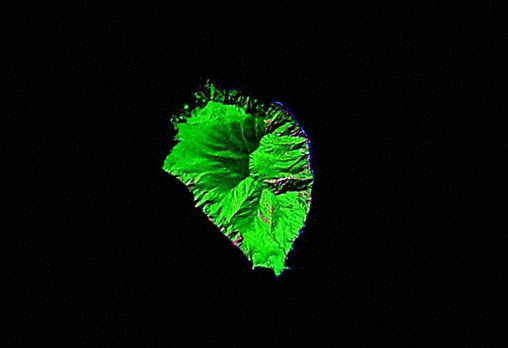
Broutona NASA-Landsat-Bild von Broutona
Gewässer Ochotskisches Meer Inselgruppe Kurilen Geographische Lage 46° 43′ 28″ N, 150° 43′ 59″ O46.724444444444150.73305555556801Koordinaten: 46° 43′ 28″ N, 150° 43′ 59″ O 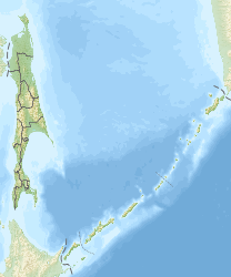

Länge 4,5 km Breite 3,2 km Fläche 7 km² Höchste Erhebung 801 m Einwohner (unbewohnt) Broutona (russisch Остров Броутона ; jap. 武魯頓島, Buroton-tō) ist eine kleine, unbewohnte Vulkaninsel der Kurilen. Sie gehört administrativ zur russischen Oblast Sachalin und ist nach William Robert Broughton benannt.
Broutona liegt etwa 55 Kilometer nordöstlich der Insel Urup sowie 17 km nordwestlich von Tschirpoi und befindet sich somit leicht innerhalb des eigentlichen, vulkanisch aktiven Inselbogens der Kurilen. Die annähernd oval geformte Insel hat eine Länge von 4,5 km, eine Breite von bis zu 3,2 km und weist eine Fläche von etwa 7 km² auf. Sie erreicht eine Höhe von rund 800 m über dem Meer.
Weblinks
- Broutona auf oceandots.com (englisch)
Inseln der KurilenAnziferowa | Atlassowa | Awos | Brat Tschirpojew | Broutona | Chabomai | Charimkotan | Ekarma | Iturup | Ketoi | Kunaschir | Lowuschki | Makanruschi | Matua | Onekotan | Paramuschir | Raikoke | Rasschua | Schiaschkotan | Schikotan | Schumschu | Simuschir | Tschirinkotan | Tschirpoi | Urup | Uschischir
Wikimedia Foundation.
Schlagen Sie auch in anderen Wörterbüchern nach:
Broutona — Saltar a navegación, búsqueda Broutona (en ruso, Броутона, y en japonés, Buroton) es una isla rusa en el archipiélago de las Kuriles. Tiene una superficie de aproximadamente 7 km². Pertenece al grupo de las Kuriles meridionales. Geografía La isla … Wikipedia Español
Broutona — Broutona, also known as Burotan jima or Buroton To, is a small island with an area of 7 km².It is located in the northern part of the Southern Kuril Islands. The coastline of the island is lined with cliffs which reach heights of 274 metres tall … Wikipedia
Brouton — 46°43′N 150°45′E / 46.717, 150.75 Brouton ou Broutona (en japonais Burotan jima ou … Wikipédia en Français
Kuril Islands — Location of Kuril Islands in the Western Pacific. Matua Isl … Wikipedia
Boussole-Straße — Boussole Straße … Deutsch Wikipedia
Sea of Okhotsk — Coordinates: 55°N 150°E / 55°N 150°E / 55; 150 … Wikipedia
Atlasov Island — For the shield volcano situated in Kamchatka, see Atlasova. Atlasov Alaid … Wikipedia
Onekotan — Native name: Онекотан 温禰古丹島 Onekotan Island (centre) from space, October 1994. North at top … Wikipedia
Chirinkotan — Native name: Чиринкотан 知林古丹島 NASA picture of Chirinkotan Island … Wikipedia
Makanrushi — Native name: Маканруши 磨勘留島 Wintertime view of Makanrushi Island, January 2001. North at top … Wikipedia
Broutona

18+
© Academic, 2000-2026
- Kontaktieren Sie uns: Unterstützung, Werbung
Wörterbücher Export, schritte mit PHP, Joomla, Drupal, WordPress, MODx.