- Deliverance Island
-
Deliverance Island
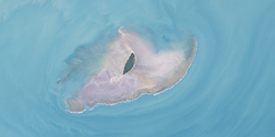
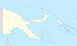
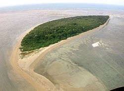
(Warul Kawa)Landsat-Bild der Insel Gewässer Arafurasee Inselgruppe Torres-Strait-Inseln Geographische Lage 9° 31′ 6″ S, 141° 34′ 12″ O-9.5183333333333141.57Koordinaten: 9° 31′ 6″ S, 141° 34′ 12″ O Länge 1,7 km Breite 470 m Fläche 0,40 km² Einwohner (unbewohnt) Deliverance Island von Norden Deliverance Island, auf Deutsch etwa „Erlösungsinsel“, in der örtlichen Kala Kaiwau Ya-Sprache Warul Kawa genannt, mit der deutschen Bedeutung „Schildkröteninsel“, ist eine kleine unbewohnte Insel der Torres-Strait-Inseln. Sie liegt etwa 34 km südlich der Küste des westlichen Papua-Neuguinea und über 162 km nordwestlich der Kap-York-Halbinsel, gehört aber dennoch zum australischen Bundesstaat Queensland. Die nächstgelegene bewohnte Insel ist die 68 km nordwestlich gelegene Insel Boigu. Die nächstgelegene Insel überhaupt ist die 7,5 km weiter südlich gelegene kleine Insel Kerr Islet.
Deliverance Islet erstreckt sich über eine Länge von 1700 Metern und ist maximal 470 Meter breit. Die vollständig bewaldete, längliche Insel ist von einem wattartigen Flachwassergebiet umgeben, das durch Braunalgen und Grünalgen dominiert wird. Daneben gibt es etwas Seegras, aber nur geringen Korallenbewuchs. Die Insel beherbergt mit ihrer Umgebung zwei international bedeutsame Populationen von Meeresschildkröten. Sie ist eine der größten Kolonien von Wallriffschildkröten. Im Flachwassergebiet finden sich zahlreiche migrierende Suppenschildkröten.
Verwaltungsmäßig ist Deliverance Island Teil der Top Western Islands, einer Inselregion im Verwaltungsbezirk Torres Shire. Die Insel genießt einen besonderen Schutzstatus als Indigenous Protected Area.
Siehe auch
Inselregionen, Hauptinseln und Inselgruppen im Archipel der Torres-Strait-Inselnzu Papua-Neuguinea gehörige Torres-Strait-Inseln: Bristow Island | Daru Island | Parama Island • Kawai-Inseln | Talbot-Inseln
Top Western: Boigu | Dauan | Deliverance | Saibai | Turnagain • Talbot-Inseln
Western: Badu | Mabuiag | Moa | Portlock | Tobin • Bellevue-Inseln | Duncan-Inseln | Farewell-Inseln | Kulbi-Inseln
Central: Aureed | Bourke | Coconut | Sassie | Sue | Yam | Yorke • Bourke-Inseln | The Three Sisters | Yorke-Inseln
Eastern: Bramble | Darnley | Murray | Stephens • Murray-Inseln
Inner: Albany | Booby | Crab | Entrance | Friday | Goods | Hammond | Horn | Packe | Port Lihou | Prince-of-Wales | Thursday | Wednesday • Manar-Inseln | Red-Wallis-Inseln | Thursday-Inseln | Tuesday-Inseln
Wikimedia Foundation.
Schlagen Sie auch in anderen Wörterbüchern nach:
Deliverance Island (Queensland) — Deliverance Island (Warul Kawa) is a small island about 80 km South of Papua New Guinea and 200 km North of Thursday Island, Torres Strait, in the Torres Strait Queensland, Australia.Surrounded by a shallow reef platform interspersed with sandy… … Wikipedia
Deliverance (disambiguation) — Deliverance may refer to: Deliverance (novel), by James Dickey, the basis for the 1972 film Deliverance Island (Queensland), a small island in the Torres Strait Queensland, Australia Movies: Deliverance (1972 film), directed by John Boorman… … Wikipedia
Norman Island — In einer Höhle auf Norman Island Gewässer Karibisches Meer … Deutsch Wikipedia
Thursday Island — Landsat Bild von Thursday Island (unten) und Hammond Island (oben) … Deutsch Wikipedia
Sassie Island — (Long Island) Landsat Bild von Sassie Island Gewässer Pazifischer Oze … Deutsch Wikipedia
Stephens Island (Torres Strait) — Stephens Island (Ugar) Landsat Bild der Insel mit dem wesentlich größeren umgebenden Korallenriff … Deutsch Wikipedia
Ordnance Island, Bermuda — St. George s Town, Bermuda, with Ordnance Island visible at the centre of the photograph … Wikipedia
Friday Island (Torres Strait) — Friday Island Landsat Bild von Friday Island Gewässer Pazifischer Ozea … Deutsch Wikipedia
Parama Island — (Bampton Island) Landsat Bild von Parama Island (Anm.: unter den Wolken!) Gewäss … Deutsch Wikipedia
Rossel Island (Yela) — is the easternmost island of the Louisiade Archipelago, which itself is part of the Milne Bay Province of Papua New Guinea. The volcanic island measures 34 km east west, and is up to 11 km wide. With an area of 262.5 km², it is the second largest … Wikipedia


