- Mokoliʻi
-
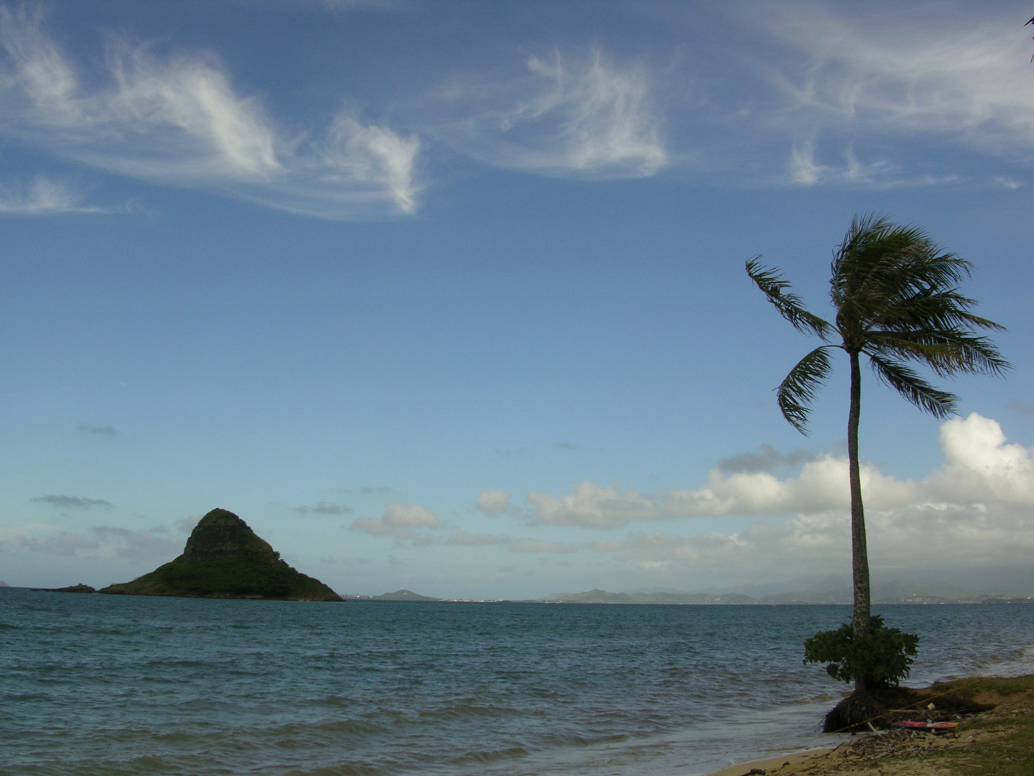
Mokoliʻi Mokoliʻi von Oʻahu aus gesehen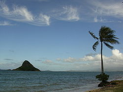
Gewässer Pazifischer Ozean Inselgruppe Hawaii Geographische Lage 21° 30′ 34,2″ N, 157° 49′ 44,8″ W21.5095-157.8291111111170Koordinaten: 21° 30′ 34,2″ N, 157° 49′ 44,8″ W 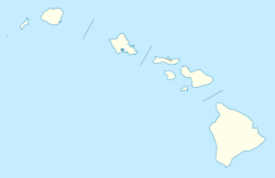

Fläche 4,7 ha Höchste Erhebung 70 m Einwohner (unbewohnt) Mokoliʻi (auch Mokoli'i, Mokolii), im Volksmund auch Chinaman's Hat genannt, ist eine kleine, unbewohnte Insel im Archipel von Hawaiʻi und gehört zum Honolulu County. Sie liegt nur etwa 500 Meter vor der Ostküste der Insel Oʻahu, unweit des Kualoa Regional Parks.
Die Insel ist vulkanischen Ursprungs; sie weist eine Fläche von 4,7 ha (0,047 km²) auf und erreicht eine Höhe von etwa 70 m über dem Meeresspiegel.
Das Eiland war einst Brutgebiet des Weißschwanz-Tropikvogels (Phaethon lepturus), heute brütet dort nur eine Seevogelart, der Keilschwanz-Sturmtaucher (Puffinus pacificus, hawaiisch: Uau Kani). Mokoliʻi ist, wie viele weitere kleine Inseln Hawaiʻis auch, ein Hawaiʻi State Seabird Sanctuary (Vogelschutzgebiet). Die Insel darf tagsüber besucht werden und ist bei Ebbe zu Fuß zu erreichen.
Weblinks
 Commons: Mokoliʻi – Sammlung von Bildern, Videos und Audiodateien
- Mokoliʻi im Geographic Names Information System des United States Geological Survey
- Mokolii im Offshore Islet Restoration Committee (englisch)

Die acht Hauptinseln: Hawaiʻi | Kahoʻolawe | Kauaʻi | Lānaʻi | Maui | Molokaʻi | Niʻihau | Oʻahu
Kleinere Inseln: ʻĀlau | Kapapa | Kaʻula | Kekepa | Lehua | Mānana | Mōkapu | Mōkōlea | Mokoliʻi | Mokuʻauia | Mokuʻaeʻae | Moku Manu | Molokini | Nā Mokulua | Poʻopoʻo
Nordwestliche Hawaii-Inseln: French Frigate | Gardner | Kure | Laysan | Lisianski | Maro Reef | Necker | Nihoa | Pearl und Hermes
Wikimedia Foundation.
Schlagen Sie auch in anderen Wörterbüchern nach:
Mokoliʻi — or Chinaman s Hat Mokoliʻi is a 12.5 acre (5.1 ha), 206 foot tall (63 m) basalt island 1⁄3 miles (0.54 km) offshore of Kualoa Point, Oahu, in Kāne ohe Bay, Hawaii, at … Wikipedia
Mokolii — Mokoliʻi Mokoliʻi von Oʻahu aus gesehen Gewässer Pazifischer Ozean … Deutsch Wikipedia
O'ahu — Oʻahu Oʻahu aus dem Weltall Gewässer Pazifischer Ozean Inselgruppe Hawaii … Deutsch Wikipedia
Oahu — Oʻahu Oʻahu aus dem Weltall Gewässer Pazifischer Ozean Inselgruppe Hawaii … Deutsch Wikipedia
Oʻahu — aus dem Weltall Gewässer Pazifischer Ozean Inselgruppe … Deutsch Wikipedia
North Ko'olaupoko, Hawai'i — Waikane, Hawaii CDP Location in Honolulu Cou … Wikipedia
Kapapa Island — im Vordergrund, Oʻahu im Hintergrund Gewässer … Deutsch Wikipedia
Mobutu Sese Seko — President of Zaire In office 24 November 1965 – 16 May 1997 Prime Minister Several Pr … Wikipedia
Hawaiian Islands — Mokupuni o Hawai‘i True colour satellite image of the Hawaiian Islands … Wikipedia
List of islands of the United States — This is a partial list of islands of the United States, including its insular areas, which are listed at the end.AlabamaCaliforniaHawaii*Hawaiian Islands **Hawai lsquo;i (also known as the Big Island) **Maui **Kaho lsquo;olawe (uninhabited;… … Wikipedia
Mokoliʻi

18+
© Academic, 2000-2025
- Kontaktieren Sie uns: Unterstützung, Werbung
Wörterbücher Export, schritte mit PHP, Joomla, Drupal, WordPress, MODx.