- Dry Tortugas National Park
-
Dry-Tortugas-Nationalpark Fort Jefferson auf einer Insel im Park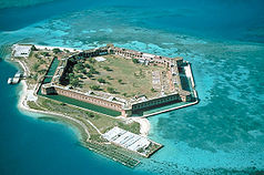

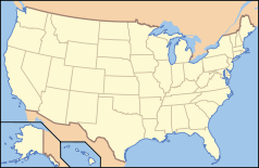
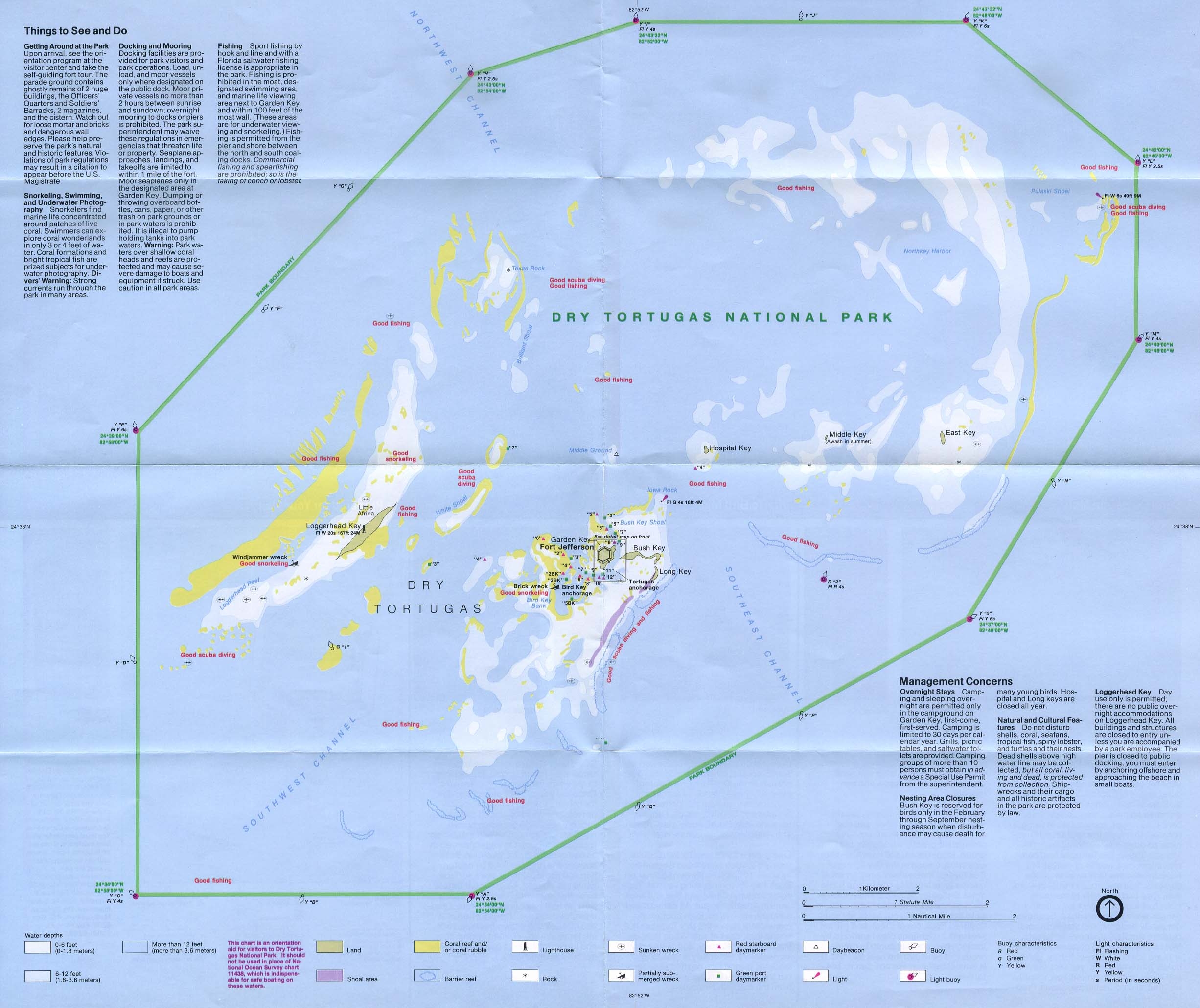
Lage: Florida, USA Nächste Stadt: Key West Fläche: 261,83 km² km² Gründung: 4. Januar 1935 Besucher: 61.765 (2005) Karte des Nationalparks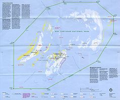
Der Dry-Tortugas-Nationalpark ist ein US-Nationalpark im Golf von Mexiko, am Ende der Inselkette Florida Keys, 70 Meilen (113 km) westlich von Key West.
Der Park liegt auf einer Fläche von 262 km² um sieben winzige Sand- und Korallen-Inseln, die Dry Tortugas genannt werden und ist berühmt für ein reichhaltiges Leben unter Wasser (marines Ökosystem), farbige Korallenriffe und Legenden um Schiffswracks und versunkene Schätze. Über 99 Prozent des Nationalparks liegt unter Wasser.
Auf einer der Inseln liegt Fort Jefferson, ein Fort aus der Mitte des 19. Jahrhunderts, das nie als Verteidigungsstellung genutzt wurde. Die US-Army nutzte es bis 1874 als Gefängnis.
Aufgrund seiner Abgeschiedenheit liegt im Dry-Tortugas-Nationalpark eines der unberührtesten Korallenriffe Nordamerikas mit 442 Arten von Fischen. Seeschwalben, Fregattvögel und Meeresschildkröten haben hier ihre Nistplätze.
Bereits 1908 wurde die Region zum Tierschutzgebiet (wildlife refuge) erklärt. 1935 wurde das Fort als National Monument unter Schutz gestellt. Seit 1992 sind die Dry Tortugas ein Nationalpark.
Als letzter Ruheplatz zahlreicher Schiffe stellen die Korallenriffe auch eine bedeutende kulturelle Ressource dar. Aufgrund ihrer Lage am Rande der seit der frühen Kolonialzeit intensiv als Schifffahrtsstraße genutzten Floridastraße und durch die lang andauernden Bauarbeiten für Fort Jefferson sind zahlreiche Schiffe den Riffen der Dry Tortugas zum Opfer gefallen. Nachdem erste Untersuchungen bereits in den 1970er Jahren begonnen wurden, erfolgte eine systematische Aufnahme ab 1993 durch die Submerged Cultural Resources Unit des amerikanischen National Park Service. Etwa 250 Schiffsverluste im Bereich der Dry Tortugas wurden bisher durch archivalische und sonstige Quellen festgestellt. Bei einer systematischen Erfassung und Vermessung vor Ort mit Hilfe von GIS konnten zahlreiche Wracks, Wrackteile und sonstige mit Schiffbrüchen und Bergungsaktivitäten zusammenhängende Artefakte und Spuren unter Wasser dokumentiert werden.
Weblinks
- National Park Service: Dry-Tortugas-Nationalpark (offizielle Seite) (englisch)
- Dry Tortugas Ferry Boat

Acadia | Arches | Amerikanisch-Samoa | Badlands | Big Bend | Biscayne | Black Canyon of the Gunnison | Bryce Canyon | Canyonlands | Capitol Reef | Carlsbad Caverns | Channel Islands | Congaree | Crater Lake | Cuyahoga Valley | Death Valley | Denali | Dry Tortugas | Everglades | Gates of the Arctic | Glacier | Glacier Bay | Grand Canyon | Grand Teton | Great Basin | Great Sand Dunes | Great Smoky Mountains | Guadalupe Mountains | Haleakalā | Hawaii Volcanoes | Hot Springs | Isle Royale | Joshua Tree | Katmai | Kenai Fjords | Kings Canyon | Kobuk Valley | Lake Clark | Lassen Volcanic | Mammoth Cave | Mesa Verde | Mount Rainier | North Cascades | Olympic | Petrified Forest | Redwood | Rocky Mountain | Saguaro | Sequoia | Shenandoah | Theodore Roosevelt | Virgin Islands | Voyageurs | Wind Cave | Wrangell-St. Elias | Yellowstone | Yosemite | Zion
24.628611111111-82.873333333333Koordinaten: 24° 37′ 43″ N, 82° 52′ 24″ W


Wikimedia Foundation.