- Lee County (Florida)
-
Verwaltung US-Bundesstaat: Florida Verwaltungssitz: Fort Myers Adresse des
Verwaltungssitzes:Lee County Government
P. O. Box 398
Fort Myers, Florida 33902Gründung: 13. Mai 1887 Gebildet aus: Monroe County Vorwahl: 001 239 Demographie Einwohner: 544.758 (2005) Bevölkerungsdichte: 263,9 Einwohner/km² Geographie Fläche gesamt: 3.139 km² Wasserfläche: 1.075 km² Karte 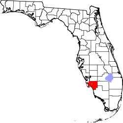
Website: www.lee-county.com Das Lee County[2] ist ein County im Südwesten des US-Bundesstaat Florida der Vereinigten Staaten von Amerika. Der Verwaltungssitz (County Seat) ist Fort Myers.
Inhaltsverzeichnis
Geschichte
Das Lee County wurde am 13. Mai 1887 gebildet und nach Robert E. Lee, einem General der amerikanischen Bürgerkriegs, benannt. Im August 2004 wurden Fort Myers und die im Nordwesten vorgelagerten Inseln Fort Myers Beach, Sanibel Island und Captiva Island von dem "Wirbelsturm Charley" schwer in Mitleidenschaft gezogen.
Geografie
Das County hat eine Fläche von 3.139 Quadratkilometern, wovon 1.057 Quadratkilometer Wasserfläche sind. Es grenzt im Uhrzeigersinn an folgende Countys: Hendry County, Collier County und Charlotte County.
Demografische Daten
Historische Einwohnerzahlen Census Einwohner ± in % 1890 1414 — 1900 3071 100 % 1910 6294 100 % 1920 9540 50 % 1930 14.990 60 % 1940 17.488 20 % 1950 23.404 30 % 1960 54.539 100 % 1970 105.216 90 % 1980 205.266 100 % 1990 335.113 60 % 2000 544.758 60 % Vor 1900[3] 1900–1990[4]
Nach der Volkszählung im Jahr 2000 lebten im Lee County 440.888 Menschen in 188.599 Haushalten und 127.681 Familien. Die Bevölkerungsdichte betrug 212 Einwohner pro Quadratkilometer. Ethnisch betrachtet setzte sich die Bevölkerung zusammen aus 87,69 Prozent Weißen, 6,59 Prozent Afroamerikanern, 0,28 Prozent amerikanischen Ureinwohnern, 0,77 Prozent Asiaten, 0,05 Prozent Bewohnern aus dem pazifischen Inselraum und 3,07 Prozent aus anderen ethnischen Gruppen; 1,55 Prozent stammten von zwei oder mehr Ethnien ab. 9,54 Prozent der Gesamtbevölkerung waren spanischer oder lateinamerikanischer Abstammung.
 Alterspyramide für das Lee County
Von den 188.599 Haushalten hatten 22,4 Prozent Kinder und Jugendliche unter 19 Jahre, die bei ihnen lebten. 55,5 Prozent waren verheiratete, zusammenlebende Paare, 8,7 Prozent waren allein erziehende Mütter und 32,3 Prozent waren keine Familien. 25,8 Prozent waren Singlehaushalte und in 13,1 Prozent lebten Menschen im Alter von 65 Jahren oder darüber. Die Durchschnittshaushaltsgröße betrug 2,31 und die durchschnittliche Familiengröße betrug 2,73 Personen.
19,6 Prozent der Bevölkerung waren unter 18 Jahre alt, 6,2 Prozent zwischen 18 und 24, 24,0 Prozent zwischen 25 und 44, 24,8 Prozent zwischen 45 und 64 und 25,4 Prozent der Bevölkerung war 65 Jahre oder älter. Das Durchschnittsalter betrug 45 Jahre. Auf 100 weibliche Personen kamen statistisch 95,6 männliche Personen und auf 100 Frauen im Alter von 18 Jahren oder darüber kamen 93,1 Männer.
Das jährliche Durchschnittseinkommen eines Haushalts betrug 40.319 USD, das Durchschnittseinkommen der Familien 46.430 USD. Männer hatten ein Durchschnittseinkommen von 31.247 USD, Frauen 24.380 USD. Das Prokopfeinkommen betrug 24.542 USD. 6,7 Prozent der Familien und 9,7 Prozent der Bevölkerung lebten unterhalb der Armutsgrenze. [5]
Weiterführende Bildungseinrichtungen
- Edison College in Fort Myers
- Florida Gulf Coast University in Fort Myers
- International College in Fort Myers
- Southwest Florida College in Fort Myers
Zum County gehörende Inseln
- Pine Island
- Matlacha Island
- Sanibel Island
- Captiva Island
- North Captiva Island
- Useppa Island
- Cabbage Cay
- Estero Island
- Lover's Key
Flughäfen
Städte und Gemeinden
- Alva
- Boca Grande
- Bokeelia
- Bonita Springs
- Cape Coral
- Captiva
- Estero
- Fort Myers Beach
- Fort Myers
- Lehigh Acres
- Matlacha
- Pine Island
- Pineland
- Sanibel Island
- Sanibel
- Tice
Einzelnachweise
- ↑ Auszug aus dem National Register of Historic Places. Abgerufen am 13. März 2011
- ↑ GNIS-ID: 295758. Abgerufen am 22. Februar 2011 (englisch).
- ↑ U.S. Census Bureau - Census of Population and Housing. Abgerufen am 15. März 2011
- ↑ Auszug aus Census.gov. Abgerufen am 14. Februar 2011
- ↑ Lee County, Florida, Datenblatt mit den Ergebnissen der Volkszählung im Jahre 2000 bei factfinder.census.gov.
Weblinks
 Commons: Lee County, Florida – Sammlung von Bildern, Videos und Audiodateien
Liste der Countys in Florida
Alachua | Baker | Bay | Bradford | Brevard | Broward | Calhoun | Charlotte | Citrus | Clay | Collier | Columbia | De Soto | Dixie | Duval | Escambia | Flagler | Franklin | Gadsden | Gilchrist | Glades | Gulf | Hamilton | Hardee | Hendry | Hernando | Highlands | Hillsborough | Holmes | Indian River | Jackson | Jefferson | Lafayette | Lake | Lee | Leon | Levy | Liberty | Madison | Manatee | Marion | Martin | Miami-Dade | Monroe | Nassau | Okaloosa | Okeechobee | Orange | Osceola | Palm Beach | Pasco | Pinellas | Polk | Putnam | Santa Rosa | Sarasota | Seminole | St. Johns | St. Lucie | Sumter | Suwannee | Taylor | Union | Volusia | Wakulla | Walton | Washington
Wikimedia Foundation.
Schlagen Sie auch in anderen Wörterbüchern nach:
County Road 869 (Lee County, Florida) — Infobox road marker state=FL County highway name=County Road 869 name notes= type= route= alternate name= maint= length mi=11.6 length round= length ref= length notes= established= decommissioned= direction a=South starting terminus=CR 867 in… … Wikipedia
Lee County, Florida — Infobox U.S. County county = Lee County state = Florida founded = 12 May 1887 seat = Fort Myers | area total sq mi =1212 area land sq mi =804 area water sq mi =408 area percentage = 33.69% census yr = 2000 pop = 440888 density km2 =212 web = http … Wikipedia
County Road 865 (Lee County, Florida) — Lee County Road 865 is a major route located in Southwest Florida. CR 865 exists in three separate sections. Each of these three sections were all originally part of the continuous State Road 865, but were transferred to county control by the… … Wikipedia
Lee County, Florida Sheriff's Office — The Lee County Sheriff s Office is located in Fort Myers, Florida. Founded in 1887, the Office of the Sheriff has a duty to enforce both the Florida State Constitution and Florida State Statutes, and to provide for the security, safety and well… … Wikipedia
County Road 876 (Lee County, Florida) — Infobox road marker state=FL County highway name=County Road 876 name notes= type= route= alternate name= maint=Lee County Department of Transportation length mi=14.4 length round= length ref= length notes= established= decommissioned= direction… … Wikipedia
National Register of Historic Places listings in Lee County, Florida — Location of Lee County in Florida This is a list of the National Register of Historic Places listings in Lee County, Florida. This is intended to be a complete list of the properties and districts on the National Register of Historic Places in… … Wikipedia
School District of Lee County (Florida) — The School District of Lee County manages public education in Lee County, Florida. The current superintendent is Dr. James Browder. As of April 3rd, 2008, there are 78,803 studentsin the whole district. This years last day of school is on June… … Wikipedia
Pine Island (Lee County, Florida) — Pine Island is an island located in Lee County, Florida, on the Gulf coast of southwest Florida. The Intracoastal Waterway passes through Pine Island Sound, to the west of the island. Matlacha Pass runs between Pine Island and the mainland. Pine… … Wikipedia
County Road 867A (Lee County, Florida) — Infobox road marker state=FL County highway name=County Road 867A name notes= type= route= alternate name= maint= length mi=9.3 length round= length ref= length notes= established= decommissioned= direction a=South starting terminus= beltway city … Wikipedia
County Road 840 (Lee County, Florida) — Infobox road marker state=FL County highway name=County Road 840 name notes= type= route= alternate name= maint= length mi=11.5 length round= length ref= length notes= established= decommissioned= direction a=West starting terminus= beltway city … Wikipedia
Lee County (Florida)


18+
© Academic, 2000-2026
- Kontaktieren Sie uns: Unterstützung, Werbung
Wörterbücher Export, schritte mit PHP, Joomla, Drupal, WordPress, MODx.