- Monroe County (Mississippi)
-
Verwaltung US-Bundesstaat: Mississippi Verwaltungssitz: Aberdeen Adresse des
Verwaltungssitzes:County Courthouse
P.O. Box 578
Aberdeen, MS 39730-0578Gründung: 9. Februar 1821 Gebildet aus: Chickasaw Land Vorwahl: 001 662 Demographie Einwohner: 36.989 (2010) Bevölkerungsdichte: 18,7 Einwohner/km² Geographie Fläche gesamt: 2.000 km² Wasserfläche: 20 km² Karte 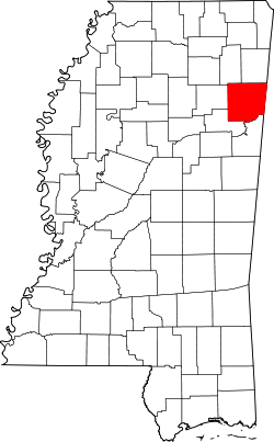
Website: www.monroecountyms.org Das Monroe County[1] ist ein County im Bundesstaat Mississippi in den Vereinigten Staaten von Amerika. Bei der Volkszählung im Jahr 2010 hatte das County 36.989 Einwohner und eine Bevölkerungsdichte von 18,7 Einwohnern pro Quadratkilometer. Der Verwaltungssitz (County Seat) ist Aberdeen, das nach der gleichnamigen Stadt in Schottland benannt wurde.
Inhaltsverzeichnis
Geografie
Das County liegt im Nordosten von Mississippi, grenzt im Osten an Alabama und hat eine Fläche von 2000 Quadratkilometern, wovon 20 Quadratkilometer Wasserfläche sind. Es grenzt an folgende Countys:
Lee County Itawamba County Chickasaw County 
Lamar County
(Alabama)Clay County Lowndes County Geschichte
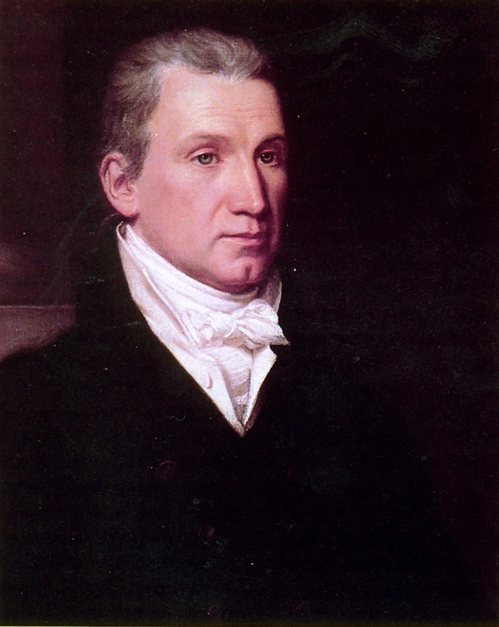
 J. Monroe
Das Monroe County wurde am 9. Februar 1821 aus Land der Chickasaw gebildet. Benannt wurde es nach James Monroe (1758-1831), dem fünften Präsidenten der USA.
Demografische Daten
Historische Einwohnerzahlen Census Einwohner ± in % 1820 2721 — 1830 3861 40 % 1840 9250 100 % 1850 21.172 100 % 1860 21.283 0,5 % 1870 22.631 6 % 1880 28.553 30 % 1890 30.730 8 % 1900 31.216 2 % 1910 35.178 10 % 1920 32.613 -7 % 1930 36.141 10 % 1940 37.648 4 % 1950 36.543 -3 % 1960 33.953 -7 % 1970 34.043 0,3 % 1980 36.404 7 % 1990 36.582 0,5 % 2000 38.014 4 % 2010 36.989 -3 % Vor 1900[2] 1900–1990[3] 2000[4] 2010[5] Nach der Volkszählung im Jahr 2000 lebten im Monroe County 38.014 Menschen in 14.603 Haushalten und 10.660 Familien. Die Bevölkerungsdichte betrug 19 Personen pro Quadratkilometer. Ethnisch betrachtet setzte sich die Bevölkerung zusammen aus 68,37 Prozent Weißen, 30,77 Prozent Afroamerikanern, 0,10 Prozent amerikanischen Ureinwohnern, 0,17 Prozent Asiaten, 0,01 Prozent Bewohnern aus dem pazifischen Inselraum und 0,11 Prozent aus anderen ethnischen Gruppen; 0,47 Prozent stammten von zwei oder mehr Ethnien ab. 0,69 Prozent der Bevölkerung waren spanischer oder lateinamerikanischer Abstammung, die verschiedenen der genannten Gruppen angehörten.
Von den 14.603 Haushalten hatten 34,7 Prozent Kinder unter 18 Jahren, die mit ihnen lebten. 52,0 Prozent waren verheiratete, zusammenlebende Paare, 17,2 Prozent waren allein erziehende Mütter und 27,0 Prozent waren keine Familien. 24,7 Prozent aller Haushalte waren Singlehaushalte und in 11,8 Prozent lebten Menschen im Alter von 65 Jahren oder darüber. Die durchschnittliche Haushaltsgröße lag bei 2,57 und die durchschnittliche Familiengröße bei 3,07 Personen.
27,2 Prozent der Bevölkerung war unter 18 Jahre alt, 8,7 Prozent zwischen 18 und 24, 27,6 Prozent zwischen 25 und 44, 22,5 Prozent zwischen 45 und 64 Jahre alt und 14,0 Prozent waren 65 Jahre oder älter. Das Durchschnittsalter betrug 36 Jahre. Auf 100 weibliche kamen statistisch 89,7 männliche Personen und auf 100 Frauen im Alter von 18 Jahren oder darüber kamen 84,7 Männer.
Das durchschnittliche Einkommen eines Haushaltes betrug 30.307 USD, das einer Familie 36.749 USD. Männer hatten ein durchschnittliches Einkommen von 30.232 USD, Frauen 20.411 USD. Das Pro-Kopf-Einkommen lag bei 14.072 USD. Etwa 13,6 Prozent der Familien und 17,2 Prozent der Bevölkerung lebten unterhalb der Armutsgrenze.[6]
Städte und Gemeinden
- Aberdeen
- Amory
- Caledonia1
- Hatley
- Nettleton2
- Smithville
- Gattman
1 - teilweise im Lowndes County
2 - teilweise im Lee County- Athens
- Becker
- Bigbee
- Binford
- Bristow
- Central Grove
- Darracott
- Flinn
- Gibson
- Greenwood Springs
- Hamilton
- Lackey
- Mormon Springs
- Muldon
- Parham
- Prairie
- Quincy
- Riggins
- Sipsey Fork
- Splunge
- Strong
- Tranquil
- Westville
- Wise Gap
- Wren
Einzelnachweise
- ↑ GNIS-ID: 695771. Abgerufen am 22. Februar 2011 (englisch).
- ↑ U.S. Census Bureau _ Census of Population and Housing Abgerufen am 19. Februar 2011
- ↑ Auszug aus Census.gov Abgerufen am 19. Februar 2011
- ↑ Auszug aus factfinder.census.gov Abgerufen am 18. Februar 2011
- ↑ United States Census 2010 Abgerufen am 22. Juni 2011
- ↑ Monroe County, Mississippi Datenblatt mit den Ergebnissen der Volkszählung im Jahre 2000 bei factfinder.census.gov
Weblinks
-
 Commons: Monroe County, Mississippi – Sammlung von Bildern, Videos und Audiodateien
 - Offizielle Webseite
- Handelskammer des Monroe County
- Local Governments - Monroe County
- www.city-data.com

Liste der Countys in Mississippi
Adams | Alcorn | Amite | Attala | Benton | Bolivar | Calhoun | Carroll | Chickasaw | Choctaw | Claiborne | Clarke | Clay | Coahoma | Copiah | Covington | DeSoto | Forrest | Franklin | George | Greene | Grenada | Hancock | Harrison | Hinds | Holmes | Humphreys | Issaquena | Itawamba | Jackson | Jasper | Jefferson | Jefferson Davis | Jones | Kemper | Lafayette | Lamar | Lauderdale | Lawrence | Leake | Lee | Leflore | Lincoln | Lowndes | Madison | Marion | Marshall | Monroe | Montgomery | Neshoba | Newton | Noxubee | Oktibbeha | Panola | Pearl River | Perry | Pike | Pontotoc | Prentiss | Quitman | Rankin | Scott | Sharkey | Simpson | Smith | Stone | Sunflower | Tallahatchie | Tate | Tippah | Tishomingo | Tunica | Union | Walthall | Warren | Washington | Wayne | Webster | Wilkinson | Winston | Yalobusha | Yazoo
Wikimedia Foundation.
Schlagen Sie auch in anderen Wörterbüchern nach:
Monroe County, Mississippi — Location in the state of Mississippi … Wikipedia
National Register of Historic Places listings in Monroe County, Mississippi — Location of Monroe County in Mississippi This is a list of the National Register of Historic Places listings in Monroe County, Mississippi. This is intended to be a complete list of the properties and districts on the National Register of… … Wikipedia
Monroe County — is the name of seventeen counties in the United States, named after James Monroe, fifth President of the United States: Monroe County, Alabama Monroe County, Arkansas Monroe County, Florida Monroe County, Georgia Monroe County, Illinois Monroe… … Wikipedia
Monroe County Jail — may refer to: Monroe County Jail (Clarendon, Arkansas), listed on the National Register of Historic Places in Monroe County, Arkansas Monroe County Jail (Athens, Mississippi), listed on the National Register of Historic Places in Monroe County,… … Wikipedia
Monroe County School District (Mississippi) — The Monroe County School District is a public school district based in Monroe County, Mississippi (USA). The district serves the communities of Smithville, Hatley, Gattman, and Hamilton as well as a small portion of Amory. Contents 1 Schools 1.1… … Wikipedia
Monroe County — Es gibt in den Vereinigten Staaten 17 Countys mit dem Namen Monroe County: Monroe County (Alabama) Monroe County (Arkansas) Monroe County (Florida) Monroe County (Georgia) Monroe County (Illinois) Monroe County (Indiana) Monroe County (Iowa)… … Deutsch Wikipedia
Monroe County, Illinois — Location in the state of Illinois … Wikipedia
Monroe County, Missouri — Location in the state of Missouri … Wikipedia
Monroe County Courthouse — may refer to: in the United States (by state) Old Monroe County Courthouse in Monroeville, Alabama, listed on the NRHP in Alabama Monroe County Courthouse (Clarendon, Arkansas), Clarendon, AR, listed on the NRHP in Arkansas Monroe County… … Wikipedia
Monroe County, Arkansas — Location in the state of Arkansas … Wikipedia
Monroe County (Mississippi)


18+
© Academic, 2000-2026
- Kontaktieren Sie uns: Unterstützung, Werbung
Wörterbücher Export, schritte mit PHP, Joomla, Drupal, WordPress, MODx.