- Vikartovce
-
Vikartovce
Wappen Karte 
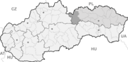

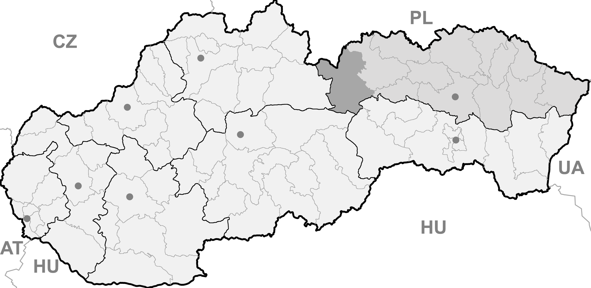
Vikartovce BasisdatenKraj: Prešovský kraj Okres: Poprad Region: Tatry Fläche: 50,274 km² Einwohner: 1.843 (31. Dez. 2010) Bevölkerungsdichte: 36,66 Einwohner je km² Höhe: 756 m n.m. Postleitzahl: 059 19 Telefonvorwahl: 0 52 Geographische Lage: 49° 0′ N, 20° 9′ O48.99444444444420.155756Koordinaten: 48° 59′ 40″ N, 20° 9′ 18″ O Kfz-Kennzeichen: PP Gemeindekennziffer: 524034 StrukturGemeindeart: Gemeinde Verwaltung (Stand: Juni 2011)Bürgermeister: Vladimír Šavel Adresse: Obecný úrad Vikartovce
159
059 19 VikartovceWebpräsenz: www.vikartovce.sk Gemeindeinformation
auf portal.gov.skStatistikinformation
auf statistics.skVikartovce (deutsch Weigsdorf oder Weichselsdorf, ungarisch Hernádfő - bis 1907 Vikartóc) ist eine Gemeinde im Osten der Slowakei, mit 1843 Einwohnern (Stand 31. Dezember 2010). Sie ist ein Teil des Okres Poprad, der zum Bezirk Prešovský kraj gehört.
Geographie
Die zur traditionellen Landschaft Zips gehörende Gemeinde liegt im oberen Tal des Hornád, nur einige Kilometer von der Quelle entfernt. Nördlich von Vikartovce befindet sich der Gebirgszug Kozie chrbty, mit ihrer höchsten Erhebung, den Kozí kameň (1.255 m n.m. oberhalb der Gemeinde, während südlich liegt das Vorgebirge und Hauptkamm der Niederen Tatra. Nordwestlich des Ortszentrums treffen sich Einzugsgebiete drei großer Flüsse Mitteleuropas: der Donau, der Theiß und der Weichsel. Vikartovce ist 17 Kilometer von Poprad entfernt.
Geschichte
Der Ort wurde zum ersten Mal 1283 als Villa Wykardi schriftlich erwähnt und gehörte dem Kloster Spišský Štiavnik. Da sie im 15. Jahrhundert völlig entvölkert war, siedelte man walachische Siedler an. Neben der Schaf- und Viehzucht, beschäftigte sich die Bevölkerung mit Land-, Forstwirtschaft und Weberei. Bis heute ist der Ort mehrheitlich landwirtschaftlich geprägt. 1828 hatte der Ort 183 Häuser und 1.329 Einwohner.
Nach dem Zweiten Weltkrieg zogen viele Einwohner aus, um die umliegenden Orte anstatt der Deutschen, die kurz zuvor vertrieben wurden, anzusiedeln.
Gemeinden im Okres PopradBatizovce (Botzdorf) | Gánovce (Gansdorf) | Gerlachov (Gerlsdorf) | Hozelec (Hohesalz) | Hôrka (Horke) | Hranovnica (Grenitz) | Jánovce (Johannsdorf) | Kravany (Kuhschwanz) | Liptovská Teplička (Zeplitschke) | Lučivná (Lautschburg) | Mengusovce (Mengsdorf) | Mlynica (Mühlenbach) | Nová Lesná (Neuwalddorf) | Poprad (Deutschendorf) | Spišská Teplica (Teplitz) | Spišské Bystré (Kuhbach) | Spišský Štiavnik (Schawnig) | Svit | Štôla (Stollen) | Štrba (Tschirm) | Šuňava (Schönau) | Švábovce (Schwabsdorf) | Tatranská Javorina (Uhrngarten) | Veľký Slavkov (Großschlagendorf) | Vernár (Wernsdorf) | Vikartovce (Weigsdorf) | Vydrník (Wiedrig) | Vysoké Tatry | Ždiar (Morgenröthe)
Wikimedia Foundation.
Schlagen Sie auch in anderen Wörterbüchern nach:
Vikartovce — (Village) Administration Pays Slovaquie … Wikipédia en Français
Vikartovce — ( hu. Hernádfő, de. Weigsdorf) is a village and large municipality in Poprad District in the Prešov Region of northern Slovakia.HistoryIn historical records the village was first mentioned in 1283.GeographyThe municipality lies at an altitude of… … Wikipedia
Mlynica — Wappen Karte … Deutsch Wikipedia
Hornád — Lac du barrage Ružín Caractéristiques Longueur 286 km Bassin 5 436 km2 Bassin collecteur … Wikipédia en Français
Poprad — For the river in Slovakia and Poland, see Poprad (river). For the airport, see Poprad Tatry Airport. Coordinates: 49°03′34″N 20°17′51″E / 49.05944°N 20.2975°E … Wikipedia
Prešov Region — Geobox | Region name = Prešov category = Region image caption = image caption = symbol = symbol type = etymology = official name = motto = nickname = country = Slovakia country state = region = district = commune = municipality = border = part… … Wikipedia
Vysoké Tatry (town) — Coordinates: 49°08′51″N 20°13′39″E / 49.1475°N 20.2275°E / 49.1475; 20.2275 … Wikipedia
Poprad District — District Country Slovakia Region (k … Wikipedia
Jánovce — Location of Jánovce within Slovakia. Jánovce (Hungarian: Szepesjánosfalva, German: Johannsdorf) is a village and municipality in Poprad District in the Prešov Region of northern Slovakia … Wikipedia
List of municipalities and towns in Slovakia — Slovakia This is a comprehensive list of municipalities and towns in Slovakia. For lists of towns and municipalities sorted by Regions see the individual articles on Regions. For an outdated list of towns only in Slovakia see also List of towns… … Wikipedia
Vikartovce

18+
© Academic, 2000-2026
- Kontaktieren Sie uns: Unterstützung, Werbung
Wörterbücher Export, schritte mit PHP, Joomla, Drupal, WordPress, MODx.