- Hachinohe
-
Hachinohe-shi
八戸市
Geographische Lage in Japan Region: Tōhoku Präfektur: Aomori Koordinaten: 40° 31′ N, 141° 29′ O40.512222222222141.48833333333Koordinaten: 40° 30′ 44″ N, 141° 29′ 18″ O Basisdaten Fläche: 305,19 km² Einwohner: 236.535
(1. Oktober 2011)Bevölkerungsdichte: 775 Einwohner je km² Gemeindeschlüssel: 02203-9 Symbole Flagge/Wappen: Baum: Japanische Eibe Blume: Garten-Chrysantheme Vogel: Japanmöwe Rathaus Adresse: Hachinohe City Hall
1-1-1, Uchimaru
Hachinohe-shi
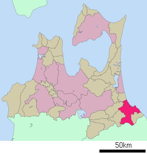
Aomori 031-8686Webadresse: http://www.city.hachinohe.aomori.jp Lage Hachinohes in der Präfektur Aomori 
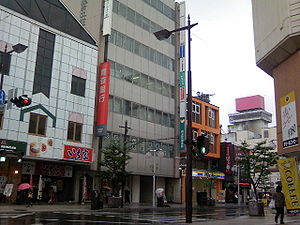
Hachinohe (jap. 八戸市, -shi) ist eine Hafenstadt in der Präfektur Aomori im Nordosten von Honshū, der Hauptinsel Japans. Die Stadt zählt über 243.000 Einwohner, neben der Fischerei spielt Textilindustrie und Holzverarbeitung eine wirtschaftliche Rolle.
Inhaltsverzeichnis
Geographie
Hachinohe liegt südöstlich von Aomori und nördlich von Morioka am Pazifischen Ozean.
Geschichte
Die Stadt besteht seit dem 1. Mai 1929.
Am 11. März 2011 war Hachinohe vom größten bisher in Japan registrierten Erdbeben, dem Tōhoku-Erdbeben und nachfolgendem Tsunami heimgesucht. Im Hafen Hachinohe entstand beträchtlicher Schaden, große und kleine Fischerboote wurden umgeworfen und fortgeschwemmt, die Straßen im Hafenviertel wurden überschwemmt. Der Hafen wurde vom ausgeflossenen Öl schwarz gefärbt, das Stadtbild veränderte sich. Die Evakuierung dauerte bis in den nächsten Tag. Ein Todesopfer wurde gemeldet, zwei weitere Personen gelten als vermisst, alle in den 60er Lebensjahren. 210 Gebäude wurden beschädigt und 915 weitere überschwemmt, 100 Autos fortgeschwemmt.[1].
Verkehr
- Zug
- Straße:
- Hachinohe-Autobahn
- Nationalstraße 45,104,340,454
Städtepartnerschaften
 Federal Way, seit 1993
Söhne und Töchter der Stadt
- Yūto Hara (* 1986), Eishockeyspieler
- Michio Hashimoto (* 1977), Eishockeyspieler
- Chiharu Ichō (* 1981), Ringerin
- Kaori Ichō (* 1984), Ringerin
- Tetsuo Miura (1931–2010), Schriftsteller
- Tadamori Ōshima (* 1946), Politiker
Einzelnachweise
- ↑ 大津波で3人死亡, Drei Tote in Aomori, Yomiuri Shimbun (japanisch)
Weblinks
Kreisfreie Städte (shi): Aomori (Verwaltungssitz) | Goshogawara | Hachinohe | Hirakawa | Hirosaki | Kuroishi | Misawa | Mutsu | Towada | Tsugaru
Higashitsugaru-gun: Hiranai | Imabetsu | Sotogahama | Yomogita | Kamikita-gun: Noheji | Oirase | Rokkasho | Rokunohe | Shichinohe | Tōhoku | Yokohama | Kitatsugaru-gun: Itayanagi | Nakadomari | Tsuruta | Minamitsugaru-gun: Fujisaki | Inakadate | Ōwani | Nakatsugaru-gun: Nishimeya | Nishitsugaru-gun: Ajigasawa | Fukaura | Sannohe-gun: Gonohe | Hashikami | Nambu | Sannohe | Shingō | Takko | Shimokita-gun: Higashidōri | Kazamaura | Ōma | Sai
Wikimedia Foundation.


