- Anthisnes
-
Anthisnes 

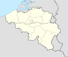
Staat Belgien Region Wallonien Provinz Lüttich Bezirk Huy Koordinaten 50° 29′ N, 5° 31′ O50.4797222222225.5233333333333Koordinaten: 50° 29′ N, 5° 31′ O Fläche 37,08 km² Einwohner (Stand) 4096 Einw. (1. Jan. 2010) Bevölkerungsdichte 110 Einw./km² Postleitzahl 4160 (Anthisnes)
4161 (Villers-aux-Tours)
4162 (Hody)
4163 (Tavier)Vorwahl 04 Bürgermeister Marc Tarabella Adresse der
StadtverwaltungRue de l'Hôtel de Ville 1
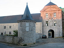
4160 AnthisnesWebseite www.anthisnes.be Anthisnes ist eine Gemeinde in der belgischen Provinz Lüttich. Sie besteht aus den Ortschaften Anthisnes, Hody, Villers-aux-Tours und Tavier.
Weblinks
- Website der Gemeinde (französisch)
Amay | Amel | Ans | Anthisnes | Aubel | Awans | Aywaille | Baelen | Bassenge | Berloz | Beyne-Heusay | Blegny | Braives | Büllingen | Burdinne | Burg-Reuland | Bütgenbach | Chaudfontaine | Clavier | Comblain-au-Pont | Crisnée | Dalhem | Dison | Donceel | Engis | Esneux | Eupen | Faimes | Ferrières | Fexhe-le-Haut-Clocher | Flémalle | Fléron | Geer | Grâce-Hollogne | Hamoir | Hannut | Héron | Herstal | Herve | Huy | Jalhay | Juprelle | Kelmis | Lüttich | Lierneux | Limbourg | Lincent | Lontzen | Malmedy | Marchin | Modave | Nandrin | Neupré | Olne | Oreye | Ouffet | Oupeye | Pepinster | Plombières | Raeren | Remicourt | Saint-Georges-sur-Meuse | Saint-Nicolas | Sankt Vith | Seraing | Soumagne | Spa | Sprimont | Stavelot | Stoumont | Theux | Thimister-Clermont | Tinlot | Trois-Ponts | Trooz | Verlaine | Verviers | Villers-le-Bouillet | Visé | Wanze | Waremme | Wasseiges | Weismes | Welkenraedt
Wikimedia Foundation.


