- Montgomery County (Pennsylvania)
-
Verwaltung US-Bundesstaat: Pennsylvania Verwaltungssitz: Norristown Adresse des
Verwaltungssitzes:County of Montgomery,
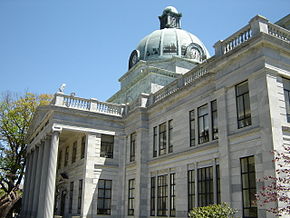
Pennsylvania Courthouse
P.O. Box 311Gründung: 10. September 1784 Gebildet aus: Philadelphia County Vorwahl: 001 610 Demographie Einwohner: 799.874 (2010) Bevölkerungsdichte: 639,4 Einwohner/km² Geographie Fläche gesamt: 1.262 km² Wasserfläche: 11 km² Karte Website: www2.montcopa.org Das Montgomery County[1] ist ein County im US-amerikanischen Bundesstaat Minnesota. Bei der Volkszählung im Jahr 2010 hatte das County 799.874 Einwohner und eine Bevölkerungsdichte von 639,4 Einwohnern pro Quadratkilometer. Der Verwaltungssitz (County Seat) ist Norristown.
Mit Keystone Foods ist einer der weltgrößten Nahrungsmittelproduzenten im County beheimatet.
Das Montgomery County ist Bestandteil der Metropolregion Delaware Valley.
Inhaltsverzeichnis
Geografie
Das County liegt im Südosten von Pennsylvania im nordwestlichen Vorortbereich der Stadt Philadelphia. Das Montgomery County hat eine Fläche von 1.262 Quadratkilometern, wovon 11 Quadratkilometer Wasserfläche sind. Es grenzt an folgende Countys:
Berks County Lehigh County Bucks County Chester County 
Delaware County Philadelphia Geschichte
Das Montgomery County wurde 10. September 1784 auf dem Gebiet des Philadelphia County gebildet. Benannt wurde es nach Richard Montgomery (1736-1775), einem General der Kontinentalarmee im Amerikanischen Unabhängigkeitskrieg.
Demografische Daten
Historische Einwohnerzahlen Census Einwohner ± in % 1790 22.918 — 1800 24.150 5 % 1810 29.703 20 % 1820 35.793 20 % 1830 39.406 10 % 1840 47.241 20 % 1850 58.291 20 % 1860 70.500 20 % 1870 81.612 20 % 1880 96.494 20 % 1890 123.290 30 % 1900 138.995 10 % 1910 169.590 20 % 1920 199.310 20 % 1930 265.804 30 % 1940 289.247 9 % 1950 353.068 20 % 1960 516.682 50 % 1970 623.799 20 % 1980 643.621 3 % 1990 678.111 5 % 2000 750.097 10 % 2010 799.874 7 % Vor 1900[2] 1900–1990[3] 2000[4] 2010[5] Nach der Volkszählung im Jahr 2010 lebten im Montgomery County 799.874 Menschen in 298.326 Haushalten. Die Bevölkerungsdichte betrug 639,4 Einwohner pro Quadratkilometer.
Ethnisch betrachtet setzte sich die Bevölkerung zusammen aus 81,1 Prozent Weißen, 8,7 Prozent Afroamerikanern, 0,1 Prozent amerikanischen Ureinwohnern, 6,4 Prozent Asiaten sowie aus anderen ethnischen Gruppen; 1,9 Prozent stammten von zwei oder mehr Ethnien ab. Unabhängig von der ethnischen Zugehörigkeit waren 4,3 Prozent der Bevölkerung spanischer oder lateinamerikanischer Abstammung.
In den 298.326 Haushalten lebten statistisch je 2,51 Personen.
22,7 Prozent der Bevölkerung waren unter 18 Jahre alt, 62,3 Prozent waren zwischen 19 und 64 und 15,0 Prozent waren 65 Jahre oder älter. 51,3 Prozent der Bevölkerung war weiblich.
Das jährliche Durchschnittseinkommen eines Haushalts betrug 74,819 USD. Das Pro - Kopf - Einkommen betrug 39.511 USD. 5,5 Prozent der Einwohner lebten unterhalb der Armutsgrenze.[6]
Städte und Gemeinden
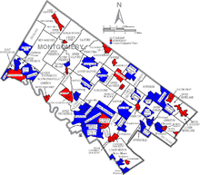
Die Kommunen und sonstigen Siedlungen im Montgomery County haben verschiedene Siedlungsformen. Bei Boroughs und bei für Pennsylvania typischen Home Rule Municipalities handelt es sich um selbstverwaltete Gemeinden. Siedlungen ohne Selbstverwaltung sind Census - designated places und Unincorporated Communities.
- Ambler
- Bridgeport
- Collegeville
- Conshohocken
- East Greenville
- Green Lane
- Hatboro
- Hatfield
- Jenkintown
- Lansdale
- Narberth
- North Wales
- Pennsburg
- Pottstown
- Red Hill
- Rockledge
- Royersford
- Schwenksville
- Souderton
- Telford1
- Trappe
- West Conshohocken
Home Rule Municipalities
- Bryn Athyn
- Cheltenham Township2
- Horsham Township2
- Norristown
- Plymouth Township2
- Whitemarsh Township2
Census-designated places (CDP)
- Flourtown
- Fort Washington
- Gilbertsville
- Glenside
- Halfway House
- Harleysville
- King of Prussia
- Kulpsville
- Lafayette Hill
- Maple Glen
- Montgomeryville
- Oreland
- Penn Wynne
- Plymouth Meeting
- Pottsgrove
- Sanatoga
- Skippack
- Spring House
- Spring Mount
- Stowe
- Trooper
- Willow Grove
- Wyncote
- Wyndmoor
- Bala Cynwyd
- Bethayres
- Dresher
- Elkins Park
- Gladwyne
- Melrose Park
- Merion
- Mont Clare
- Rosemont3
- Villanova3
- Wynnewood3
1 - teilweise im Bucks County
2 - trotz der Bezeichnung Township handelt es sich um Kommunen
3 - teilweise im Delaware CountyEinzelnachweise
- ↑ Montgomery County im Geographic Names Information System des United States Geological Survey Abgerufen am 22. Februar 2011
- ↑ U.S. Census Bureau _ Census of Population and Housing Abgerufen am 28. Februar 2011
- ↑ Auszug aus Census.gov Abgerufen am 28. Februar 2011
- ↑ Auszug aus factfinder.census.gov Abgerufen am 28. Februar 2011
- ↑ United States Census 2010 Abgerufen am 14. August 2011
- ↑ U.S. Census Buero, State & County QuickFacts - Montgomery County
Weblinks
-
 Commons: Montgomery County, Pennsylvania – Sammlung von Bildern, Videos und Audiodateien
 - Offizielle Webseite
- U.S. Census Buero, State & County QuickFacts - Montgomery County
- Yahoo Bildersuche - Montgomery County
- www.city-data.com - Montgomery County
40.21-75.37Koordinaten: 40° 13′ N, 75° 22′ WListe der Countys in Pennsylvania
Adams | Allegheny | Armstrong | Beaver | Bedford | Berks | Blair | Bradford | Bucks | Butler | Cambria | Cameron | Carbon | Centre | Chester | Clarion | Clearfield | Clinton | Columbia | Crawford | Cumberland | Dauphin | Delaware | Elk | Erie | Fayette | Forest | Franklin | Fulton | Greene | Huntingdon | Indiana | Jefferson | Juniata | Lackawanna | Lancaster | Lawrence | Lebanon | Lehigh | Luzerne | Lycoming | McKean | Mercer | Mifflin | Monroe | Montgomery | Montour | Northampton | Northumberland | Perry | Philadelphia | Pike | Potter | Schuylkill | Snyder | Somerset | Sullivan | Susquehanna | Tioga | Union | Venango | Warren | Washington | Wayne | Westmoreland | Wyoming | York
Wikimedia Foundation.
Schlagen Sie auch in anderen Wörterbüchern nach:
Montgomery County, Pennsylvania — Flag … Wikipedia
Montgomery Township, Montgomery County, Pennsylvania — For other Pennsylvania townships of the same name, see Montgomery Township, Pennsylvania. Coordinates: 40°15′03″N 75°15′05″W / 40.25083°N 75.25139°W … Wikipedia
National Register of Historic Places listings in Montgomery County, Pennsylvania — Location of Montgomery County in Pennsylvania This is a list of the National Register of Historic Places listings in Montgomery County, Pennsylvania. This is intended to be a complete list of the properties and districts on National Register of… … Wikipedia
Cheltenham Township, Montgomery County, Pennsylvania — Coordinates: 40°04′00″N 75°06′59″W / 40.0666667°N 75.11639°W / 40.0666667; 75.11639 … Wikipedia
Douglass Township, Montgomery County, Pennsylvania — For other Pennsylvania townships of the same name, see Douglass Township, Pennsylvania (disambiguation). Coordinates: 40°22′36″N 75°34′29″W / 40.37667°N 7 … Wikipedia
Marlborough Township, Montgomery County, Pennsylvania — Not to be confused with East Marlborough Township, Chester County, Pennsylvania or West Marlborough Township, Chester County, Pennsylvania. Coordinates: 40°23′00″N 75°25′59″W / … Wikipedia
New Hanover Township, Montgomery County, Pennsylvania — For other townships in Pennsylvania with similar names, see Hanover Township, Pennsylvania.. Coordinates: 40°19′31″N 75°32′53″W / 40.32528°N 75.54806°W … Wikipedia
Abington Township, Montgomery County, Pennsylvania — Geobox Township name = Abington Township native name = other name = other name1 = category = Township image size = image caption = flag size = symbol = symbol size = nickname = motto = country = United States state = Pennsylvania region =… … Wikipedia
Springfield Township, Montgomery County, Pennsylvania — Geobox Township name = Springfield Township native name = other name = other name1 = category = Township image size = image caption = flag size = symbol = symbol size = nickname = motto = country = United States state = Pennsylvania region =… … Wikipedia
Moreland Township, Montgomery County, Pennsylvania — For other townships in Pennsylvania with similar names, see Moreland Township, Pennsylvania. Moreland Township, is a defunct township that was located in Montgomery County, Pennsylvania. It was founded in 1682 and named by William Penn after… … Wikipedia


