- Delaware County (Pennsylvania)
-
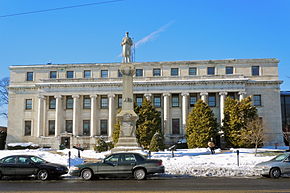
Verwaltung US-Bundesstaat: Pennsylvania Verwaltungssitz: Media Adresse des
Verwaltungssitzes:Delaware County Courthouse & Government Center,
201 West Front Street
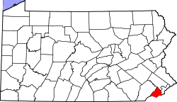
Media, PA 19063Gründung: 26. September 1789 Gebildet aus: Lancaster County Vorwahl: 001 610 Demographie Einwohner: 558.979 (2010) Bevölkerungsdichte: 1.171,9 Einwohner/km² Geographie Fläche gesamt: 494 km² Wasserfläche: 17 km² Karte Website: www.co.delaware.pa.us Das Delaware County[1] ist ein County im US-amerikanischen Bundesstaat Pennsylvania. Bei der Volkszählung im Jahr 2010 hatte das County 558.979 Einwohner und eine Bevölkerungsdichte von 1.171,9 Einwohnern pro Quadratkilometer. Der Verwaltungssitz (County Seat) ist Media.
Das Delaware County ist Bestandteil der Delaware Valley genannten Metropolregion um die Stadt Philadelphia.
Inhaltsverzeichnis
Geografie
Das County liegt im westlichen und südwestlichen Vorortbereich von Philadelphia am Delaware River, der die südöstliche Grenze des Countys zu New Jersey bildet. Im Süden wird das County durch den Delaware getrennt. Das Delaware County hat eine Fläche von 494 Quadratkilometern, wovon 17 Quadratkilometer Wasserfläche sind. Es grenzt an folgende Countys:
Montgomery County Chester County 
Philadelphia New Castle County
(Delaware)Gloucester County
(New Jersey)Geschichte
Das Delaware County wurde am 26. September 1789 auf dem Territorium eines Teils des Chester Cunty gebildet. Der Name stammt vom Delaware River, der wiederum nach Thomas West, 3. Baron De La Warr, dem zweiten Gouverneur der damaligen englischen Kolonie Virginia, benannt worden ist.
Demografische Daten
Historische Einwohnerzahlen Census Einwohner ± in % 1790 9469 — 1800 12.809 40 % 1810 14.734 20 % 1820 14.810 0,5 % 1830 17.323 20 % 1840 19.791 10 % 1850 24.679 20 % 1860 30.597 20 % 1870 39.403 30 % 1880 56.101 40 % 1890 74.683 30 % 1900 94.762 30 % 1910 117.906 20 % 1920 173.084 50 % 1930 280.264 60 % 1940 310.756 10 % 1950 414.234 30 % 1960 553.154 30 % 1970 600.035 8 % 1980 555.007 -8 % 1990 547.651 -1 % 2000 550.864 0,6 % 2010 558.979 1 % Vor 1900[2] 1900–1990[3] 2000[4] 2010[5] Nach der Volkszählung im Jahr 2010 lebten im Delaware County 558.979 Menschen in 204.481 Haushalten. Die Bevölkerungsdichte betrug 1.171,9 Einwohner pro Quadratkilometer.
Ethnisch betrachtet setzte sich die Bevölkerung zusammen aus 72,5 Prozent Weißen, 19,7 Prozent Afroamerikanern, 0,2 Prozent amerikanischen Ureinwohnern, 4,7 Prozent Asiaten sowie aus anderen ethnischen Gruppen; 2,0 Prozent stammten von zwei oder mehr Ethnien ab. 3,0 Prozent der Bevölkerung waren spanischer oder lateinamerikanischer Abstammung, die verschiedenen der genannten Gruppen angehörten.
In den 204.481 Haushalten lebten statistisch je 2,60 Personen.
23,2 Prozent der Bevölkerung waren unter 18 Jahre alt, 62,5 Prozent waren zwischen 19 und 64 und 14,3 Prozent waren 65 Jahre oder älter. 51,8 Prozent der Bevölkerung war weiblich.
Das jährliche Durchschnittseinkommen eines Haushalts betrug 61.848 USD. Das Pro - Kopf - Einkommen betrug 31.819 USD. 9,3 Prozent der Einwohner lebten unterhalb der Armutsgrenze.[6]
Städte und Gemeinden
Die Kommunen und sonstigen Siedlungen im Delaware County haben verschiedene Siedlungsformen. Bei Citys, Boroughs und bei für Pennsylvania typischen Home Rule Municipalities handelt es sich um selbstverwaltete Gemeinden. Siedlungen ohne Selbstverwaltung sind Census - designated places und Unincorporated Communities.
- Aldan
- Brookhaven
- Chester Heights
- Clifton Heights
- Collingdale
- Colwyn
- Darby
- East Lansdowne
- Eddystone
- Folcroft
- Glenolden
- Lansdowne
- Marcus Hook
- Media
- Millbourne
- Morton
- Norwood
- Parkside
- Prospect Park
- Ridley Park
- Rose Valley
- Rutledge
- Sharon Hill
- Swarthmore
- Trainer
- Upland
- Yeadon
Home Rule Municipality
Census-designated places (CDP)
- Folsom
- Lima
- Linwood
- Tinicum Township3
- Upper Providence Township3
- Woodlyn
- Garrett Hill
- Riddlewood
- Rosemont1
- Villanova1
- Wallingford
- Wawa
- Wayne4
1 - teilweise im Montgomery County
2 - trotz des Namensbestandteils Township handelt es sich um eine Home Rule Minicipality
3 - diese Siedlung ist Township und CDP zugleich
4 - teilweise im Chester und im Montgomery CountyEinzelnachweise
- ↑ Delaware County im Geographic Names Information System des United States Geological Survey Abgerufen am 22. Februar 2011
- ↑ U.S. Census Bureau _ Census of Population and Housing Abgerufen am 28. Februar 2011
- ↑ Auszug aus Census.gov Abgerufen am 28. Februar 2011
- ↑ Auszug aus factfinder.census.gov Abgerufen am 28. Februar 2011
- ↑ United States Census 2010 Abgerufen am 16. August 2011
- ↑ U.S. Census Buero, State & County QuickFacts - Delaware County Abgerufen am 16. August 2011
Weblinks
- Offizielle Webseite
- U.S. Census Buero, State & County QuickFacts - Delaware County
- Yahoo Bildersuche - Delaware County
- www.city-data.com - Delaware County
Liste der Countys in Pennsylvania
Adams | Allegheny | Armstrong | Beaver | Bedford | Berks | Blair | Bradford | Bucks | Butler | Cambria | Cameron | Carbon | Centre | Chester | Clarion | Clearfield | Clinton | Columbia | Crawford | Cumberland | Dauphin | Delaware | Elk | Erie | Fayette | Forest | Franklin | Fulton | Greene | Huntingdon | Indiana | Jefferson | Juniata | Lackawanna | Lancaster | Lawrence | Lebanon | Lehigh | Luzerne | Lycoming | McKean | Mercer | Mifflin | Monroe | Montgomery | Montour | Northampton | Northumberland | Perry | Philadelphia | Pike | Potter | Schuylkill | Snyder | Somerset | Sullivan | Susquehanna | Tioga | Union | Venango | Warren | Washington | Wayne | Westmoreland | Wyoming | York
Wikimedia Foundation.


