- Oyace
-
Oyace 
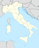

Staat: Italien Region: Aostatal Koordinaten: 45° 51′ N, 7° 23′ O45.857.3833333333333Koordinaten: 45° 51′ 0″ N, 7° 23′ 0″ O Fläche: 30 km² Einwohner: 225 (31. Dez. 2010)[1] Bevölkerungsdichte: 8 Einw./km² Postleitzahl: 11010 Vorwahl: 0165 ISTAT-Nummer: 007047 Website: http://www.comune.oyace.ao.it/ Oyace ist eine kleine italienische Gemeinde in der autonomen Region Aostatal.
Oyace hat 225 Einwohner (Stand 31. Dezember 2010) und liegt in einer Höhe von 1177 m ü. M. im Valpelline. Dies ist ein Seitental des Valle del Gran San Bernardo. Durch Oyace fließt der Le Buthier di Valpelline.
Die Nachbargemeinden sind Bionaz, Nus, Ollomont, Quart und Valpelline.
Während der Zeit des Faschismus trug das Dorf den italianisierten Namen Oiasse.
Einzelnachweise
- ↑ Statistiche demografiche ISTAT. Bevölkerungsstatistiken des Istituto Nazionale di Statistica vom 31. Dezember 2010.

Allein | Antey-Saint-André | Aosta | Arnad | Arvier | Avise | Ayas | Aymavilles | Bard | Bionaz | Brissogne | Brusson | Challand-Saint-Anselme | Challand-Saint-Victor | Chambave | Chamois | Champdepraz | Champorcher | Charvensod | Châtillon | Cogne | Courmayeur | Donnas | Doues | Emarèse | Étroubles | Fontainemore | Fénis | Gaby | Gignod | Gressan | Gressoney-La-Trinité | Gressoney-Saint-Jean | Hône | Introd | Issime | Issogne | Jovençan | La Magdeleine | La Salle | La Thuile | Lillianes | Montjovet | Morgex | Nus | Ollomont | Oyace | Perloz | Pollein | Pont-Saint-Martin | Pontboset | Pontey | Pré-Saint-Didier | Quart | Rhêmes-Notre-Dame | Rhêmes-Saint-Georges | Roisan | Saint-Christophe | Saint-Denis | Saint-Marcel | Saint-Nicolas | Saint-Oyen | Saint-Pierre | Saint-Rhémy-en-Bosses | Saint-Vincent | Sarre | Torgnon | Valgrisenche | Valpelline | Valsavarenche | Valtournenche | Verrayes | Verrès | Villeneuve


Wikimedia Foundation.