- Emarèse
-
Emarèse 

Staat: Italien Region: Aostatal Koordinaten: 45° 43′ N, 7° 42′ O45.7166666666677.71170Koordinaten: 45° 43′ 0″ N, 7° 42′ 0″ O Höhe: 1.170 m s.l.m. Fläche: 10 km² Einwohner: 223 (31. Dez. 2010)[1] Bevölkerungsdichte: 22 Einw./km² Postleitzahl: 11020 Vorwahl: 0166 ISTAT-Nummer: 007025 Demonym: emaresotti oder emaresots Website: http://www.comune.emarese.ao.it/ Emarèse ist eine italienische Gemeinde mit 223 Einwohnern (Stand 31. Dezember 2010) in der autonomen Region Aostatal. Die Gemeinde liegt auf einer mittleren Höhe von 1.170 m s.l.m. und verfügt über eine Größe von 10 km². Die Einwohner werden emaresotti oder emaresots genannt. Hône ist Mitglied des Gemeindeverbands Comunità Montana Monte Cervino.
Emarèse besteht aus den Ortsteilen (ital. Frazioni) Fontujllun, La Saléraz, Érésaz, Ravet, Chassan, Settarme, Sommarèse und Longeon. Die Nachbargemeinden sind Brusson, Challand-Saint-Anselme, Challand-Saint-Victor, Montjovet und Saint-Vincent.
Während der Zeit des Faschismus trug das Dorf den italianisierten Namen Emarese.
Einzelnachweise
- ↑ Statistiche demografiche ISTAT. Bevölkerungsstatistiken des Istituto Nazionale di Statistica vom 31. Dezember 2010.
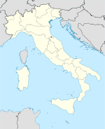
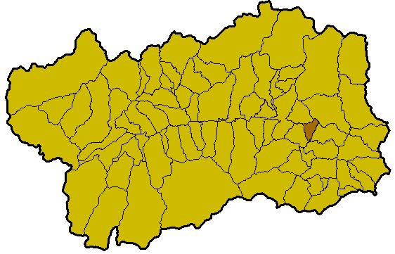
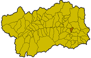 Lage von Emarèse innerhalb der Region Aostatal
 Gemeinden in der autonomen Region Aostatal
Allein | Antey-Saint-André | Aosta | Arnad | Arvier | Avise | Ayas | Aymavilles | Bard | Bionaz | Brissogne | Brusson | Challand-Saint-Anselme | Challand-Saint-Victor | Chambave | Chamois | Champdepraz | Champorcher | Charvensod | Châtillon | Cogne | Courmayeur | Donnas | Doues | Emarèse | Étroubles | Fontainemore | Fénis | Gaby | Gignod | Gressan | Gressoney-La-Trinité | Gressoney-Saint-Jean | Hône | Introd | Issime | Issogne | Jovençan | La Magdeleine | La Salle | La Thuile | Lillianes | Montjovet | Morgex | Nus | Ollomont | Oyace | Perloz | Pollein | Pont-Saint-Martin | Pontboset | Pontey | Pré-Saint-Didier | Quart | Rhêmes-Notre-Dame | Rhêmes-Saint-Georges | Roisan | Saint-Christophe | Saint-Denis | Saint-Marcel | Saint-Nicolas | Saint-Oyen | Saint-Pierre | Saint-Rhémy-en-Bosses | Saint-Vincent | Sarre | Torgnon | Valgrisenche | Valpelline | Valsavarenche | Valtournenche | Verrayes | Verrès | Villeneuve
Wikimedia Foundation.
Schlagen Sie auch in anderen Wörterbüchern nach:
Émarèse — Émarèse … Wikipédia en Français
Emarese — Émarèse Émarèse … Wikipédia en Français
Emarèse — Émarèse Émarèse … Wikipédia en Français
Emarèse — Saltar a navegación, búsqueda Emarèse Archivo:Emarèse Stemma.png Escudo … Wikipedia Español
Emarèse — Infobox CityIT official name = Comune di Emarèse img coa = Emarèse Stemma.png img coa small = image caption = region = RegioneIT|sigla=VAO province = none mayor = mayor party = elevation footnotes = elevation m = 1170 area footnotes = area total… … Wikipedia
Emarese — Original name in latin Emarse Name in other language Emarese, Emarse, marse State code IT Continent/City Europe/Rome longitude 45.72456 latitude 7.70181 altitude 1179 Population 202 Date 2012 02 15 … Cities with a population over 1000 database
Challand-Saint-Anselme — Pour l ancienne commune, voir Challant. Challand Saint Anselme … Wikipédia en Français
Montjovet — Montjovet … Wikipédia en Français
Эмарез — Коммуна Эмарез Émarèse Герб … Википедия
Brusson (Aostatal) — Brusson … Deutsch Wikipedia
Emarèse


18+
© Academic, 2000-2026
- Kontaktieren Sie uns: Unterstützung, Werbung
Wörterbücher Export, schritte mit PHP, Joomla, Drupal, WordPress, MODx.