- East Renfrewshire
-
East Renfrewshire
Siorrachd Rinn Friù an Ear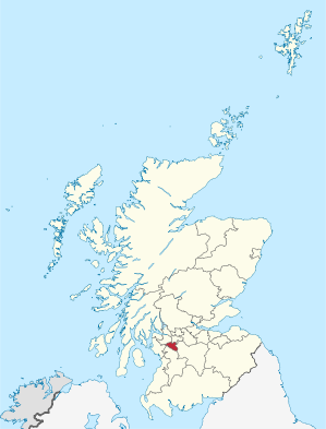
Verwaltungssitz Giffnock Fläche 174 km² (28.) Einwohner 89.540 (2010)[1] (24.) ISO 3166-2 GB-ERW ONS-Code 00QN Website www.eastrenfrewshire.gov.uk East Renfrewshire (gälisch Siorrachd Rinn Friù an Ear) ist eine von 32 Unitary Authorities in Schottland. Sie grenzt an North Ayrshire, East Ayrshire, Renfrewshire, South Lanarkshire und Glasgow. Von 1975 bis 1996 bildete East Renfrewshire (ohne Barrhead) unter dem Namen Eastwood einen District der Region Strathclyde.
Orte
- Barrhead
- Busby
- Clarkston
- Eaglesham
- Giffnock
- Neilston
- Netherlee
- Newton Mearns
- Stamperland
- Thornliebank
Politik
Der Council von East Renfrewshire umfasst 20 Sitze, die sich wie folgt auf die Parteien verteilen:[2]
Partei Sitze Scottish Labour 7 Scottish Conservatives 7 Scottish National Party 3 Unabhängig 2 Liberal Democrats 1 Einzelnachweise
- ↑ Amtliche Einwohnerzahlen 2010
- ↑ East Renfrewshire Council: http://www.eastrenfrewshire.gov.uk/council/your_local_councillor.htm Your Local Councillor (Abgerufen am 13. April 2008)

Aberdeen | Aberdeenshire | Angus | Argyll and Bute | Clackmannanshire | Dumfries and Galloway | Dundee | East Ayrshire | East Dunbartonshire | East Lothian | East Renfrewshire | Edinburgh | Falkirk | Fife | Glasgow | Highland | Inverclyde | Midlothian | Moray | Äußere Hebriden | North Ayrshire | North Lanarkshire | Orkney | Perth and Kinross | Renfrewshire | Scottish Borders | Shetland | South Ayrshire | South Lanarkshire | Stirling | West Dunbartonshire | West Lothian
Wikimedia Foundation.
Schlagen Sie auch in anderen Wörterbüchern nach:
East Renfrewshire — East Renfrewshire, [ iːst ], Verwaltungsgebiet in Schottland, 173 km2, 88 000 Einwohner; Verwaltungssitz ist Giffnock … Universal-Lexikon
East Renfrewshire — infobox Scotland council area Council= East Renfrewshire Siorrachd Rinn Friù an Ear SizeRank= 28th Size= 174 km² Water= ? AdminHQ= Giffnock ISO= GB ERW ONS= 00QN PopulationRank= 24th PopulationDate= 2004 Population= 89,610 [Statistics from the… … Wikipedia
East Renfrewshire — 55° 47′ 54″ N 4° 17′ 27″ W / 55.7984, 4.2907 … Wikipédia en Français
East Renfrewshire — Sp Rytų Reñfrušyras Ap East Renfrewshire L Škotijos adm. sr., Jungtinė Karalystė … Pasaulio vietovardžiai. Internetinė duomenų bazė
East Renfrewshire — Admin ASC 2 Code Orig. name East Renfrewshire Country and Admin Code GB.SCT.U7 GB … World countries Adminstrative division ASC I-II
East Renfrewshire by-election — East Renfreshire by election may refer to one of three parliamentary by elections held for the British House of Commons constituency of East Renfrewshire, in Scotland:*East Renfrewshire by election, 1926 *East Renfrewshire by election, 1930 *East … Wikipedia
East Renfrewshire (UK Parliament constituency) — UK constituency infobox alt Name = East Renfrewshire Type = County Entity = Scotland DivisionType = Council areas Division = East Renfrewshire Year = 1885, 2005 MP = Jim Murphy Party = Labour EP = ScotlandEast Renfrewshire is a county… … Wikipedia
East Renfrewshire by-election, 1940 — The East Renfrewshire by election, 1940 was a parliamentary by election held on 9 May 1940 for the British House of Commons constituency of East Renfrewshire in Scotland. Previous MP The seat had become vacant when the constituency s Unionist… … Wikipedia
East Renfrewshire by-election, 1930 — The East Renfrewshire by election, 1930 was a parliamentary by election held on 28 November 1930 for the British House of Commons constituency of East Renfrewshire in Scotland. Previous MP The seat had become vacant on when the constituency s… … Wikipedia
East Renfrewshire Schools Coalition — Infobox UK school name = East Renfrewshire Council size = 250px latitude = longitude = dms = motto = motto pl = established = type = Public, Secondary religion = head label = Director Of Education head = John Wilson Bsc (Hons) r head label = r… … Wikipedia
East Renfrewshire

18+
© Academic, 2000-2026
- Kontaktieren Sie uns: Unterstützung, Werbung
Wörterbücher Export, schritte mit PHP, Joomla, Drupal, WordPress, MODx.