- Kawartha Lakes (Ontario)
-
Kawartha Lakes
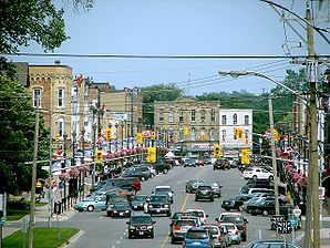
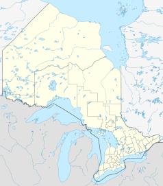
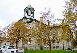
LindsayMotto: Catch the Kawartha Spirit Lage in Ontario Staat: Kanada Provinz: Ontario Koordinaten: 44° 21′ N, 78° 45′ W44.35-78.75Koordinaten: 44° 21′ N, 78° 45′ W Fläche: 3.059,47 km² Einwohner: 74.561 (Stand: 2006) Bevölkerungsdichte: 24,4 Einw./km² Zeitzone: Eastern Time (UTC−5) Bürgermeister: Ric McGee Webpräsenz: www.city.kawarthalakes.on.ca/ Kawartha Lakes ist eine Stadt mit 74,561 Einwohnern in der kanadischen Provinz Ontario. Kawartha Lakes hat eine Fläche von 3,059.47 km² und eine Bevölkerungsdichte von 22,6 Einwohner je km².
Einstufige Gemeinden: Brant | Brantford | Chatham-Kent | Greater Sudbury | Haldimand | Hamilton | Kawartha Lakes | Norfolk | Ottawa | Prince Edward | Toronto
Regionalgemeinden: Durham | Halton | Muskoka | Niagara | Oxford | Peel | Waterloo | York
Countys: Bruce | Dufferin | Elgin | Essex | Frontenac | Grey | Haliburton | Hastings | Huron | Lambton | Lanark | Leeds and Grenville | Lennox and Addington | Middlesex | Northumberland | Perth | Peterborough | Prescott and Russell | Renfrew | Simcoe | Stormont, Dundas and Glengarry | Wellington
Distrikte: Algoma | Cochrane | Kenora | Manitoulin | Nipissing | Parry Sound | Rainy River | Sudbury | Thunder Bay | Timiskaming
Wikimedia Foundation.
Schlagen Sie auch in anderen Wörterbüchern nach:
Kawartha Lakes, Ontario — Infobox Settlement official name = City of Kawartha Lakes other name = native name = nickname = settlement type = motto = Catch the Kawartha Spirit. imagesize = image caption = flag size = image seal size = image shield = shield size = image… … Wikipedia
List of numbered roads in Kawartha Lakes, Ontario — This page lists the numbered roads in Kawartha Lakes, OntarioVictoria County Road 46, formerly Highway 46. *, or Simcoe Street … Wikipedia
Kawartha Lakes Road 35 — Kawartha Lakes Municipal Road 35 Route information Maintained by city of Kawartha Lakes Length: 30.50 km … Wikipedia
Kawartha Lakes Road 8 — Kawartha Lakes Municipal Road 8 … Wikipedia
Kawartha Lakes Road 49 — Kawartha Lakes Municipal Road 49 Route information Maintained by city of Kawartha Lakes Length: 18.0 km … Wikipedia
Kawartha Lakes — This article is about the city of Kawartha Lakes. For the geographical lakes of the same name, see Kawartha lakes (Ontario). City of Kawartha Lakes Unitary authority city … Wikipedia
Kawartha lakes — (The) Kawartha lakes may refer to: Kawartha lakes (Ontario) a series of lakes in central Ontario used heavily by recreational cottagers and fishers. Kawartha Lakes a city in central Ontario, named for the lakes, and encompassing several of them.… … Wikipedia
Kawartha Lakes Road 46 — Kawartha Lakes Municipal Road 46 Route information Maintained by city of Kawartha Lakes Length: 25.7 km (16.0 mi) … Wikipedia
Kawartha Lakes — ▪ Ontario, Canada formerly Lindsay city, southeastern Ontario, Canada. It was formed in 2001 by the merger of the former town of Lindsay and the other communities constituting what until the amalgamation had been Victoria county. It was… … Universalium
Long Beach, Kawartha Lakes, Ontario — Long Beach is located on the east shore of Sturgeon Lake, in Ontario, Canada, in the former Township of Fenelon, Ontario … Wikipedia


