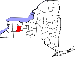
- Livingston County (New York)
-
Verwaltung US-Bundesstaat: New York Verwaltungssitz: Geneseo Adresse des
Verwaltungssitzes:6 Court Street
Geneseo, NY 14454Gründung: 23. Februar 1821 Gebildet aus: Genesee County,
Ontario CountyVorwahl: 001 585 Demographie Einwohner: 64.328 (2000) Bevölkerungsdichte: 39,3 Einwohner/km² Geographie Fläche gesamt: 1.659 km² Wasserfläche: 22 km² Karte Website: www.co.livingston.state.ny.us Livingston County[1] ist ein County im Bundesstaat New York der Vereinigten Staaten von Amerika. Bei der Volkszählung im Jahr 2000 hatte das County 64.328 Einwohner und eine Bevölkerungsdichte von 39 Einwohner pro Quadratkilometer. Der Verwaltungssitz (County Seat) ist Geneseo.
Inhaltsverzeichnis
Geschichte
Das County wurde am 23. Februar 1821 aus Genesee County und Ontario County gebildet. Benannt wurde es nach Robert R. Livingston (1746-1813), einem Abgeordneten des Kontinentalkongress aus New York. Teile Allegany Countys wurde 1846 und 1856 annektiert. Im Jahr 1860 hatte das County 39.256 Einwohner.
Geografie
Das County hat eine Fläche von 1.659 Quadratkilometern, wovon 22 Quadratkilometer Wasserfläche sind. Livingston County grenzt im Uhrzeigersinn an folgende Countys: Monroe County, Ontario County, Allegany County, Wyoming County und Genesee County.
Städte
- Avon
- Caledonia
- Conesus
- Geneseo
- Groveland
- Leicester
- Lima
- Livonia
- Mount Morris
- North Dansville
- Nunda
- Ossian
- Sparta
- Springwater
- West Sparta
- York
Dörfer
- Avon*
- Caledonia*
- Dansville
- Leicester*
- Lima*
- Livonia*
- Mount Morris*
- Nunda*
*Dorf liegt innerhalb des gleichnamigen Stadtgebiets.
Einzelnachweise
- ↑ GNIS-ID: 974124. Abgerufen am 22. Februar 2011 (englisch).
Liste der Countys in New York
Albany | Allegany | Bronx | Broome | Cattaraugus | Cayuga | Chautauqua | Chemung | Chenango | Clinton | Columbia | Cortland | Delaware | Dutchess | Erie | Essex | Franklin | Fulton | Genesee | Greene | Hamilton | Herkimer | Jefferson | Kings (Brooklyn) | Lewis | Livingston | Madison | Monroe | Montgomery | Nassau | New York (Manhattan) | Niagara | Oneida | Onondaga | Ontario | Orange | Orleans | Oswego | Otsego | Putnam | Queens | Rensselaer | Richmond (Staten Island) | Rockland | Saratoga | Schenectady | Schoharie | Schuyler | Seneca | St. Lawrence | Steuben | Suffolk | Sullivan | Tioga | Tompkins | Ulster | Warren | Washington | Wayne | Westchester | Wyoming | Yates
Wikimedia Foundation.
Schlagen Sie auch in anderen Wörterbüchern nach:
Livingston County, New York — Infobox U.S. County county = Livingston County state = New York map size = 250 founded = 1821 seat = Geneseo | area total sq mi =640 area water sq mi =8 area percentage = 1.30% census yr = 2000 pop = 64328 density km2 =39 web =… … Wikipedia
National Register of Historic Places listings in Livingston County, New York — Location of Livingston County in New York … Wikipedia
Dansville, Livingston County, New York — Not to be confused with the town of Dansville, Steuben County, New York.. Dansville Village … Wikipedia
Coopersville, Livingston County, New York — Coopersville is a hamlet in Livingston County, New York. Coopersville lies at an elevation of 843 feet (257 m). References U.S. Geological Survey Geographic Names Information System: Coopersville, Livingston County, New York Coordinates … Wikipedia
Livingston Manor, New York — Infobox Settlement official name = Livingston Manor, New York settlement type = CDP nickname = motto = imagesize = image caption = image |pushpin pushpin label position = pushpin map caption =Location within the state of New York pushpin mapsize … Wikipedia
County Route 149 (Sullivan County, New York) — County Route 149 Map of Sullivan County and vicinity with CR 149 highlighted in red … Wikipedia
Monroe County, New York — Location in the state of New York … Wikipedia
Richmond County (New York) — Verwaltung US Bundesstaat: New York Verwaltungssitz: Adresse des Verwaltungssitzes: Gründung: 1683 … Deutsch Wikipedia
Genesee County, New York — Infobox U.S. County county = Genesee County state = New York map size = 250 founded = March 30 1802 seat = Batavia area total sq mi =495 area water sq mi =1 area percentage = 0.25% census yr = 2000 pop = 60370 density km2 =47 web = www.co.genesee … Wikipedia
Wyoming County, New York — Infobox U.S. County county = Wyoming County state = New York map size = 250 founded = 1841 seat = Warsaw | area total sq mi =596 area water sq mi =4 area percentage = 0.59% census yr = 2000 pop = 43424 density km2 =28 web = www.wyomingco.net… … Wikipedia

