- Prince George’s County
-
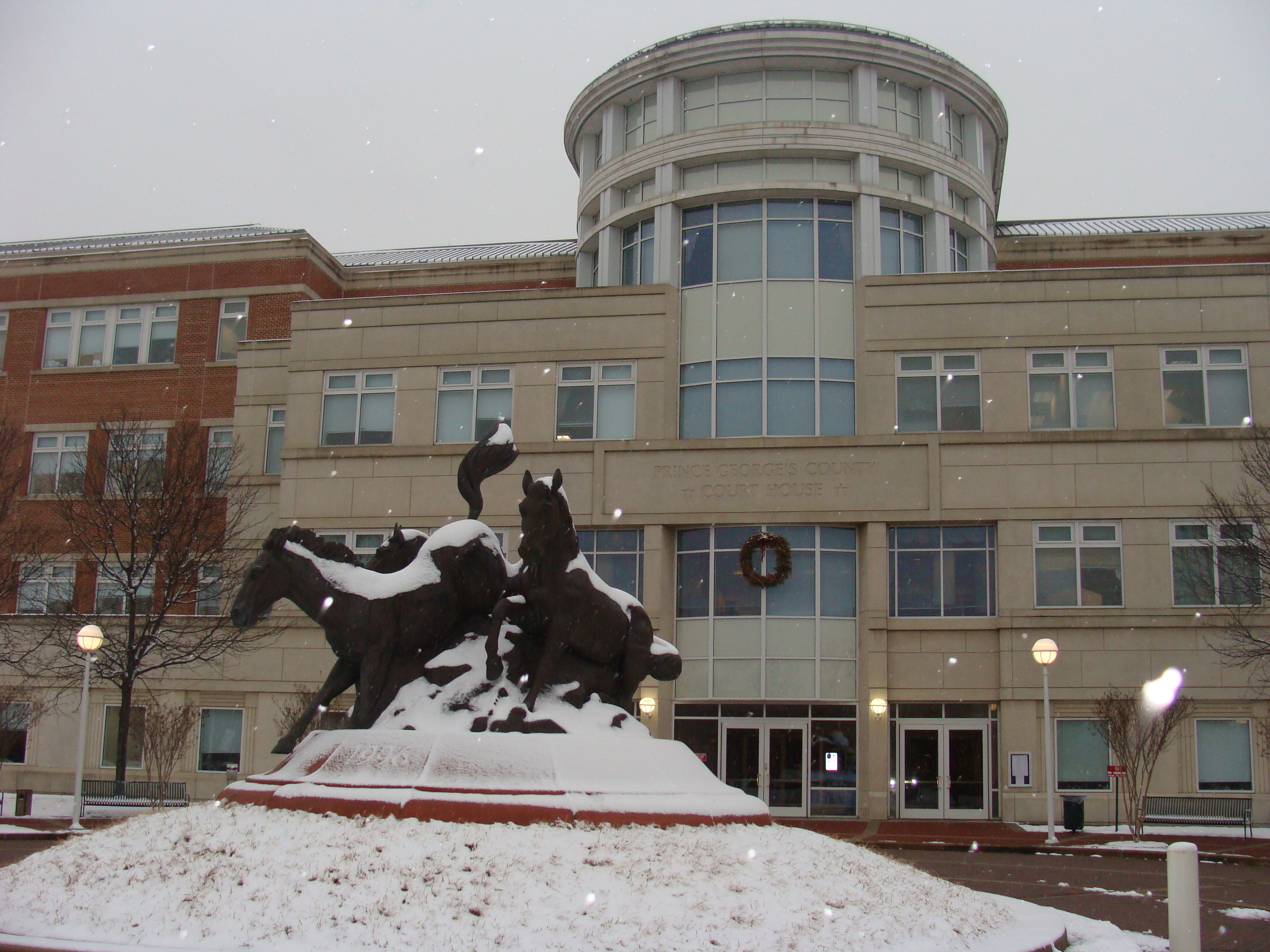
 Das Prince George’s County Courthouse in Upper Marlboro
Verwaltung US-Bundesstaat: Maryland Verwaltungssitz: Upper Marlboro Adresse des
Verwaltungssitzes:County Administration Building
14741 Governor Oden Bowie Drive
Upper Marlboro, MD 20772-3050Gründung: 1696 Gebildet aus: Charles County, Calvert County Vorwahl: 001 301 Demographie Einwohner: 863.420 (2010) Bevölkerungsdichte: 686,9 Einwohner/km² Geographie Fläche gesamt: 1.291 km² Wasserfläche: 34 km² Karte 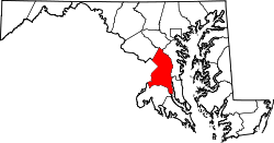
Website: www.princegeorgescountymd.gov Das Prince George’s County[1] ist ein County im US-amerikanischen Bundesstaat Maryland. Bei der Volkszählung im Jahr 2010 hatte das County 863.420 Einwohner und eine Bevölkerungsdichte von 686,9 Einwohnern pro Quadratkilometer. Der Verwaltungssitz (County Seat) ist Upper Marlboro.
Das Prince George’s County ist Bestandteil der Metropolregion um die US-Hauptstadt Washington.
Inhaltsverzeichnis
Geografie
Das County liegt am Ostufer des Potomac River im östlichen und südlichen Vorortbereich der US-Bundeshauptstadt Washington. Der Potomac bildet die Grenze zu Virginia. Das Prince George’s County hat eine Fläche von 1.291 Quadratkilometern; davon sind 34 Quadratkilometer (2,61 Prozent) Wasserflächen. Es grenzt an folgende Countys und selbstständigen Städte:
Montgomery County Howard County Washington, D.C. 
Anne Arundel County Fairfax County (Virginia),
Alexandria (Virginia)Charles County Calvert County Geschichte
 Prinz Georg
Das County wurde 1696 aus Teilen des Charles und des Calvert County gegründet. Benannt wurde es nach Georg, Prinz von Dänemark (1653-1708), dem Ehemann von Königin Anne von Großbritannien.
1748 wurde auf einem ausgegliederten Teil des Prince Georg's County das Frederick County gegründet. 1791 wurde für das neu zu gründende District of Columbia ein weiterer Teil aus dem County ausgegliedert.
Demografische Daten
Historische Einwohnerzahlen Census Einwohner ± in % 1790 21.344 — 1800 21.175 -0,8 % 1810 20.589 -3 % 1820 20.216 -2 % 1830 20.474 1 % 1840 19.539 -5 % 1850 21.549 10 % 1860 23.327 8 % 1870 21.138 -9 % 1880 26.451 30 % 1890 26.080 -1 % 1900 29.898 10 % 1910 36.147 20 % 1920 43.347 20 % 1930 60.095 40 % 1940 89.490 50 % 1950 194.182 100 % 1960 357.395 80 % 1970 660.567 80 % 1980 665.071 0,7 % 1990 729.268 10 % 2000 801.515 10 % 2010 863.420 8 % vor 1900[2] 1900–1990[3] 2000[4] 2010[5] Nach der Volkszählung im Jahr 2010 lebten im Prince George’s County 863.420 Menschen in 297.937 Haushalten. Die Bevölkerungsdichte betrug 686,9 Einwohner pro Quadratkilometer.
Ethnisch betrachtet setzte sich die Bevölkerung zusammen aus 19,2 Prozent Weißen, 64,5 Prozent Afroamerikanern, 0,5 Prozent amerikanischen Ureinwohnern, 4,1 Prozent Asiaten sowie aus anderen ethnischen Gruppen; 3,2 Prozent stammten von zwei oder mehr Ethnien ab. Unabhängig von der ethnischen Zugehörigkeit waren 14,9 Prozent der Bevölkerung spanischer oder lateinamerikanischer Abstammung.
In den 297.937 Haushalten lebten statistisch je 2,74 Personen.
24,8 Prozent der Bevölkerung waren unter 18 Jahre alt, 65,7 Prozent waren zwischen 18 und 64 und 9,5 Prozent waren 65 Jahre oder älter. 51,8 Prozent der Bevölkerung war weiblich.
Das jährliche Durchschnittseinkommen eines Haushalts lag bei 69.545 USD. Das Pro - Kopf - Einkommen betrug 30.917 USD. 7,8 Prozent der Einwohner lebten unterhalb der Armutsgrenze.[6]
Städte und Gemeinden
- Bowie
- College Park
- District Heights
- Glenarden
- Greenbelt
- Hyattsville
- Laurel
- Mount Rainier
- New Carrollton
- Seat Pleasant
- Berwyn Heights
- Bladensburg
- Brentwood
- Capitol Heights
- Cheverly
- Colmar Manor
- Cottage City
- Eagle Harbor
- Edmonston
- Fairmount Heights
- Forest Heights
- Landover Hills
- Morningside
- North Brentwood
- Riverdale Park
- University Park
- Upper Marlboro
Census-designated places (CDP)
- Accokeek
- Adelphi
- Andrews Air Force Base
- Beltsville
- Brandywine
- Calverton1
- Camp Springs
- Chillum
- Clinton
- Coral Hills
- East Riverdale
- Forestville
- Fort Washington
- Friendly
- Glenn Dale
- Goddard
- Greater Landover
- Greater Upper Marlboro
- Hillandale1
- Hillcrest Heights
- Kettering
- Konterra
- Lake Arbor
- Langley Park
- Largo
- Marlow Heights
- Marlton
- Mitchellville
- Rosaryville
- South Laurel
- Springdale
- Temple Hills
- Walker Mill
- West Laurel
- Woodlawn
- Woodmore
1 - teilweise im Montgomery County
Einzelnachweise
- ↑ GNIS-ID: 1714670. Abgerufen am 22. Februar 2011 (englisch).
- ↑ University of Virginia Library - Historical Census Browser Abgerufen am 7. September 2011
- ↑ United States Census.gov Abgerufen am 7. September 2011
- ↑ U.S. Census Buero - United States Census 2000 für das Prince George’s County Abgerufen am 7. September 2011
- ↑ United States Census 2010 Abgerufen am 7. September 2011
- ↑ U.S. Census Buero, State & County QuickFacts - Prince George’s County Abgerufen am 8. September 2011
Weblinks
 Commons: Prince George's County, Maryland – Sammlung von Bildern, Videos und Audiodateien
- Offizielle Webseite
- U.S. Census Buero, State & County QuickFacts - Prince George’s County
- Maryland State Archives - Prince George’s County
- Yahoo Bildersuche - Prince George’s County
- www.city-data.com - Prince George’s County

Liste der Countys in Maryland
Allegany | Anne Arundel | Baltimore City | Baltimore | Calvert | Caroline | Carroll | Cecil | Charles | Dorchester | Frederick | Garrett | Harford | Howard | Kent | Montgomery | Prince George’s | Queen Anne’s | Saint Mary's | Somerset | Talbot | Washington | Wicomico | Worcester
Wikimedia Foundation.
Schlagen Sie auch in anderen Wörterbüchern nach:
Prince George's County — Verwaltung US Bundesstaat: Maryland Verwaltungssitz: Upper Marlboro Adresse des Verwaltungssitzes: Gründung: 1696 … Deutsch Wikipedia
Prince George's County — Sp Princo Džòrdžo apýgarda Ap Prince George s County L JAV (Merilandas) … Pasaulio vietovardžiai. Internetinė duomenų bazė
Prince George's County — Admin ASC 2 Code Orig. name Prince George s County Country and Admin Code US.MD.033 US … World countries Adminstrative division ASC I-II
Prince George's County Public Schools — (PGCPS) is a large school district headquartered in Upper Marlboro, Maryland, United States; the district serves Prince George s County.As of 2006 the district has an enrollment of almost 134,000 students and is the second largest school district … Wikipedia
Prince George's County, Maryland — Infobox U.S. County county = Prince George s County state = Maryland map size = 225 founded year = 1696 seat wl = Upper Marlboro | leader = Jack B. Johnson area total sq mi =498 area land sq mi =485 area water sq mi =13 area percentage = 2.61%… … Wikipedia
Prince George's County Sheriff's Office — Infobox Police Department name = Office of the Sheriff, Prince George s County motto = established = 1696 jurisdiction = State Agency, via County sworn = non sworn = CSO = stations = jails = helicopters = policeboats = chief = sheriff = Michael A … Wikipedia
Prince George's County Police Department — Infobox Police Department name = Prince George s County Police Department motto = established = 1927 jurisdiction = County sworn = 1,420 non sworn = 263 CSO = stations = 6 jails = helicopters = 2 policeboats = 2 chief = Roberto Hylton sheriff =… … Wikipedia
Prince George's County Delegation — if you have information that can be referenced with a , please, feel free to help! Expand section|date=June 2008 The Prince George s County Delegation refers to the delegates who are elected from districts in Prince George s County to serve in… … Wikipedia
National Register of Historic Places listings in Prince George's County, Maryland — Location of Prince George s County in Maryland This is a list of the National Register of Historic Places listings in Prince George s County, Maryland. This is intended to be a complete list of the properties and districts on the National… … Wikipedia
Nottingham, Prince George's County, Maryland — Nottingham Site U.S. National Register of Historic Places Nearest city: Upper Marlboro, Maryland … Wikipedia
Prince George’s County


18+
© Academic, 2000-2026
- Kontaktieren Sie uns: Unterstützung, Werbung
Wörterbücher Export, schritte mit PHP, Joomla, Drupal, WordPress, MODx.